Norwalk (California)
| Norwalk | ||
|---|---|---|
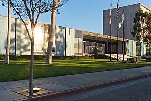
 Norwalk City Hall |
||
| Location in California | ||
|
|
||
| Basic data | ||
| Foundation : | 1957 | |
| State : | United States | |
| State : | California | |
| County : | Los Angeles County | |
| Coordinates : | 33 ° 55 ′ N , 118 ° 5 ′ W | |
| Time zone : | Pacific ( UTC − 8 / −7 ) | |
| Residents : | 107.096 (as of 2014) | |
| Population density : | 4,425.5 inhabitants per km 2 | |
| Area : | 24.2 km 2 (approx. 9 mi 2 ) of which 24.2 km 2 (approx. 9 mi 2 ) is land |
|
| Height : | 28 m | |
| Postcodes : | 90650-90652, 90659 | |
| Area code : | +1 562 | |
| FIPS : | 06-52526 | |
| GNIS ID : | 1661123 | |
| Website : | www.ci.norwalk.ca.us | |
| Mayor : | Mike Mendez (2016-2017) | |
Norwalk is a city in Los Angeles County in the US state of California in the United States . It is located about 25 kilometers southeast of Los Angeles and belongs to the Greater Los Angeles Area .
history
The first inhabitants of the Norwalk area were Shoshone . During the Spanish colonial rule, the Mexican soldier Manuel Nieto was given around 680 km² of land ( Rancho in Spanish ) for his cattle breeding in 1784 , on which today's Norwalk is located.
After the end of the Mexican-American War in 1848, the land was partitioned and put up for sale when California became a part of the United States. The Sproul brothers from Oregon acquired 463 acres (1.87 km²) in Corazon de los Valles in 1869 at a price of 11 US dollars per acre (about 53,000 US dollars / km² based on today's purchasing power).
For the construction of a railway line in 1873, the Sprouls made part of their land available on the condition that a passenger stop would be established. The "North-walk" was registered in 1874 as a Norwalk.
At the turn of the century, Norwalk was a center of the dairy industry: most of the 50 local families from the 1900 census were in agriculture ( sugar beet ) or in the dairy industry. In the early 20th century, many Dutch dairy farmers settled in Norwalk. In the second half of the 20th century, the number of Hispanics grew .
In 1957, Norwalk received city rights (Incorporation).
- Plane crash
In February 1958 two military aircraft, a Douglas C-118 military transport and a Lockheed P-02 bomber of the US Navy collided over Norwalk at night . 47 soldiers died as well as a 23-year-old woman on the ground who was hit by falling wreckage. At the site of the accident, Firestone Boulevard and Pioneer Boulevard, a plaque commemorates the disaster.
traffic
Norwalk is the terminus of the Green Line of the Los Angeles Metro Rail . The city is also served by suburban trains of the Metrolink Los Angeles on the 91 / Perris Valley Line and the Orange County Line . Three freeways run through the city, including Interstate 105 (California) .
Town twinning
Twin cities of Norwalk are the Mexican cities of Morelia in the state of Michoacán and Hermosillo in the state of Sonora .
sons and daughters of the town
- Ruth Asawa (1926–2013), sculptor
- Tiffany Darwish (* 1971), pop singer and actress
- Nikki Ziering (* 1971), model and actress
- Rashaad Penny (born 1996), American football player
Web links
Individual evidence
- ^ Norwalk Chamber of Commerce: The Norwalk of Yesterday , accessed November 30, 2016
- ^ The Hispanic population, 2000, Volume 8, Issue 2 in the Google book search
- ↑ Two survivors according to the Aviation Safety Network
- ↑ Norwalk website , accessed November 30, 2016


