
Emergency beacon
A Indicating Radio Beacon emergency position (. English Emergency position-Indicating radio beacon station - EPIRS or EPIRB ) in Germany also Indicating Radio Beacon emergency position (short locator beacon ) is a radio station of the mobile communications whose emissions are to facilitate search and rescue operations .
As a rule, small radio transmitters are used, for example as a rescue device radio station , with the help of which satellites or search and rescue forces can locate ships , people or aircraft in need of rescue . Emergency radio beacons optimized for aviation are known as ELT (emergency locator transmitter). The emergency beacons optimized for personal use on land and in coastal waters, e.g. B. for hikers, skiers, canoeists or snowmobilers, wear the designation PLB (personal locator beacon). EPIRB is the designation for emergency radio beacons optimized for shipping , but also serves as a generic term for emergency radio beacons regardless of their area of application, since the alerting works according to the same principles for everyone.
history
The reason for the development of emergency beacons was the plane crash of Nick Begich and Hale Boggs , two US congressmen, in Alaska in 1972 , which were never found. In response to this, emergency beacons for alerting on 121.5 MHz, the emergency frequency of air traffic , were developed and made mandatory for all American aircraft . Due to the many disadvantages of this system (unsafe alarming, insufficient position determination, high proportion of false alarms), the USA , Canada and France initiated the satellite-based SARSAT system in the late 1970s . Between 1979 and 1985 it was gradually merged with the COSPAS system developed in parallel in the former Soviet Union to form COSPAS / SARSAT . Many other nations have now joined this system.
While 121.5 MHz-based beacons were initially still widespread in air traffic, devices for 406 MHz were also developed in shipping in parallel to the establishment of satellite-based alarms. Since around 1990, PLBs and ELTs for 406 MHz have also been increasingly sold. In the USA, 406 MHz PLBs were only approved in Alaska in a test phase from 1995 to 2003. Since there were few false alarms in this test phase, but many successful rescues due to the emergency radio transmitter, the approval was then extended to the entire USA.
Operation and distribution
An emergency beacon is activated either manually or automatically. PLB are usually always activated manually. ELT are usually activated automatically by an acceleration sensor (G-sensor) , which registers the impact of the aircraft on the ground. EPIRB are activated by the water pressure (at approx. 1.2 bar absolute, corresponds to approx. 2 m water depth) when a ship sinks.

EPIRB in protective housing on fishing boat. Hydrostatically releasing housing lock.

ELT

Various aircraft antennas, ELT and their mounting

Size comparison PLB ↔ mobile phone

PLB with antenna extended


Once triggered, the beacon sends an alarm signal on one or more standardized emergency frequencies, with newer emergency beacons always on 406 MHz. This emergency signal is received by satellites of the COSPAS / SARSAT system and forwarded to a (mostly unmanned) ground station (local user terminal, LUT). From there it is sent to a rescue coordination center (rescue coordination center RCC), such as the Maritime Rescue Co of DGzRS in Germany or the US Coast Guard in the US. This evaluates the signal and, if necessary, initiates search and rescue measures.
Modern emergency beacons are designed for reception by satellites and (in shipping) are part of the Global Maritime Distress and Safety System (GMDSS). In addition to the alarm signal, they usually also send a bearing signal at 121.5 MHz, which enables the SAR aircraft or ships to align themselves to the emergency position (also known as homing ). Older emergency beacons only transmit on 121.5 MHz and are designed for reception by aircraft flying past. They are not part of the GMDSS and are no longer recommended today for various reasons (see below in the section " Aircraft or military emergency radio "). In addition, there are emergency beacons for the immediate coastal area, which send an emergency signal directly to the nearest coastal radio station via VHF .

Portable antenna for radio direction finding

Antennas on a boat or vehicle for radio direction finding

Emergency beacons are usually in a signal color, maximum 30 cm in size, freely available in stores, and cost several hundred to several thousand euros, depending on the design and area of application. High-quality beacons stand out among others. a. through an integrated GNSS receiver . In the event of an emergency, it makes it possible to send information such as the identity of the sender and the type of emergency as well as your own position in the emergency signal, which can significantly shorten the time required for search and rescue. The lifespan of an emergency beacon is around ten years.
According to the SOLAS contract, satellite-based emergency radio beacons are required for seagoing vehicles on international voyages from a size of 300 GT and for all passenger ships. In contrast, their use in recreational shipping is voluntary and - u. a. due to their high price - not very common in coastal areas. In aviation , ELTs are sometimes required for sport aircraft (e.g. in Austria and since January 1, 2010 also in Germany) .
Alarm systems currently in use
For historical reasons, there are different alarm systems, each of which was a new feature at the time of their development. They differ mainly in the frequency used and who receives the distress signal: planes , satellites . The alarm time and the accuracy of the position determination depend on the type of alarm .
Aviation or military emergency radio
The oldest system is the alarm on the emergency frequency of air traffic (121.5 MHz ) or the military (243 MHz). Airplanes flying past can receive the emergency signal and send a message to the nearest rescue control center. A major disadvantage of this method is the uncertain alarm time until an aircraft happens to receive the signal; in particular, there is no obligation to intercept the emergency frequency in air traffic. The position determination is very imprecise (approx. 10 nautical miles ); an aircraft can only determine that a signal has been emitted somewhere in the area of the earth's surface that is visible from its position. In addition, it is not certain whether the signal actually originates from an emergency beacon. Reception at the 121.5 MHz frequency is unstable and severely affected by various sources of interference; even pizza ovens and ATMs have already sent signals on this frequency. Due to the resulting high proportion of false alarms (97–99.9% according to various estimates) and the lack of verification options, the use of this frequency is now only recommended for weak homing signals of approx. 0.1 watts to avoid SAR emergency services in the To facilitate the journey to the destination near the person in need of rescue.
Alerting via the emergency frequency of 121.5 MHz and 243 MHz was supported by the COSPAS / SARSAT satellites until January 2009 .
Polar orbiting satellites (LEOSAR)
The COSPAS / SARSAT system was developed in the early 1980s due to the above-mentioned weaknesses in alerting on the emergency flight frequency . Today it includes, among other things, six polar orbiting weather satellites (low earth orbiting search and rescue, LEOSAR) that monitor the internationally agreed 406 MHz emergency frequency. Signals that are received on this frequency are temporarily stored and forwarded to a ground station as soon as possible.
Footprint of the polar orbiting satellites (LEOSAR)

Pole Orbiting Satellite (LEOSAR)
Animation of the orbit of a polar orbiting satellite


The satellites orbit the earth in about 100 minutes on an orbit inclined by 83 ° or 99 ° in relation to the equator and thus cover the entire surface of the earth in the course of time. Since such a satellite has a relatively high intrinsic movement compared to the signal source, the received frequency changes due to the Doppler effect . With the help of this frequency change , the approximate position of the signal source can be determined with an accuracy of approx. 1 to 3 nautical miles by taking several measurements every 15 minutes. After four hours at the latest, the beacon is recorded by one of the satellites so that the alarm time is roughly between these two values. If the transmitting emergency beacon can determine its position itself using an integrated GNSS receiver , this information is sent along with the emergency signal so that the location can be located with a high degree of accuracy (100 m). Emergency beacons for 406 MHz send identity information along with the emergency signal, so that many false alarms can be clarified through queries before a rescue operation is initiated.
Thanks to the use of radio frequencies in the lower range of the UHF frequency band , an emergency beacon enables alarms to be issued in dense vegetation , such as in the forest , via a polar orbiting COSPAS-SARSAT satellite (LEOSAR). In the case of dense vegetation, alarms via the MEOSAR or GEOSAR satellites of the COSPAS-SARSAT satellite network are not possible. MEOSAR and GEOSAR have an inadequate average link margin for alerting in dense vegetation. For the polar orbiting satellites (LEOSAR), the average link margin is around 13 dB .
Geostationary satellites (GEOSAR)
In addition to the polar orbiting satellites, the COSPAS / SARSAT system has also had geostationary satellites (geostationary search and rescue, GEOSAR) since 1996/1997 , which also receive signals at 406 MHz.

View of the earth from the geostationary satellite GOES 8 (GOES-EAST)

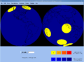
Network coverage of geostationary satellites (GEOSAR)


As can be seen in the adjacent picture, geostationary satellites constantly have large parts of the earth's surface in view and can therefore receive emergency signals , which are sent between approx. 70 ° north and south latitude , within a few seconds and forward them to one of the ground stations provided for them. Since the satellites do not move relative to the earth's surface, they themselves have no way of measuring the position of a signal source using the Doppler effect. If the emergency beacon transmits its position, which has been determined by an integrated GNSS receiver, in the emergency signal, it is therefore possible to determine the position with high accuracy (100 meters), otherwise not at all.

In the future, the satellites of the global navigation satellite systems GPS , GLONASS and GALILEO are to be equipped with an additional module for receiving emergency signals (406 MHz) and forwarding emergency signals to the appropriate ground stations (MEOLUT). The GNSS satellites equipped with a COSPAS / SARSAT module are called MEOSAR (Medium-Earth Orbit Search-and-Rescue).
The use of GNSS satellites for COSPAS / SARSAT has several advantages: The GNSS satellites orbit the earth at an altitude of around 20,000 km. The footprint of the GNSS satellites is therefore significantly larger than the footprint of the low-flying, polar orbiting weather satellites (LEOSAR). And in contrast to GEOSAR, the footprint of the GNSS satellites also includes the polar caps. The aim is to install as many COSPAS / SARSAT modules as possible in the first generation of GALILEO satellites and in the next generation of GPS and GLONASS satellites, so that COSPAS / SARSAT can achieve worldwide network coverage.
If the emergency beacon has a clear view of the sky in all directions from an elevation angle of 24 °, it is guaranteed in the near future that the ground station will receive the emergency call signal practically without delay. At the latest with the completion of the GALILEO navigation system (after 2020), the immediate location of the emergency beacon should also be possible at any time using the Doppler effect . In 2018 more than 34 MEOSAR satellites are fully functional and integrated into the "active" COSPAS / SARSAT operation.
For the GNSS satellites (MEOSAR) the average link margin is only 3 dB . Because of the free space attenuation , the uplink to a MEOSAR or GEOSAR satellite is significantly more susceptible to interference than the uplink to a LEOSAR satellite. The uplink of MEOSAR and GEOSAR is susceptible to atmospheric disturbances such as heavy rainfall or fog. Objects in the Fresnel zone can make satellite communication impossible. There should be no shrubs, trees, rocks, house or hut walls in the first Fresnel zone.
Historical alarm systems
The alarm systems listed below are no longer in use today.
Inmarsat E.
The Inmarsat company operated four geostationary satellites ( Inmarsat E ) until December 2006 , which operated in the so-called L-band at 1.6 GHz. Inmarsat E was a highly redundant system: for each of the four satellites, a further satellite was provided as a replacement for failures. Similar to the emergency radio beacons for 406 MHz, beacons intended for 1.6 GHz also sent identity information so that many false alarms could be cleared up in good time. In addition, the emergency signal could contain further information, such as the type of emergency (see below). The transmission from the emergency beacon to a satellite via Inmarsat E was equipped with forward error correction (FEC) , i. H. the signal contains redundant additional information with the help of which many transmission errors could be recognized and corrected. Inmarsat E + was a further development of Inmarsat E, in which the rescue control center could send an acknowledgment of receipt to an appropriately equipped emergency radio beacon via an Inmarsat satellite. This could then indicate optically or acoustically that the emergency signal was received.
Types of emergency beacons currently in use
Several types of emergency beacons are commercially available, which differ in the alarm system used and more or less accessories.
Category I / II (406 MHz)
A widespread type of emergency beacon, which is also part of the GMDSS, transmits on 406 MHz (more precisely: 406.025 MHz and 406.028 MHz). Your signal can be received and forwarded by all satellites of the COSPAS / SARSAT system. Most of these beacons also send out a weak signal at 121.5 MHz as a homing signal. Emergency beacons for 406 MHz are divided into two categories: Category I devices can be triggered automatically or manually, while Category II devices can only be triggered manually. Emergency beacons can also be equipped with search and rescue radar transponders (SART) that respond to 9 GHz radar signals.
COSPAS / SARSAT beacons are registered when they are purchased and assigned to a specific ship or aircraft or to a specific person. After activation, the emergency beacon sends a personal identification feature, such as your serial number or the ship's Maritime Mobile Service Identity (MMSI) (a globally unique call number for the ship in the GMDSS), as well as your position, if a GNSS receiver is integrated. By registering, the rescue coordination center already receives important information from the emergency signal, such as the type of ship affected (e.g. yacht or tanker ). Contact details provided at the time of purchase, for example those of relatives, also enable the control center to clear many false alarms before a rescue operation is initiated.
VHF DSC EPIRB (Channel 70)
Emergency beacons are available for the immediate coastal area, which transmit an emergency alarm via Digital Selective Calling (DSC) on VHF channel 70. Their major disadvantage is the short range of a maximum of 30 nautical miles to the nearest coast radio station . A VHF marine radio system offers the same function, with the additional advantage that after the alarm has been raised, contact with a coast station or other ships can be established via VHF radio. A VHF-DSC-EPIRB only offers an additional benefit if it is also equipped with an integrated radar transponder to make it easier for the SAR emergency services to find it.
Historical types of emergency beacons

The types of emergency beacons listed below are no longer supported and should be replaced.
Mini-B (121.5 / 243 MHz)
The oldest and simplest type of emergency radio transmitter, often available under the name Mini-B , transmits on 121.5 MHz . This type of transmitter was supported by the COSPAS / SARSAT system until January 2009 . Your signal can be received by SAR emergency services for target travel (homing); however, a direct line of sight is necessary for this, which is not always given, for example in rough seas. As explained above, they are too insecure as the primary alert source and lead to many anonymous false alarms that are difficult to trace. For these reasons, such devices are no longer recommended.
Inmarsat E / E + (1.6 GHz)
Inmarsat E was a service of the Inmarsat company (a privatized subsidiary of the International Maritime Organization ) and also part of the GMDSS. Emergency beacons that used this service sent their emergency signal in the so-called L-band at 1.6 GHz to one of the Inmarsat satellites. These beacons were also registered when they were purchased and sent a unique identifier. Since they were only designed for geostationary satellites, such emergency radio beacons were always equipped with a GPS receiver and, once activated, announced their position , course and speed at short intervals . In addition, the type of emergency (shipwreck, fire , collision , etc.) could be set for some devices and embedded in the emergency signal. Often these beacons were equipped with a radar transponder (9 GHz) and a 121.5 MHz homing signal, sometimes also with a strobe light . Inmarsat E + emergency radio beacons also had the option of visually or acoustically indicating that the emergency signal had been received by a rescue control center. The successor version type D + also has this function.
Inmarsat E was discontinued on December 1, 2006. A total of only 1300 customers could be won for this service, less than 100 of them from shipping requiring equipment (SOLAS shipping). Inmarsat Global Ltd. offers all previous users of Inmarsat E the free exchange of their emergency beacon for a COSPAS / SARSAT beacon with an integrated GNSS receiver .
See also
swell
- SARSAT homepage
- Cospas-Sarsat overview of national regulations
- US Coast Guard EPIRB page
- EPIRB site from Navtec
Web links
- Tabular comparison of different EPIRB types ( Memento from March 4, 2012 in the Internet Archive ) on: yachtschule-spittler.de
- https://www.cospas-sarsat.int (English): Homepage of COSPAS / SARSAT
- http://maritime.inmarsat.com (English): Homepage of Inmarsat, Maritimes section
- https://www.youtube.com (English) Official Youtube video channel from COSPAS-SARSAT with information material
- https://www.gsc-europa.eu (English) Current operating status information of the MEOSAR modules on the GALILEO satellites.
Individual evidence
- ↑ Internationale Fernmeldeunion (ITU), Funkvollzugsordnung (VO Funk), 2012 edition, Article 1.93, definition: radio beacon to identify the emergency position / emergency position-indicating radiobeacon station .
- ↑ Green Paper - Frequency range allocation plan for the Federal Republic of Germany and international allocation of the frequency ranges 9 kHz - 400 GHz; 1994; issued by the BMPT; BAPT order no. 5010311 001-1; Page 16, No. 88_4.31, designation *: Radio beacon to identify the distress position (short: emergency radio beacon ).
- ↑ https://www.youtube.com/watch?v=oFOrgwOV-vA Youtube-Video from COSPAS-SARSAT - Episode 02 - Beacons (English Subtitles)
- ↑ § 16 emergency transmitter (to § 22 LuftBO). on: gesetze-im-internet.de
- ↑ COMPARISON OF THE 406 MHz AND 121.5 MHz DISTRESS BEACONS. (PDF; 26 kB)
- ↑ http://www.insidegnss.com/auto/novdec14-WP_0.pdf InsideGNSS - MEOSAR: New GNSS Role in Search & Rescue
- ↑ http://www.insidegnss.com/auto/novdec14-WP_0.pdf InsideGNSS - MEOSAR: New GNSS Role in Search & Rescue
- ↑ https://www.cospas-sarsat.int/en/system/space-segment-status-pro/current-space-segment-status-and-sar-payloads-pro COSPAS-SARSAT - Current Space Segment Status and SAR Payloads
- ↑ http://www.insidegnss.com/auto/novdec14-WP_0.pdf InsideGNSS - MEOSAR: New GNSS Role in Search & Rescue
- ↑ Kiel March 27, 2006. ( Memento of the original from May 9, 2008 in the Internet Archive ) Info: The archive link was inserted automatically and has not yet been checked. Please check the original and archive link according to the instructions and then remove this notice. New on: satpro.org
- ↑ The historical development of Inmarsat-E.