Ochsenhude
Coordinates: 51 ° 4 '53.8 " N , 9 ° 4' 6.2" E
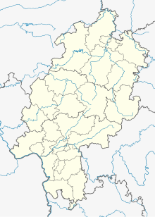
The Ochsenhude is an extensive natural monument (ND 21-023) in the district of Hundsdorf , a south-western district of Bad Wildungen in the northern Hessian district of Waldeck-Frankenberg . It is located in the Kellerwald-Edersee nature park and the natural area 344.2, Wildunger Bergland , around 1.8 km east of Hundsdorf or 3.5 km west of Odershausen and around 500 m west of federal highway 253 .
The 2.39 hectares large protected area includes a source stream with an alder swamp forest , a silted pond and an adjacent wetland area . The area of the former pond is characterized by large sedge made of mostly swamp sedge ( Carex acutiformis ) and by pond horsetail - reeds . A number of rare plant species grow on the wet meadow, including common devil's bite ( Succisa pratensis ) and black devil's claw ( Phyteuma nigrum ). Local wildlife includes newt , crested newt , grass snake and meadowsweet mother-of-pearl butterflies .
The stream that rises in the protected area flows through the area in a northeast direction, crosses under the B 253, continues north and after a total of about 1.3 km flows into the 8 km long Sonderbach, which flows into the Wilde at Bad Wildungen train station .
The natural monument Berthold Oak (ND 21-030) is located about 800 m north-north-west of the Ochsenhude . The Jägersburg area natural monument (ND 21-028) is located about 350 m to the south-east , and three Süntel beeches (ND 21-025), which are also designated as natural monuments, are 400 m south of it .
Footnotes
- ↑ Corridor 17, parcels 9/1, 17 (see map http://www.landkreis-waldeck-frankenberg.de/city_info/display/dokument/show.cfm?region_id=81&id=358409 )
- ↑ NABU Bad Wildungen: Nature of the Year 2015
