
Pensacola Mountains
| Pensacola Mountains | ||
|---|---|---|
 |
||
| location | Queen Elizabeth Land , West Antarctica | |
| part of | Transantarctic Mountains | |
|
||
| Coordinates | 83 ° 45 ′ S , 55 ° 0 ′ W | |

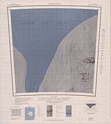
The Pensacola Mountains are a large group of mountain ranges and individual mountain peaks that extend in a north-east-south-west orientation for around 450 kilometers in the West Antarctic Queen Elizabeth Land . They include the Argentina Range , the Forrestal Range , the Dufek Massif , the Cordiner Peaks , the Neptune Range , the Patuxent Range , the Rambo Nunatakker and the Pecora Escarpment . The Foundation Ice Current and the Support Force Glacier flow north through them to the Filchner-Ronne Ice Shelf .
The Pensacola Mountains were discovered and photographed during the transcontinental flight carried out by the United States Navy on January 13, 1956 as part of the first Operation Deep Freeze from McMurdo Sound to the Weddell Sea and back. The Advisory Committee on Antarctic Names named it in 1957 after Naval Air Station Pensacola in memory of the historical importance of this facility in pilot training. The area was mapped by the United States Geological Survey and using aerial photographs from 1956 to 1967.
Web links
- Pensacola Mountains in the Geographic Names Information System of the United States Geological Survey (English)
- Pensacola Mountains on geographic.org (English)
Cordiner Peaks , Dufek Massif and Spanley Rocks


