Perambalur (district)
| Perambalur District பெரம்பலூர் மாவட்டம் |
|
|---|---|

|
|
| State | Tamil Nadu |
| Administrative headquarters : | Perambalur |
| Area : | 1,756 km² |
| Residents : | 565,223 (2011) |
| Population density : | 322 inhabitants / km² |
| Website : | perambalur.tn.nic.in |
The district of Perambalur ( Tamil : பெரம்பலூர் மாவட்டம் ) is a district of the Indian state of Tamil Nadu . The administrative center is the eponymous city of Perambalur . The district of Perambalur has an area of 1,756 square kilometers and around 570,000 inhabitants (2011 census).
geography
The district of Perambalur is located in the central interior of Tamil Nadu. Neighboring districts are Cuddalore in the northeast, Ariyalur in the southeast, Tiruchirappalli in the southwest and Salem in the northwest.
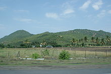
With an area of 1,756 square kilometers, the Perambalur district is one of the smallest districts in Tamil Nadu. The district area is mostly flat, but in the far west the Perambalur district has a share of the Pachaimalai Mountains , an isolated branch of the Eastern Ghats . The periodically water-bearing river Vellar flows through the north of the district .
In the district of Perambalur there is an alternately humid tropical climate . The annual mean temperature in Perambalur is 28.5 ° C, the annual mean precipitation is 894 mm. Most of the rainfall occurs during the northeast monsoon in October and November. It also rains during the southwest monsoons in August and September.
history
The area of what is now the Perambalur district was under the rule of changing dynasties before it became part of British India in 1801 . The British incorporated the area as part of the Tiruchirappalli district in the Madras province . After Indian independence, the area came to the newly formed state of Madras in 1956 as part of the States Reorganization Act , which now included the Tamil-speaking areas and was renamed Tamil Nadu in 1969 . Perambalur has existed as an independent district since 1995, when the Tiruchirappalli district was divided into the three districts Tiruchirappalli, Karur and Perambalur. In 2001, the Ariyalur district was separated from the eastern parts of the Perambalur district, but was reintegrated into it a year later. In November 2007, the Ariyalur district was re-established.
population
According to the 2011 Indian census, the Perambalur district has 565,223 inhabitants. In terms of population, it is the smallest district in Tamil Nadu. The population density is also below average: with 322 inhabitants per square kilometer it is the third lowest in the state and is well below the mean value of Tamil Nadu (555 inhabitants per square kilometer). The Perambalur district is very rural: Only 17 percent of the population live in cities. The degree of urbanization is one of the lowest in Tamil Nadu and is well below the state average (48 percent). 31 percent of the district's residents are scheduled castes . The literacy rate is 74 percent, lower than the state average (80 percent).
According to the 2011 census , the Hindus make up a large majority of the district's residents with 92 percent. Almost 6 percent of the population profess Islam . The Christians are less than 2 percent, only a small minority. The main language in the district of Perambalur is, as in all of Tamil Nadu, Tamil . According to the 2001 census, 97 percent of the district's residents speak it as their first language. There is also a small minority of Telugu speakers (2 percent).
Administrative division
The district of Perambalur is divided into three taluks (sub-districts):
| Taluk | main place | Population (2011) |
|---|---|---|
| Kunnam | Kunnam | 254.124 |
| Perambalur | Perambalur | 162,356 |
| Veppanthattai | Veppanthattai | 148.743 |
Cities
In the district of Perambalur there is a city with its own city administration ( Municipality ) and four small towns ( Town Panchayats ) administered according to the Panchayat system .
- Municipality
- Perambalur (49,648)
- Town panchayats
- Arumbavur (12,467)
- Kurumbalur (12,420)
- Labbaikudikadu (11,891)
- Poolambadi (10,737)
Web links
Individual evidence
- ↑ Census of India 2011: Primary Census Abstract - Tamil Nadu. (PDF; 873 kB)
- ↑ Climate data from climate-data.org .
- ^ Census of India 2011: Primary Census Data Highlights - Tamil Nadu. Chapter - I Population, Size and Decadal Change.
- ^ Census of India 2011: Primary Census Data Highlights - Tamil Nadu. Chapter - II Scheduled Castes and Scheduled Tribes Population.
- ^ Census of India 2011: Primary Census Data Highlights - Tamil Nadu. Chapter - III Literates and Literacy Rate.
- ^ Census of India 2011: C-1 Population By Religious Community. Tamil Nadu.
- ↑ Census of India 2001: C-15: Population by Mother Tongue (Tamil Nadu), accessed under Tabulations Plan of Census Year - 2001 .
- ↑ a b Census of India 2011: Primary Census Abstract Data Tables: Perambalur.
