Kanyakumari (District)
| Kanyakumari District கன்னியாகுமரி மாவட்டம் |
|
|---|---|

|
|
| State | Tamil Nadu |
| Administrative headquarters : | Rodent coil |
| Area : | 1,684 km² |
| Residents : | 1,870,374 (2011) |
| Population density : | 1,111 inhabitants / km² |
| Website : | kanyakumari.tn.nic.in |
The district of Kanyakumari ( Tamil : கன்னியாகுமரி மாவட்டம் ; also: Kanniyakumari ) is the southernmost district of the Indian state of Tamil Nadu . It is named after the city of Kanyakumari on the southern tip of India . The largest city and administrative center of the district is Nagercoil . The Kanyakumari district has an area of 1,684 square kilometers and a population of 1.9 million (2011 census). There are close cultural and historical ties to the neighboring state of Kerala .
geography
The district of Kanyakumari is located in the southernmost tip of the Indian mainland (only the Nicobar archipelago is further south). The Cape Comorin at 8 ° 4 'north latitude and 77 ° 35' east longitude located, the southern tip marks the Indian subcontinent . This is where the Arabian Sea and the Bay of Bengal meet. The city of Kanyakumari , which gives the district its name, is located directly on Cape Komorin . The district capital Nagercoil is located around 20 kilometers inland. With an area of 1,684 square kilometers, Kanyakumari is the second smallest district of Tamil Nadu after the city district of Chennai .
The district of Kanyakumari borders in the northeast on the district Tirunelveli and in the northwest on the neighboring state of Kerala ( district Thiruvananthapuram ). While the Western Ghats otherwise form a natural border between the two states, the coastline has always been passable without any problems. Therefore, the connections to Kerala are far stronger than in other parts of Tamil Nadu. The foothills of the Western Ghats in the Kanyakumari district reach almost as far as Cape Comorin. The highest point is the 1,868 meter high Agastya Malai on the border with Kerala. The mountain slopes of the Western Ghats are densely forested. A total of 30 percent of the district area is covered with forests, which makes the Kanyakumari the third most forest-rich district in Tamil Nadu.
In the Kanyakumari district there is an alternating humid tropical climate . The annual mean temperature in Nagercoil is 27.6 ° C, the annual mean precipitation is 1045 mm. The precipitation conditions are largely influenced by the monsoons . Due to its location in the transition area between the climatic zones of the west and east coast, the district of Kanyakumari receives rainfalls during the southwest monsoon in June and July as well as during the northeast monsoon between October and December.
history
The district of Kanyakumari is the historical heartland of the ruling house of Travancore , which ruled the southern part of today's Kerala until the middle of the 20th century. This dynasty originally comes from the small town of Thiruvithancode in today's Kanyakumari district (the name Travancore is a corruption of Thiruvithancode ). From 1550 the nearby Padmanabhapuram was the capital of Travancore. After the Portuguese had established themselves on the southwest coast of India from the early 16th century, the Dutch influence increased in the 17th century . The Raja Marthanda Varma succeeded in defeating the Dutch in 1741 in the Battle of Colachel in what is now the Kanyakumari district. In 1750 the Rajas of Travancore moved their residence to Thiruvananthapuram (Trivandrum), now the capital of the state of Kerala. During the British colonial era , Travancore was a nominally independent princely state under British suzerainty.
After Indian independence, Travancore united with the Princely State of Cochin in 1949 to form the Travancore-Cochin Federation and joined India. In 1956, the States Reorganization Act redrawn the boundaries of the southern Indian states according to the language boundaries . The greater part of Travancore-Cochin together with the Malabar district of the state of Madras formed the new state of Kerala, in which the main language was Malayalam . At the same time, the southernmost part of Travancore, in which predominantly Tamil was spoken, came to the state of Madras as the Kanyakumari district (renamed Tamil Nadu in 1969).
population
According to the 2011 Indian census, the Kanyakumari district has 1,870,374 inhabitants. The district is very densely populated. The population density is 1,111 people per square kilometer, twice the Tamil Nadu average (555 people per square kilometer) and is only surpassed by the city district of Chennai among the districts of the state . The settlement structure in the Kanyakumari district differs from the rest of Tamil Nadu and is similar to that in neighboring Kerala. Instead of clearly delimited villages, scattered settlements prevail. In the census statistics, these areas are the basis of certain criteria as urban areas classified (see. Census city ). This explains the high degree of urbanization in the Kanyakumari district, which at 82 percent is well above the Tamil Nadu average (48 percent) and is only exceeded by the Chennai city district. Four percent of the district's residents are scheduled castes . At 92 percent, the literacy rate is the highest of all Tamil Nadu districts and is well above the state average (80 percent).
The religious makeup of the district's population differs from the rest of Tamil Nadu. According to the 2011 census, the otherwise dominant Hindus only make up the relative majority with 49 percent. Almost as high is the proportion of Christians , who make up 47 percent of the district's population. There is also a smaller minority of Muslims (4 percent). The high Christian population is explained by the conversion of the fishing caste of the Paravar by Saint Francis Xavier in the 16th century.
The main language in the Kanyakumari district as in the whole of Tamil Nadu is Tamil . According to the 2001 census, 94 percent of the district's residents speak it as their first language. 6 percent speak Malayalam , the language of the neighboring state of Kerala.
Economy and Infrastructure
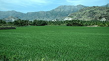
The climatically favored district of Kanyakumari offers excellent conditions for agriculture. All rice , coconut palms and tapioca are grown , and rubber trees in the mountains . Furthermore, fisheries traditionally play an important role as an economic factor.
Kanyakumari is the starting point of two important highways: National Highway 7 , with 2,369 kilometers of the longest highway in India, which leads into Varanasi in northern India, and National Highway 47 , which runs parallel to the coast through southern Kerala, then swings east and ends in Salem . Nagercoil Railway Station is an important railway junction with numerous connections to both Kerala and Tamil Nadu. A smaller branch line leads from Nagercoil to Kanyakumari. The nearest airport is in Thiruvananthapuram.
Culture and sights
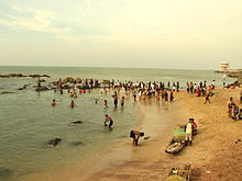
The main attraction of the district is Kanyakumari , located on Cape Komorin , the southern tip of the Indian subcontinent . Due to its location, Kanyakumari is an important Hindu pilgrimage destination. Off the coast, on two small rocks, are the Vivekananda rock memorial and the Tiruvalluvar statue , a colossal statue of the Tamil poet Tiruvalluvar .
Culturally, the district of Kanyakumari has a lot in common with neighboring Kerala. Many buildings are built in the Keralesian style, which is characterized by steep roofs and the use of wood as a building material. One of the most outstanding examples of this architecture is the Palace of Padmanabhapuram , where the rulers of Travancore resided between 1550 and 1750. In the neighboring Thiruvithancode there is a church which, according to local tradition, was founded by the Apostle Thomas .
Other sights in the Kanyakumari district are the St. Xaver Church in Nagercoil , which dates back to 1600 , the forts of Vattakottai and Udayagiri , the historical Jaina monuments of Chitharal from the 9th to 11th centuries, the waterfalls of Olakaruvi and Thiruparrapu , the Mathur Aqueduct and the Pechiparai Reservoir.
Administrative division
The Kanyakumari District is divided into four taluks (sub-districts):
| Taluk | main place | Population (2011) |
|---|---|---|
| Agastheeswawram | Rodent coil | 552.175 |
| Calculam | Padmanabhapuram | 606.706 |
| Thovala | Boothapandi | 120,926 |
| Vilavancode | Kuzhitturai | 590,567 |
Cities
In Kanyakumari district has four cities with its own city government ( Municipalities ), 56 after the Panchayat managed system townships ( Town Panchayats ) and 36 census towns ( census town ). The number of inhabitants is given according to the 2011 census.
- Municipalities
- Colachel (23,227)
- Kuzhithurai (21,307)
- Nagercoil (224,849)
- Padmanabhapuram (21,342)
- Town panchayats
- Agastheeswaram (9,717)
- Alagappapuram (9,626)
- Alur (15,063)
- Anjugrammam (10,982)
- Aralvaimozhi (22,846)
- Arumanai (16,283)
- Asaripallam (16,822)
- Athur (11,910)
- Azhagiapandiapuram (11,392)
- Boothapandi (15,931)
- Edaicode (25,378)
- Eraniel (10,375)
- Ezhudesam (24,657)
- Ganapathipuram (14,598)
- Kadayal (21,665)
- Kaliyakkavilai (15,625)
- Kallukuttam (19,093)
- Kanyakumari (22,453)
- Kappiyarai (15,998)
- Karungal (16,691)
- Keezhkulam (17,327)
- Killiyoor (20,938)
- Collan code (38.385)
- Kothanallur (17,662)
- Kottaram (11,055)
- Kulasekaram (17,267)
- Kumarapuram (14,728)
- Manavalakurichi (10,969)
- Mandaikadu (13,317)
- Marungur (11,236)
- Mulagumudu (19,538)
- Mylaudy (10,070)
- Nalloor (17,989)
- Neyyoor (12,917)
- Pacode (24,050)
- Palappallam (18,589)
- Palugal (18,276)
- Ponmanai (15,554)
- Puthalam (13,073)
- Puthukkadai (9,909)
- Reethapuram (21,177)
- Suchindrum (13,193)
- Thazhakudy (8,992)
- Thengampudur (14,538)
- Thenthamaraikulam (11,872)
- Therur (7,615)
- Thingalnagar (13,567)
- Thirparappu (22,401)
- Thiruvattar (18,985)
- Thiruvithan code (18,723)
- Unnamalaikadai (23,656)
- Valvaithankoshtam (16,965)
- Vellimalai (13,182)
- Verkilambi (19,730)
- Vilavur (14,320)
- Villukuri (15,304)
- Censorship cities
- Adaikkakuzhi (8,888)
- Athivilai (7,401)
- Ayacode (8,874)
- Chenbagaramanputhur (5,028)
- Choozhal (6,807)
- Dharamapuram (17,476)
- Gandhipuram (6,106)
- Kannanoor (7,747)
- Kattathurai (17,271)
- Katima Code (8,541)
- Kulappuram (7,677)
- Malayadi (7,812)
- Manakudi (4,083)
- Mancad (4,889)
- Manjalumoodu (6,840)
- Maruthan code (8,277)
- Math code (6,532)
- Methukummal (19,417)
- Midalam (8,625)
- Muzhucode (8,000)
- Nadaikavu (8,727)
- Nattalam (7,674)
- Nullivilai (16,138)
- Painkulam (23,630)
- Pallanthurai (5,386)
- Paloor (6,818)
- Peruvilai (6,090)
- Puliyoorsalai (6,361)
- Putheri (5,576)
- Thadikarankonam (6,241)
- Thikkanamcode (14,086)
- Vanniyoor (4,319)
- Vavarai (8,362)
- Vellamcode (12,715)
- Vilathurai (19,758)
- Vilavancode (6,731)
Web links
Individual evidence
- ↑ Census of India 2011: Primary Census Abstract - Tamil Nadu. (PDF; 873 kB)
- ↑ Website of the Kanyakumari District: Forests ( Memento of the original from June 19, 2009 in the Internet Archive ) Info: The archive link was inserted automatically and has not yet been checked. Please check the original and archive link according to the instructions and then remove this notice.
- ↑ Climate data from climate-data.org .
- ^ Census of India 2011: Primary Census Data Highlights - Tamil Nadu. Chapter - I Population, Size and Decadal Change.
- ^ Census of India 2011: Primary Census Data Highlights - Tamil Nadu. Chapter - II Scheduled Castes and Scheduled Tribes Population.
- ^ Census of India 2011: Primary Census Data Highlights - Tamil Nadu. Chapter - III Literates and Literacy Rate.
- ^ Census of India 2011: C-1 Population By Religious Community. Tamil Nadu.
- ↑ Census of India 2001: C-15: Population by Mother Tongue (Tamil Nadu), accessed under Tabulations Plan of Census Year - 2001 .
- ↑ a b Census of India 2011: Primary Census Abstract Data Tables: Kanniyakumari.


