
Pilchau (Tännesberg)
|
Pilchau
Tännesberg market
Coordinates: 49 ° 30 ′ 54 ″ N , 12 ° 20 ′ 12 ″ E
|
||
|---|---|---|
| Height : | 561 m | |
| Postal code : | 92723 | |
| Area code : | 09655 | |
Location of Pilchau in Bavaria |
||
 Pilchau (2015)
|
||

Pilchau is a district of the Tännesberg market in the Neustadt an der Waldnaab district . Pilchau was an independent municipality until 1830 , before the place became part of the Zeinried municipality. On May 1, 1978 Pilchau was incorporated into the Tännesberg market. This involved a change from the Schwandorf district to the Neustadt an der Waldnaab district.
geography
The place is about two kilometers from the Tännesberg market. It can be reached via Bundesstraße 22 or via the communal road leading from Tännesberg to Neumühle. There are a few farms in Pilchau.
history
Pilchau clearing settlement
The lords of Tännesberg opened up the area around their manor house through clearing settlements. The place names give information about the settlement activity in this area. These are the "-dorf-Orte" as the oldest form of settlement in the area, then the "richt" or "-ried" and "-schwand places" ( Großenschwand , Kleinschwand ). The "-hof-Orte" ( Bernhof ) followed later . The "-dorf-Orte" are basic settlements, which were followed by the "-richt", "-ried" and "-schwand-Orte" in the 11th and 12th centuries . The ending "-schwand" describes a special form of clearing. Clearing settlements near Tännesberg were Lampenricht and Zeinried. The village of Pilchau is also a clearing settlement. The places Gleiritsch , Teunz and Kaufnitz go back to Slavic origins. Documented sources of Pilchau are not yet available, based solely on the place name, it can be assumed that it was founded after the turn of the millennium.
In 1280 the Paulsdorf lords are on Tännesberg. Four documents from the years 1394 to 1399 provide information about the extent of the domain of the Paulsdorfer, named after Paulsdorf near Amberg . They owned "... in 'Pernhof' ( Bernhof , Gleiritsch municipality) two farms, a mill and five estates, ..., in 'Groszen Swant' ( Großenschwand , Markt Tännesberg) sixteen farms ..., in 'Cheaffnitz' (Kaufnitz, Markt Tännesberg) a manor and a pond, in 'Luetzel Swant' ( Kleinschwand , Markt Tännesberg) four farms, a mill and nine goods, ..., in 'Pilchaw' (Pilchau, Markt Tännesberg) four farms and ten rights, ... "
Statistical descriptions
Pilchau (mid-16th century)
11 properties: 2 courtyards, 2 half courtyards, 4 fiefs, 1 Sölde, 1 mill, 1 shepherd's house.
Today's Schnegelmühle is meant by the “zu Schnegelhausen” mill.
Pilchau (18th century)
12 properties including the shepherd's house
Tax District and Parish Education
The Kingdom of Bavaria was divided into 15 districts in 1808. These districts were named after rivers based on the French model ( Naabkreis , Regenkreis , Unterdonaukreis , etc.). The districts were divided into district courts. The districts in turn should be divided into individual municipality areas. In 1808 the Vohenstrauß Regional Court was divided into 47 tax districts and individual communities. One of them was Zeinried . The villages of Zeinried, Pilchau, Schömersdorf, Ödmiesbach, Miesmühle and Weiherhäusl belonged to the community.
In 1821 the communities were formed . Pilchau formed an independent community with the Neumühle and Schnegelmühle.
In 1830 the independent communities Pilchau and Ödmiesbach became part of the community Zeinried.
On May 1, 1978, the Zeinried community was dissolved. The village of Pilchau was incorporated into the Tännesberg market. This also involved a move to the Neustadt an der Waldnaab district.
Picture gallery

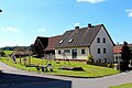
Pilchau, Tännesberg (2015)
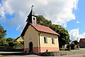
Village chapel (2013)

Village chapel (2013)
Playground (2013)

Pilchau, Lampenricht (2012)


Individual evidence
- ^ Federal Statistical Office (ed.): Historical municipality directory for the Federal Republic of Germany. Name, border and key number changes in municipalities, counties and administrative districts from May 27, 1970 to December 31, 1982 . W. Kohlhammer, Stuttgart / Mainz 1983, ISBN 3-17-003263-1 , p. 653 .
- ^ Schwarz, Ernst, Language and Settlement in Northeast Bavaria, Nuremberg 1960, pp. 80 ff.
- ^ Name of clearing
- ↑ Ernst Schwarz: Language and Settlement in Northeast Bavaria. Nuremberg 1960, p. 129.
- ↑ Main State Archives Munich I, holdings: Landgraviate Leuchtenberg, Certificate No. 1
- ↑ Main State Archives Munich I, holdings: Upper Palatinate documents, No. 1916, 1918, 1920, and 1921.
- ^ Ernst Emmering: The government of the Upper Palatinate. History of a Bavarian middle authority. Contributions to the history and regional studies of the Upper Palatinate. Issue 20, Regensburg 1981, p. 12 ff.
- ↑ Main State Archives Munich, Ministry of the Interior, No. 54270
- ↑ State Gazette 1978, No. 29
literature
- Rich. Hoffmann, Georg Hager: The art monuments of the Kingdom of Bavaria, Upper Palatinate and Regensburg. VIII District Office Vohenstrauss. Munich 1907
- Georg Hager: The art monuments of the Kingdom of Bavaria, Upper Palatinate and Regensburg. VII District Office Oberviechtach. Munich 1906
- Dieter Bernd: Vohenstrauss . In: Historical Atlas of Bavaria , part of Old Bavaria . Series I, issue 39. Komm. Für Bayerische Landesgeschichte, Munich 1977, ISBN 3-7696-9900-9 ( digitized version ).
- Emma Mages: Oberviechtach . In: Historical Atlas of Bavaria , part of Old Bavaria . Series I, issue 61. Komm. Für Bayerische Landesgeschichte, Munich 1996, ISBN 3-7696-9693-X ( digitized version ).
- Karl-Otto Ambronn: Historical Atlas of Bavaria. Part of old Bavaria. Series II, Issue 3, Landsassen and Landsassengüter of the Principality of the Upper Palatinate in the 16th century, Munich 1982, ISBN 3-7696-9932-7