Piz Val Lunga
| Piz Val Lunga | ||
|---|---|---|
|
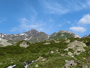
Piz Salteras and Piz Val Lunga (from left to right) taken from Val Tschitta |
||
| height | 3,078.2 m above sea level M. | |
| location | Canton of Graubünden , Switzerland | |
| Mountains | Albula Alps | |
| Dominance | 0.465 km → Piz Salteras | |
| Notch height | 84 m ↓ saddle between Piz Val Lunga and Piz Salteras | |
| Coordinates | 773 753 / 161.98 thousand | |
|
|
||
|
Stone figures on the Piz Val Lunga |
||
The Piz Val Lunga ( Rhaeto-Romanic for long valley ) is a mountain east of Tinizong-Rona and west of Preda in the canton of Graubünden in Switzerland with an altitude of 3,078 m above sea level. M. It is a technically easily accessible vantage point and ski mountain with an impressive view of the Ela south-west face and the other Bergüner sticks . The name comes from the narrow channel west of the summit.
Location and surroundings
The Piz Val Lunga belongs to the Bleis Marscha group, a subgroup of the Albula Alps . The municipal boundary between Surses and Bergün Filisur runs above the summit . The Piz Val Lunga is bordered in the west by the Val d'Err , a side valley of the Oberhalbstein , and in the east by the Val Tschitta , a side valley of the Albula valley.
The neighboring peaks include the Piz Ela ( 3339 m ) in the north, the Tschimas da Tschitta ( 2745 m ) in the east, the Piz Salteras ( 3111 m ) in the south and the Pizza Grossa ( 2939 m ) in the west.
Valley locations are Tinizong and Preda . Frequent starting points are Alp d'Err, Ela-Hütte and Naz .
Routes to the summit
Summer routes
A frequent starting point is Plang la Curvanera. A small road leads from Savognin via Tussagn to the Plang la Curvanera car park ( 1893 m above sea level ) . The alpine road from Tinizong into the Val d'Err is closed to general motor vehicle traffic. A hiking bus runs from Savognin to Plang la Curvanera on Wednesdays and to Pensa on Tuesdays and Fridays.
Over the north slope
- Starting point: Tinizong ( 1232 m ), Plang la Curvanera (parking lot) ( 1844 m ) or Ela hut ( 2252 m )
- Via: Lai Grond
- Difficulty: L
- Time required: 6 hours from Tinizong, 5½ from Plang la Curvanera or 3½ from the Ela hut
Over the northeast ridge
- Starting point: Naz ( 1747 m )
- Via: Fuorcla da Tschitta ( 2830 m )
- Difficulty: L
- Time required: 3¾ hours
Over the south ridge
- Starting point: Tinizong ( 1232 m ) or Naz ( 1747 m )
- Via: P. 2994 south of Piz Val Lunga
- Difficulty: WS
- Time required: 6 hours from Tinizong or 4 hours from Naz
Winter routes
From Tinizong
- Starting point: Tinizong ( 1232 m )
- Via: Alp Viglia, Laiets, northeast ridge
- Exposures: N, S, W
- Difficulty: ZS
- Time required: 5½ hours
From the Ela hut
- Starting point: Ela hut ( 2252 m )
- Via: Pass d'Ela ( 2724 m ), Lai Grond ( 2594 m ), Fuorcla da Tschitta ( 2830 m ), northeast ridge
- Exposures: N, S
- Difficulty: WS +
- Time required: 3 hours
- Comment: Until Fuorcla da Tschitta L
From Naz
- Starting point: Naz ( 1747 m )
- Via: Val Tschitta, Sattel P. 2858, northeast ridge
- Exposures: N, E
- Difficulty: WS +
- Time required: 4 hours
panorama
gallery
View to Piz Ela .
View to Piz Mitgel and Corn da Tinizong .
View to Piz Salteras .
literature
- Manfred Hunziker: Club Guide, Bündner Alpen, Volume VI - From Septimer to Flüela. 3. Edition. Verlag des SAC, 2000, ISBN 3-85902-187-7 . Pp. 243-244.
- Vital Eggenberger: Ski tours Graubünden South. Verlag des SAC, 2010, ISBN 978-3-85902-301-7 . Pp. 117-120.
- National map of Switzerland, sheet 1236 Savognin, 1: 25000, Federal Office of Topography, 2001 edition.
Web links
- Panorama from Piz Val Lunga
- www.hikr.org Tour reports
Individual evidence
- ↑ Bike & hiking bus timetable on the Savognin Bivio Albula holiday region website, accessed on April 8, 2018


