
Piz d'Emmat Dadora
| Piz d'Emmat Dadora | ||
|---|---|---|
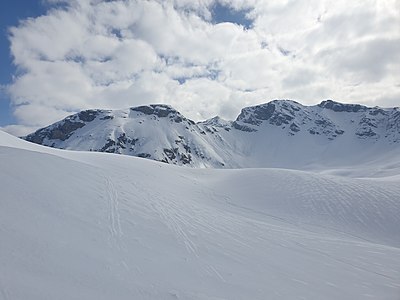
 Piz d'Emmat Dadora (r.) And Piz d'Emmat Dadaint (l.). |
||
| height | 2850 m above sea level M. | |
| location | Canton of Graubünden , Switzerland | |
| Mountains | Albula Alps | |
| Dominance | 0.47 km → Piz d'Emmat Dadaint | |
| Notch height | 95 m ↓ Fuorcla d'Emmat | |
| Coordinates | 773 714 / 146370 | |
|
||
| Normal way | About Leg Grevasalvas | |
 Steinmann on the summit, Piz d'Emmat Dadaint in the background. |
||

The Piz d'Emmat Dadora is a mountain southwest of the Julier Pass in the canton of Graubünden in Switzerland with an altitude of 2850 m above sea level. M. Being close to the Julier Pass, he is a popular, easy-to-reach mountain ski tours. The Piz d'Emmat Dadora is a north-west extension of the Piz d'Emmat Dadaint ( 2928 m ).
Location and surroundings

The Piz d'Emmat Dadora belongs to the Piz Lagrev group, a subgroup of the Albula Alps . The mountain is located entirely in the area of the municipality of Surses and is between the Oberhalbstein and the Engadin. The mountain is connected to the Piz d'Emmat Dadaint via the Fuorcla d'Emmat ( 2755 m ) .
The neighboring peaks include the Piz da las Coluonnas ( 2802 m ) and the Piz Lagrev ( 3165 m ) in the east, in the south the Piz d'Emmat Dadaint ( 2928 m ) and the Piz Materdell ( 2966 m ), as well as the Roccabella ( 2730 m ) m ) in the west.
The most distant visible point ( 46 ° 5 ′ 0.3 ″ N , 7 ° 51 ′ 25.9 ″ E ) from Piz d'Emmat Dadora is the Täschhorn in the canton of Valais . It belongs to the Mischabel massif and is 147.2 km away.
The valley location is Bivio ( 1769 m ). A frequent starting point is the Julier Pass ( 2284 m ).
Origin of name
Emmat (Demat) is probably derived from the Romansh gliemat, emat for 'floor beam, threshold'. A derivation from the Latin intimus for 'innermost' is possible, but less certain . In the idiom Surmiran, Dadora stands for 'outside, outside' and is derived from the Latin foras, -is for 'outside'.
Routes to the summit
Summer routes
About the Leg Grevasalvas
- Starting point: La Veduta ( 2237 m ) or Punt Brüscheda ( 2044 m ) on the Julier Pass road.
- Via: Leg Grevasalvas ( 2390 m )
- Difficulty: EB , to Leg Grevasalvas, marked as a white-red-white hiking trail .
- Time required: 2½ hours
Winter routes
About the Leg Grevasalvas
- Starting point: La Veduta ( 2237 m )
- Via: Leg Grevasalvas ( 2390 m )
- Exposures: N, E
- Difficulty: WS +
- Time required: 2½ hours
departure to
- Destination: Punt Brüscheda ( 2044 m ) on the Julierpass road
- Exposures: E, N
- Difficulty: WS +
panorama

gallery
Piz d'Emmat Dadora, Fuorcla d'Emmat, Piz d'Emmat Dadaint (from left to right) and Piz Lagrev (back), taken by Bocchetta d'Emmat.

In the foreground the Leg Grevasalvas , in the background the Julier Pass and the Piz Julier . To the right of it Piz da las Coluonnas , Piz Albana and Piz Lagrev .

Leg Grevasalvas, in the background on the left the Piz Lagrev , on the right the Piz d'Emmat Dadaint, the Fuorcla d'Emmat and the Piz d'Emmat Dadora.


literature
- Eugen Wenzel, Paul Gross: club guide, Bündner Alps . Albula. 2nd Edition. tape VI . Verlag des SAC, 1980, ISBN 3-85902-012-9 , p. 43 .
- Vital Eggenberger: Ski tours Graubünden South . Verlag des SAC, 2010, ISBN 978-3-85902-301-7 , pp. 152 .
- National map of Switzerland, sheet 1256 Bivio, 1: 25,000, Federal Office of Topography, 2015 edition.
Web links
- Calculated 360 ° panorama of Piz d'Emmat Dadora
- Tour reports on www.hikr.org
Individual evidence
- ↑ Calculated 360 ° panorama ( U. Deuschle ; information ) from Piz d'Emmat Dadora
- ↑ Andrea Schorta: How the mountain got its name . Small Rhaetian name book with two and a half thousand geographical names of Graubünden. Terra Grischuna Verlag, Chur and Bottmingen / Basel 1988, ISBN 3-7298-1047-2 , p. 85 .
- ↑ Andrea Schorta: How the mountain got its name . Small Rhaetian name book with two and a half thousand geographical names of Graubünden. Terra Grischuna Verlag, Chur and Bottmingen / Basel 1988, ISBN 3-7298-1047-2 , p. 82 .