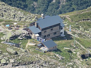
Plauen hut
| Plauener hut DAV hut category I |
||
|---|---|---|
|
Plauener Hut 2020 |
||
| location | above the Zillergründlsee; Tyrol , Austria | |
| Mountain range | Zillertal Alps | |
| Geographical location: | 47 ° 7 '5.6 " N , 12 ° 5' 46.5" E | |
| Altitude | 2363 m above sea level A. | |
|
|
||
| owner | DAV - Section Plauen - Vogtland | |
| Built | 1898/1899 | |
| Construction type | hut | |
| Development | Material ropeway | |
| Usual opening times | Mid-June to mid-September | |
| accommodation | 6 beds, 74 camps | |
| Winter room | 5 bearings | |
| Web link | Site of the hut | |
| Hut directory | ÖAV DAV | |

The Plauener hut is a refuge of section Plauen - Vogtland of the German Alpine Association in Austria . It is located at an altitude of 2363 m above sea level. A. .
history
The hut was built in 1898/99 and inaugurated on July 19, 1899. Structurally, it was expanded in 1912, 1926 and 1985.
Ascent
After crossing the Zillertal via Mayrhofen and Bärenbad to the Zillergründl reservoir dam and from there up a mountain path, the Plauener Hütte is reached , the walking time is approx. Two hours. From the hut you can see the Zillergründlsee.
Transitions
The Plauener Hütte is located on the Zentralalpenweg, a long-distance hiking trail across Austria, which runs from one hut over various transitions to the other. The following transitions are possible from the shelter:
- Richterhütte (via Gamsscharte , 2976 m ); A via ferrata newly laid out in 2009 ( difficulty level B – C) replaces the old snow field, walking time 3 hours.
- Krimmler Tauernhaus ( 1622 m ) via Zillerplattenscharte ( 2874 m ) and Windbachtal, walking time: 6 hours.
- Via Heiliggeistjöchl to Kasern im Ahrntal , walking time: 4½ hours or to the Birnlückenhütte , walking time: 8 hours.
summit
- Reichenspitze ( 3303 m ), walking time: 3½ hours
- Richterspitze ( 3054 m ), walking time: 2 hours
- Zillerplattenspitze ( 3147 m ), walking time: 3½ hours
- Zillerspitze ( 3091 m ), walking time: 2½ hours
- Kuchelmooskopf ( 3221 m ), walking time: 3½ hours
- Spaten ( 2956 m ), walking time: 4 hours
- Wildgerlosspitze ( 3280 m ), walking time: 4 hours
Web links
- Plauener Hütte in the historical Alpine archive of the Alpine clubs in Germany, Austria and South Tyrol (temporarily offline)
Literature and maps
- Heinrich Klier / Walter Klier : Alpine Club Guide Zillertal Alps , Munich 1996, ISBN 3-7633-1269-2
- Alpine Club Map 1: 25,000, sheet 35/1, Zillertal Alps, western sheet
- Kompass hiking map 1: 25,000, sheet 037, Mayrhofen-Tuxer Tal-Zillergrund , ISBN 978-3-85491-561-4


