
Birnlückenhütte
| Birnlückenhütte | ||
|---|---|---|
 Birnlückenhütte with Birnlücke |
||
| location | below the pear gap ; South Tyrol , Italy ; Valley location: Kasern | |
| Mountain range | Venediger group | |
| Geographical location: | 47 ° 4 '47.8 " N , 12 ° 12' 22.8" E | |
| Altitude | 2441 m slm | |
|
||
| owner | Autonomous Province of Bolzano - South Tyrol | |
| Built | 1900 | |
| Construction type | hut | |
| Usual opening times | Mid June to early October | |
| accommodation | 30 beds, 16 camps | |
| Winter room | 6 bearings | |
| Web link | Birnlückenhütte | |
| Hut directory | ÖAV DAV | |

The Birnlückenhütte ( Italian Rifugio Brigata Tridentina or Rifugio Forcella del Picco ) is a refuge in South Tyrol .
location
The Birnlückenhütte is located at 2,441 m above sea level, southwest of the Austrian - Italian border pass Birnlücke (west of the Großvenediger ) on the Italian side in South Tyrol . It is located in the area of the Rieserferner-Ahrn Nature Park . Since it can only be reached via very steep and narrow paths, it is supplied by helicopters. In summer, the exposed location can occasionally lead to bottlenecks in the water supply.
History
In 1900 the first three-story hut was built by Alois Voppichler, a Prettau innkeeper, and operated until 1927 after an interruption in the First World War . At that time the house was also known as the Bockegghütte . Then the Italian state bought them, which they used for the financial watch. The Tridentina military brigade gave the hut its current name, Rifugio Tridentina . In World War II, part of the hut was destroyed. It was again poorly repaired and operated briefly in 1953, but soon abandoned again. In 1969/1970 the Italian army repaired the hut and for a few years it was again used for military purposes. In 1975 the hut was taken over by the CAI section in Bruneck and officially reopened in 1977. Between 1987 and 1999, major renovation measures aimed at protecting the environment (sewage treatment plant, water treatment) were carried out.
Together with 24 other shelters expropriated by the state, the Birnlückenhütte became the property of the Autonomous Province of Bolzano - South Tyrol in 1999; At the end of 2010, the license for their management by the CAI expired. Since 2015, the state of South Tyrol has been supported in the management of the hut (assignment to tenants, supervision of management, renovation measures) by a joint commission, in which the AVS and CAI are represented in addition to the public sector .
Ascent
- From Kasern via Heilig Geist (Chiesa di Santo Spirito) to the Lahner Alm snack station , then follow the steep ascent.
- From Krimml via the Krimmler Tauernhaus and the Birnlücke .
Tours from the Birnlückenhütte
- Dreiherrnspitze (3,499 m), approx. 4 hours
- Klockerkarkopf (2,912 m), approx. 2 hours
Transition to other huts
- Plauener Hut (2,363 m), approx. 8 hours
- Warnsdorfer Hütte (2,336 m), approx. 3 hours
- Lenkjöchlhütte (2,603 m), approx. 5 hours
- Richterhütte (2,374 m), approx. 7 hours
- Krimmler Tauernhaus (1,631 m), approx. 4 hours
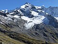
Birnlückenhütte with Dreiherrnspitze

View from the hut to the Lahneralm with Lahner Moos

View from the ascent path at the Lahneralm to the hut


Literature and map
- Heinrich Klier / Walter Klier : Alpine Club Guide Zillertal Alps , Bergverlag Rother , Munich 1996, ISBN 3-7633-1269-2
- Alpine Club map 1: 25,000, sheet 35/3, Zillertal Alps eastern sheet (the hut is here on the lower right edge of the map.)
- Alpine Club map 1: 25,000, sheet 36, Venediger group (on the far left edge of the map)
- Casa Editrice Tabacco: Carta Topografica 1: 25.000, sheet 035, Valle Aurina / Ahrntal, Vedrette di Ries / Rieserferner Group (on the upper right edge of the map)
Web links
- Birnlückenhütte in the historical Alpine archive of the Alpine clubs in Germany, Austria and South Tyrol (temporarily offline)
Individual evidence
- ^ Hanspaul Menara : South Tyrolean refuges . 2nd Edition. Athesia, Bozen 1983, ISBN 88-7014-017-2 , p. 156-157 .
- ↑ Transition of the refuges: basis laid for leadership body. Autonomous Province of Bolzano - South Tyrol, press releases, October 2, 2009, accessed on January 30, 2012 .
- ↑ refuges. Autonomous Province of Bolzano - South Tyrol, Asset Management Department, accessed on January 30, 2012 .
- ^ Refuge: Agreement signed between Land, CAI and AVS. Autonomous Province of Bolzano - South Tyrol, press releases, July 8, 2015, accessed on July 8, 2015 .