Quelkhorn
|
Quelkhorn
Spots Ottersberg
Coordinates: 53 ° 8 ′ 1 ″ N , 9 ° 5 ′ 1 ″ E
|
|
|---|---|
| Height : | 29 m above sea level NN |
| Incorporation : | 1968 |
| Incorporated into: | Fischerhude |
| Postal code : | 28870 |
| Area code : | 04293 |
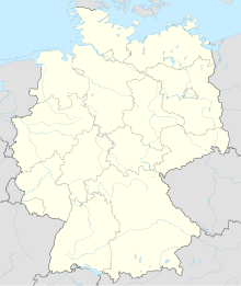
Location of Quelkhorn (Flecken Ottersberg) |
Quelkhorn is a place in the district of Verden , Lower Saxony and today belongs to the municipality of Ottersberg . Quelkhorn and the adjacent Fischerhude artists' colony are separated from each other by the Wümme River .
history
Archaeological finds in burial fields testify to settlement activity in Quelkhorn as early as the older Bronze Age.
As part of the Wilstedt parish , Quelkhorn and Fischerhude were first mentioned in 1124 as Quilechorne and Widagheshude an der Wemmo as the property of the Rastede Monastery . Later the patronage of the church in Wilstedt passed from the abbot of Rastede to the Counts of Oldenburg and remained in the possession of the Grand Duke of Oldenburg until the 19th century.
A part of Quelkhorn, the Surheide , is a shifting dune on the southern slope of the 29 meter high Quelkhorn mountain up to the Wümmeniederung, which was fortified by planting in the first half of the 19th century. The last free dune areas disappeared between 1970 and 1990. The Surheide was pasture and cattle ground for the farmers.
Wilhelmshausen was a district on the country road to Fischerhude. Most of the courtyards there were built after the great fire in the Quelkhorn center in the 1920s. The Wilhelmhaus was a building with a customs post on the road just before the Wümme-Nordarmbrücke, where goods were loaded from carts onto boats and then transported on the Wümme to Bremen and Lilienthal .
Before the moor colonization by Jürgen Christian Findorff , there was the Fischerhuder moorland on the road to Lilienthal and the Quelkhorn moorland parallel to Wilstedter Kirchweg.
The Fischerhuder moorland was completely dismantled and converted into pure pastureland. There is now a small industrial area and the sports field of the local football club.
The Quelkhorn moorland, on the other hand, is only slightly degraded and will be rewetted, decussed and renatured in order to preserve or regain the original high moor.
With the municipal territorial reform in 1968 the localities Fischerhude and Quelkhorn were merged. On July 1, 1972, Fischerhude was incorporated into the unified community of Flecken Ottersberg.
coat of arms
Quelkhorn's coat of arms shows the Erd-Holländer windmill from 1880 , which is located on the current grounds of the Parzival farm on the Mühlenberg. This can also be found in the coat of arms of the Quelkhorn shooting club.
societies
- Shooting club (at the shooting range in Surheide - Toboggan Hill)
- Riding and car pool (RFG-Fischerhude)
- Riding club (Trifte)
- TSV Fischerhude-Quelkhorn - gymnastics and sports club emerged from the merger of the two clubs TSV Fischerhude and FC Quelkhorn
- Fischerhude-Quelkhorn volunteer fire brigade
Personalities
Daughters and sons of the place:
- Heinrich Peper (1902–1984), NSDAP politician
Other personalities related to the location:
- Otto Modersohn (1865–1943), landscape painter and co-founder of the Worpswede artists' colony
- Sophie Gallwitz (1873–1948), writer
- Richard Jansen (1878–1941), architect
- Rolf Speckmann (1918–1995), politician (FDP), senator in Bremen and banker
- Hille Darjes (1943–2018), actress and radio play and audio book speaker
- Manfred Schaefer (* 1943), Australian soccer player and coach
- Sven Schomacker (* 1973), politician (Pirate Party)
- Lennard Bertzbach (* 1988), actor, musician and singer
Individual evidence
- ↑ Document of September 27, 1124: Pope “Calixtus II” confirms the rights and possessions of the Rastede monastery; Copy in Johann Martin Lappenberg (ed.): Hamburger Urkundenbuch, first volume , Perthes, Besser & Mauke, Hamburg 1842, p. 127f
- ^ Federal Statistical Office (ed.): Historical municipality directory for the Federal Republic of Germany. Name, border and key number changes in municipalities, counties and administrative districts from May 27, 1970 to December 31, 1982 . W. Kohlhammer GmbH, Stuttgart and Mainz 1983, ISBN 3-17-003263-1 , p. 247 .


