Râul Negru
| Râul Negru | ||
|
The Râul Negru at Sântionlunca |
||
| Data | ||
| location | Transylvania ( Romania ) | |
| River system | Danube | |
| Drain over | Olt → Danube → Black Sea | |
| source |
Nemira Mountains 46 ° 9 ′ 52 ″ N , 26 ° 19 ′ 5 ″ E |
|
| Source height | 1150 m | |
| muzzle | at Lunca Câlnicului in the Olt coordinates: 45 ° 45 ′ 37 ″ N , 25 ° 45 ′ 24 ″ E 45 ° 45 ′ 37 ″ N , 25 ° 45 ′ 24 ″ E |
|
| Mouth height | 500 m | |
| Height difference | 650 m
|
|
| Catchment area | 2320 km² | |
| Left tributaries | Pârâul Mare , Brețcu , Opălnău , Ojdula , Racoş , Ghelința , Zăbala , Covasna , Pârâul Beldii , Lisnău , Pârâul Satului , Tărlung | |
| Right tributaries | Lemnia , Estelnic , Cașin , Hățuica , Valea Mare , Cernat , Fundul Pârâului , Dalnic , Pădureni , Reci , Angheluș | |
| Medium-sized cities | Târgu Secuiesc | |
| Communities |
Lemnia , Catalina , Zăbala , Brateș , Boroșneu Mare , Reci , Ozun , Chichiș , Prejmer |
|
|
The Râul Negru in Romania |
||
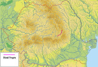
The Râul Negru ( Schwarzbach ; Hungarian Feketügy ) is a tributary of the Olt ( Alt ), which flows in the Covasna and Brașov districts in the Romanian region of Transylvania .
It rises in the Nemira Mountains , a part of the Eastern Carpathian Mountains , and then flows mainly in a south-westerly direction until it flows into the Olt in the municipality of Prejmer ( Tartlau ).
On its course through very hilly terrain, the water is mainly characterized by alternating rapids and smaller waterfalls. The Râul Negru serves as an important source of water for agriculture and the neighboring communities.
swell
- Administrația Națională Apelor Române - Cadastrul Apelor - Bucureşti
- Institutul de Meteorologie și Hidrologie - Rîurile României - București 1971
- ICPA - Comune vulnerabile - Județul Brașov ( Memento of February 8, 2012 in the Internet Archive ) (PDF file; 5.9 MB)
- ICPA - Comune vulnerabile - Județul Covasna ( Memento of February 8, 2012 in the Internet Archive ) (PDF file; 2.7 MB)
- Trasee turistice - județul Covasna

