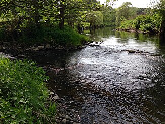
Rehbach (dill)
| Rehbach | ||
|
Mouth of the Rehbach into the Dill |
||
| Data | ||
| Water code | DE : 25848 | |
| location | Rhineland-Palatinate, Hesse, Germany | |
| River system | Rhine | |
| Drain over | Dill → Lahn → Rhine → North Sea | |
| source | North of Homberg 50 ° 38 ′ 42 ″ N , 8 ° 6 ′ 27 ″ E |
|
| Source height | 606 m above sea level NN | |
| muzzle | North of Sinn in the Dill coordinates: 50 ° 39 ′ 50 ″ N , 8 ° 19 ′ 11 ″ E 50 ° 39 ′ 50 ″ N , 8 ° 19 ′ 11 ″ E |
|
| Mouth height | 196 m above sea level NN | |
| Height difference | 410 m | |
| Bottom slope | 20 ‰ | |
| length | 20.5 km | |
| Catchment area | 48.666 km² | |
| Reservoirs flowed through | Krombachtalsperre , Driedorftalsperre | |
The Rehbach is a 20 km long orographically right or western tributary of the Dill in Rhineland-Palatinate and Hesse , Germany .
geography
The Rehbach rises about 400 m north of Homberg at an altitude of 606 m above sea level. NN . It first flows in a south-easterly direction through deer and then reaches the Krombachtalsperre . After flowing through the reservoir, the Rehbach flows mainly in northeastern directions. After flowing through Mademühlen , the stream is dammed again by the Driedorftalsperre . The barrage of this dam is located on the southern outskirts of Driedorf , although the village itself is not traversed. Flowing further in northeastern directions, the Rehbach passes Guntersdorf (Herborn) on the left bank of the river with another dam. Then it touches Merkenbach north . Here, the Rehbach water is stored in a pressure reservoir (Merkenbacher water tower) and fed to a turbine at the reservoir in Sinn (Hesse) before the stream, after crossing under the federal motorway 45, is on the right at 196 m above sea level. NN flows into the dill .
In terms of length, gradient and water volume, the Rehbach was already one of the best-used creek systems in Germany for energy production in the 1930s. The water quality is so good now that freshwater mussels have been settled here.
With a height difference of 410 m between the source and the mouth, the mean bed slope is 20.5 ‰. The 48.666 km² catchment area is drained to the North Sea via Dill, Lahn and Rhine .
Individual evidence
- ↑ a b Measurement using a topographic map 1: 25,000
- ↑ a b Water directory of the State Office for Nature, Environment and Consumer Protection NRW 2006 ( Memento from February 15, 2010 in the Internet Archive ) (PDF; 1.03 MB)

