Rehberg (Harz)
| Rehberg | ||
|---|---|---|
|
View from the Jordanshöhe near Sankt Andreasberg |
||
| height | 893 m above sea level NHN | |
| location | near Sankt Andreasberg ; District of Goslar , Lower Saxony ( Germany ) | |
| Mountains | resin | |
| Dominance | 3.2 km → Achtermannshöhe | |
| Notch height | 122 m | |
| Coordinates | 51 ° 44 '26 " N , 10 ° 32' 17" E | |
|
|
||
The Rehberg near Sankt Andreasberg in the Lower Saxony district of Goslar is 893 m above sea level. NHN the fourth highest mountain in Lower Saxony and one of the highest mountains in the Harz .
geography
location
The Rehberg rises in the Upper Harz in the Harz National Park . Its summit about 3.5 km north-northeast of the Braunlager district of Sankt Andreasberg . In the north-east, east and south-east its landscape slopes down into the Oder valley - in the east over the high cliffs . In the south - above the Rehberger Graben - are the Wulffsschurre cliffs . To the south-south-west, its landscape runs roughly along state road 519 to the Jordanshöhe with the hilltop to the west, and to the west it drops over the valley of the Fischbach to that of the Sieber . In the north-west is the small one and beyond it the large sun mountain .
Natural allocation
The Rehberg is located in the natural spatial main unit group Harz (No. 38) and in the main unit Hochharz (381) in the subunit Torfhäuser Hügelland (381.1). Its landscape descends in a southerly direction into the main unit Upper Harz (380) with the subunit Southern Upper Harz (380.8): to the south-west and south into the natural area Andreasberger Plateau (380.83) and to the south-east into the natural area Oderbergland (380.81).
Protected areas and nature
Parts of the fauna-flora-habitat area Harz National Park (Lower Saxony) (FFH no. 4129-302; 157.70 km² ) and the Harz National Park bird sanctuary (VSG no. 4229-402; 155.59 ) are located on the Rehberg km²).
The Rehberg is a fairly flat and wide knoll that is mostly wooded. A swamp biotope was created on its summit region through artificial water damming.
Observatory


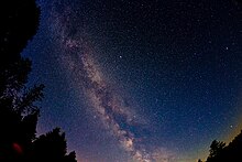
Due to the geographical location and the small number of buildings on the Rehberg, it has an almost naturally dark night sky with a surface brightness of 21.75 mag / arcsec².
For this reason, the Sankt Andreasberg e. V. selected a building on the grounds of the Internationale Haus Sonnenberg (IHS) on the southwestern part of the mountain as the location for its accessible observatory (see the astronomy section of the article Sankt Andreasberg ).
Ski cross, hiking and Rehberger Grabenhaus
The Rehberg Ski Cross is located between the Rehberg and the Kleiner Sonnenberg . On a steel pole it carries a compass rose , which instead of the cardinal points shows the letters "S" for the Sonnenberg, "O" for the Oderteich, "R" for the Rehberg and "A" for Sankt Andreasberg.
The mountain is difficult to access because the access path leading past the ski cross was renatured a few years ago by the Harz National Park as part of its route plan in terms of nature conservation.
On the east and south flanks of the mountain, along the Rehberger Graben , where the Rehberger Grabenhaus is located, the Rehberger Grabenweg and the somewhat higher Rehberger Planweg lead hikers and cross-country skiers around the mountain.
See also
Web links
References and comments
- ↑ a b Rehberg , on harzlandhexe.de
- ↑ Jürgen Spönemann: Geographical Land Survey: The natural spatial units on sheet 100 Halberstadt. Federal Institute for Regional Studies, Bad Godesberg 1970. → Online map (PDF; 4.7 MB)
- ↑ Map services of the Federal Agency for Nature Conservation ( information )
- ↑ a b Utz Schmidtko, Harz Observatory
- ↑ Sternwarte Sankt Andreasberg - Sternpark ( Memento of the original from October 29, 2013 in the Internet Archive ) Info: The archive link has been inserted automatically and has not yet been checked. Please check the original and archive link according to the instructions and then remove this notice. , accessed October 6, 2014


