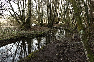
Riedelbach (Irrsee)
| Riedelbach | ||
| Data | ||
| Water code | AT : HZB: 2-122-152-001-001, OWK: 40272 | |
| location | Salzkammergut , Upper Austria | |
| River system | Danube | |
| Drain over | Irrsee → Zellerache → Mondsee → Seeache → Attersee → Ager → Traun → Danube → Black Sea | |
| River basin district | Danube below Jochenstein (DUJ) | |
| Beginning | at Wegdorf 47 ° 56 ′ 36 ″ N , 13 ° 18 ′ 28 ″ E |
|
| Source height | 571 m above sea level A. | |
| muzzle | West Laiter coordinates: 47 ° 55 '53 " N , 13 ° 18' 0" E 47 ° 55 '53 " N , 13 ° 18' 0" E |
|
| Mouth height | 553 m above sea level A. | |
| Height difference | 18 m | |
| Bottom slope | approx. 9.9 ‰ | |
| length | approx. 1.8 km | |
| Catchment area | 1.703 km² | |
| Communities | Oberhofen am Irrsee | |
The Riedelbach is a small brook on the Zeller or Irrsee in Mondseeland , part of the Salzkammergut in the Hausruckviertel of Upper Austria .
Run and landscape
The stream rises in the municipality of Oberhofen am Irrsee not far north of the lake in a ditch between Wegdorf and Haarberg at about 570 m above sea level. A. It flows southwest towards the Kolomannsberg , then turns southeast below Speck and flows at the Irrsee north moor between Laiter and Fischhof after almost 2 kilometers into the Irrsee ( 553 m above sea level ).
Geology and hydrography
The stream originates at the valley between Irrsee and Straßwalchen crossing Riedel , of which he has his name. This is one of the larger terminal moraines of the Dachstein glacier from the Würm Ice Age , the last ice age (approx. 100,000-10,000 years before today), which also formed the Irrsee. It forms the valley watershed between the catchment area of the Ager (with Attersee and Mondsee), which flows eastward to the Traun , and the Mattig , which goes northwest to the Inn . The Irrsdorfer Bach (Mühlbach) drains north of the watershed . It is a run formation in the glacier retreat - apron . Bog and moss meadows on the north bank of the Irrsee are silting areas; it is assumed that the lake was initially much larger here. To the north and northwest are alluvial plains, which could represent the old overflows of the Wurmzeitlichen Irrsee as a glacier end lake (and perhaps a later much larger Mondsee ). To the south, as the entire Mondsee-Irrsee area is drained today ("upside down" inwards into the Alps), the runoff can only have arisen much later, when the glacier finally opened the inflow of the Seeache to the Attersee on the Schafberg .
The brook represents the uppermost section of the main line in the Ager catchment area , up to its confluence with the Traun there are a good 82 kilometers of flow path from the hydrographic Riedelbach origin.
Web links
Individual evidence
-
↑ a b c d e f g h i Hence HZB code 2-122-152-001-001, first detailed water body of the Ager (2-122-152-001, route ID 2122152 noted); DWK no. 40272 0000, stationed as such from km 82.23177 to km 80.40683 (1.82494);
Information about DORIS , subject of water and geology , information on detailed catchment areas , doris.ooe.gv.at -
↑ cf. Eberhard Fugger: The Upper Austrian Pre-Alps between Irrsee and Traunsee . In: Yearbook dkk geol. Reichsanstalt. 1903, Volume 63, Issue 2, Chapter Der Irrsee , esp. P. 298 (whole article p. 295–350, with panel XIV., PDF, geologie.ac.at , there p. 4);
Gustav Görzinger: Report 1959 about recordings on sheet Straßwalchen (64) . In: Negotiations of the Federal Geological Institute 1960, Quaternary section : Zellerseer branch of the Traungletscher , p. A 38 ( full article p. A 36–38, pdf , opac.geologie.ac.at) - ↑ The pass landscapes Thalgau - Enzersberg as well as Oberwang - Traschwandt of the two side tongues of the Mondsee glacier are both at approx. 640 m above sea level. A. , so can never have been lake outflows. The Mondsee is 481 m above sea level. A. , the Attersee 469 m above sea level. A. , but it is assumed that the two lakes were separated from the Schafberg much later by a landslide. This could have wiped out the late Neolithic moon sea culture (approx. 5000 years ago).
- ↑ Here, lakes are not completely measured in a straight line, but along main axes in the river bed. The Irrsee is stationed at 4.9 kilometers from km 80.40683 to 75.52143, the length of the lake from north to south is only 4.7 km.
