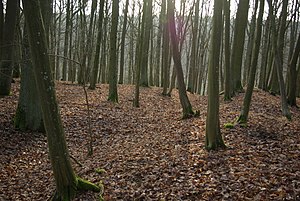
Ringwall Schwedenschanze (Kützberg)
| Ringwall Schwedenschanze | ||
|---|---|---|
|
Ring wall on the southeast side with an earth bridge |
||
| Creation time : | 9th century | |
| Castle type : | Höhenburg, ring wall system | |
| Conservation status: | Castle stable, ring wall with outer moat preserved | |
| Place: | Poppenhausen - Kützberg -Flur "Bauholz" | |
| Geographical location | 50 ° 5 '24.8 " N , 10 ° 6' 16.5" E | |
| Height: | 310.5 m above sea level NN | |
|
|
||
The ring wall Schwedenschanze is an abandoned early medieval hill fort (ring wall system) at 310.5 m above sea level. NN on a spur-like mountain corner pushed forward to the west above the valley of the Kützberger Bach and a tributary. It is located about 1400 meters northwest of the Catholic parish church of St. Michael in Kützberg in the Lower Franconian community of Poppenhausen in the district of Schweinfurt in Bavaria . No historical or archaeological information is known about this ring wall ; due to the construction with slope trenches, it is dated to the early Middle Ages, probably the 9th century. Only a rectangular ring wall with an outer moat has survived from the complex . The place is protected as ground monument number D-6-5926-0039: Early medieval ring wall "Schwedenschanze" .
description
The roughly rectangular fortification, stretching from northeast to southwest, had dimensions of 115 by 85 meters, and is located on terrain sloping to the southwest. Its south-west side runs parallel to the steep mountain slope that slopes down to the valley, which has also been artificially steepened here. The facility is secured here by a 0.5 meter high terrace, which extends around the western tip of the fortification and also runs along the northwest side. On this side, which is also naturally well protected by steep mountain slopes to a side valley, the terrace then turns into a wall with a sloping ditch. The moat is very well preserved on the entire rising north-east side and on the south-east side, here it reaches a height of 0.8 meters and a width of three meters. The upstream trench is 0.7 meters deep and also three meters wide. There are no more traces of building visible above ground on the inner surface.
The earlier access was on the southeast side, about 20 meters southwest of the eastern corner of the facility. Here the ring wall is interrupted over a length of two meters, an earth bridge of the same width was left in the ditch.
literature
- Björn-Uwe Abels : The prehistoric and early historical site monuments of Lower Franconia . (Material booklets on Bavarian prehistory, series B, volume 6). Verlag Michael Lassleben, Kallmünz 1979, ISBN 3-7847-5306-X , pp. 175-176.
- Björn-Uwe Abels: Guide to prehistoric and early historical monuments, Volume 27: Würzburg, Karlstadt, Iphofen, Schweinfurt . Verlag Philipp von Zabern , Mainz 1977, pp. 158 and 286–287.
Individual evidence
- ↑ Location of the ring wall in the Bavaria Atlas
- ↑ Björn-Uwe Abels: Guide to prehistoric and early historical monuments, Volume 27: Würzburg, Karlstadt, Iphofen, Schweinfurt , pp. 158 and 286
- ↑ List of monuments for Poppenhausen (PDF) at the Bavarian State Office for Monument Preservation (PDF; 145 kB)


