Burgstall Bergheide
| Burgstall Bergheide | ||
|---|---|---|
|
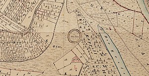
The castle site on an enlarged section of the Bavarian premiere (1808 to 1864) |
||
| Creation time : | High medieval | |
| Castle type : | Höhenburg, spur location | |
| Conservation status: | Burgstall, trench remains | |
| Place: | Gochsheim - Weyer - "Herrenberg" | |
| Geographical location | 50 ° 1 '54.7 " N , 10 ° 18' 40" E | |
| Height: | 242 m above sea level NHN | |
|
|
||
The Burgstallberg Heide is an Outbound high medieval hilltop castle on the Herrenberg, about 1,000 meters north-west of the church in Weyer , in the municipality of Gochsheim in the district of Schweinfurt in Bavaria . Only a ring moat has survived from the complex; the site is protected as a ground monument number D-6-5927-0058 "Medieval castle stables" Bergheide "".
history
In 1205 nobles were named at Bergheide Castle, which was destroyed in 1447. The castle is said to have been the seat of the knight of Bergheide, who was also the feudal lord of the village of Bergheide, which fell at the foot of the mountain. On the top of the hill, the ten-meter-wide ring moat that has collapsed is still preserved and the castle path can be seen on the slope.
In 1812 a wayside shrine was erected on the hill behind the former castle with the representation of St. Moritz , which reminds of the much-visited pilgrimage chapel "St. Moritz Chapel", which was demolished after the secularization . The field names "Kapelläcker", "Kapellholz" and "Kapellweg" are reminiscent of the chapel.
description
The small, one-piece castle site is 242 m above sea level. NN height, and thus around 30 meters above the valley floor of the Main , on the mountain nose of Herrenberg, which tapers to the north in the corridor Kapelläcker. This complex belongs to the type of the one- storey residence , which means that its inner surface is neither raised nor raised compared to the area in front of it.
The roughly round castle surface has a diameter of around 30 meters, its inner surface slopes slightly to the north. To the north as well as to the northeast, the terrain drops steeply on the edge of the castle area to the valley of the Main, on the northwest side steeply into a small erosion valley. To the south, the area in front of the building goes slightly uphill into a small plateau, on which the route of the federal motorway 70 also runs. A ten meter wide and two meter deep neck ditch was created on the south side of the castle to protect against approaching from this direction . This trench merges into a slope trench in the northern area of the facility, so that it appears as a ring trench overall.
literature
- Heinrich Habel and Helga Himen (arr.): Monuments in Bavaria - ensembles, architectural monuments, archaeological site monuments: Volume VI . Lower Franconia. Bavarian State Office for the Preservation of Monuments (ed.). Munich 1985.
- Björn-Uwe Abels : The prehistoric and early historical site monuments of Lower Franconia . (Material booklets on Bavarian prehistory, series B, volume 6). Verlag Michael Lassleben, Kallmünz 1979, ISBN 3-7847-5306-X , p. 182.
- Römisch-Germanisches Zentralmuseum (Hrsg.): Guide to prehistoric and early historical monuments, Volume 27: Würzburg, Karlstadt, Iphofen, Schweinfurt . Verlag Philipp von Zabern , Mainz 1977, p. 184.
Web links
- Entry on Bergheide Castle (Kapell-Äcker) in the private database "Alle Burgen".
- Relief map with the Burgstall in the Geoportal Bavaria
Individual evidence
- ↑ List of monuments for Gochsheim (PDF) at the Bavarian State Office for Monument Preservation (PDF; 134 kB)
- ↑ Weyer's village history at gochsheim.de
- ↑ Bergheide at schweinfurtfuehrer.de
- ↑ St. Moritz at schweinfurtfuehrer.de
- ^ Location of the Burgstall in the Bavarian Monument Atlas
- ↑ Source description: Björn-Uwe Abels: The prehistoric and early historical terrain monuments of Lower Franconia , p. 182


