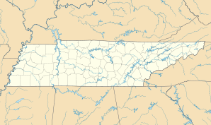
Rockford, Tennessee
| Rockford | ||
|---|---|---|
|
Location in Tennessee
|
||
| Basic data | ||
| Foundation : | 1970 (incorporated) | |
| State : | United States | |
| State : | Tennessee | |
| County : | Blount County | |
| Coordinates : | 35 ° 50 ′ N , 83 ° 56 ′ W | |
| Time zone : | Central ( UTC − 6 / −5 ) | |
|
Inhabitants : - Metropolitan Area : |
856 (status: 2010) 698.030 (status: 2010) |
|
| Population density : | 103 inhabitants per km 2 | |
| Area : | 8.31 km 2 (approx. 3 mi 2 ) | |
| Height : | 252 m | |
| Postal code : | 37853 | |
| Area code : | +1 865 | |
| FIPS : | 47-64160 | |
| GNIS ID : | 1299809 | |
Rockford is a small town (with the status " City ") in Blount County in the US -amerikanischen State Tennessee . In 2010 , Rockford had a population of 856, which increased to 862 by 2013.
Rockford is located in the Knoxville Metropolitan Area , the metropolitan area around the city of Knoxville .
geography
Rockford is located in eastern Tennessee on the Little River , which is part of the Mississippi River basin across the Tennessee River and the Ohio .
The geographical coordinates of Rockford are 35 ° 49'39 "north latitude and 83 ° 56'27" west longitude. The urban area extends over an area of 8.31 km².
Neighboring towns to Rockford are Seymour (13 miles east-northeast), Wildwood (10.3 km east-southeast), Eagleton Village (4.3 km south), Alcoa (on the southwestern city limits) and Louisville (12 km west).
Knoxville city center is located 17 km to the northeast. The nearest other major cities are Lexington , Kentucky (295 km northwest), Charlotte , North Carolina (371 km east-southeast), Greenville , South Carolina (269 km southeast), Atlanta , Georgia (292 km south), Chattanooga (181 km southwest) , Tennessee's capital Nashville (292 km west), Bowling Green in Kentucky (323 km northwest) and Kentucky's largest city Louisville (401 km northwest).
traffic
The Interstate 140 , a feeder of I 40 , runs along the south-western limit of Rockford. The Tennessee State Route 33 runs as the main road in north-south direction by Rockford. All other roads are subordinate country roads, some unpaved roads and inner-city connecting roads.
A freight railway line for the Norfolk Southern Railway (NS) forms the northwestern city limits of Rockford.
The nearest airport is McGhee Tyson Airport, 7 km southwest of Knoxville.
population
| Population development | |||
|---|---|---|---|
| Census | Residents | ± in% | |
| 1980 | 567 | - | |
| 1990 | 646 | 13.9% | |
| 2000 | 798 | 23.5% | |
| 2010 | 856 | 7.3% | |
| 2013 estimate | 862 | 0.7% | |
| 1980-2000 2010-2013 | |||
According to the 2010 census , Rockford had 856 people in 340 households. The population density was 103 inhabitants per square kilometer. Statistically, 2.52 people lived in each of the 340 households.
The racial the population was composed of 96.8 percent white, 0.4 percent African American, 0.1 percent (one person) Native American and 0.7 percent Asian; 2.0 percent were descended from two or more races. Hispanic or Latino of any race was 1.3 percent of the population, regardless of ethnicity.
21.3 percent of the population were under 18 years old, 62.3 percent were between 18 and 64 and 16.4 percent were 65 years or older. 51.5 percent of the population were female.
The average annual income for a household was 53,375 USD . The per capita income was $ 25,642. 3.5 percent of the population lived below the poverty line.
Individual evidence
- ↑ a b c American Fact Finder. Retrieved December 21, 2014
- ↑ Distance information according to Google Maps. Accessed on December 21, 2014
- ↑ United States Census Bureau - Census of Population and Housing.Retrieved December 21, 2014
