Rosbach (Nidda)
| Rosbach | ||
|
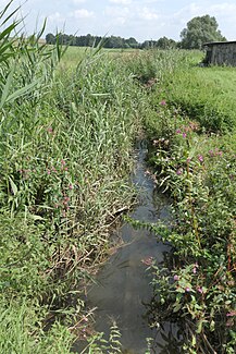
The Rosbach near Nieder-Rosbach |
||
| Data | ||
| Water code | DE : 24852 | |
| location | Germany | |
| River system | Rhine | |
| Drain over | Nidda → Main → Rhine → North Sea | |
| source | on the northern edge of the city of Rosbach in front of the Höhe am Taunus 50 ° 18 ′ 17 ″ N , 8 ° 41 ′ 12 ″ E |
|
| muzzle | near Nieder-Wöllstadt in the Nidda coordinates: 50 ° 16 '38 " N , 8 ° 47' 4" E 50 ° 16 '38 " N , 8 ° 47' 4" E
|
|
| length | 9 km | |
| Catchment area | 23.66 km² | |
| Discharge A Eo : 23.66 km² at the mouth |
MNQ MQ Mq |
36 l / s 128.3 l / s 5.4 l / (s km²) |
The Rosbach is a brook in the state of Hesse , Germany .
geography
course
The Rosbach rises on the northern edge of the city of Rosbach am Taunus . The source can no longer be identified precisely due to the development of the Ober-Rosbach district , but there is a small pond near a leisure facility that certainly feeds the stream. From here the brook runs in pipes to the eastern edge of Ober-Rosbach. From the B455 , the stream flows freely.
This is where the Fahrenbach flows . This stream has its source in the crater-like valley on the Steinkopf . It carries more water and is longer than the Rosbach, but the Rosbach has kept its name. When it rains the water is often clouded, as some former in the headwaters of quartzite - quarries lie.
Now the stream reaches the Nieder-Rosbach district , where it feeds the moat of the moated castle . There are other ponds here, which have a negative impact on the water quality due to their high duck populations . After leaving the town of Rosbach, a sewage treatment plant follows . The stream now flows in a small depression in the Wetterau to Ober- Wöllstadt . From here the stream is called Gänsbach . The Nieder-Wöllstadt brook flows through a forest. Here the Lachengraben flows from the right side . As the Aubach , it flows into the Nidda after a short stretch .
Tributaries
- Fahrenbach ( right ), 4.7 km, 5.82 km²,
- Lachengraben [GKZ 2485234] ( left ), 1.5 km
- Lachengraben [GKZ 2485292] ( right ), 1.4 km
Nidda river system
Individual evidence
- ↑ a b Water map service of the Hessian Ministry for the Environment, Climate Protection, Agriculture and Consumer Protection ( information )
- ↑ Designation according to the property map
Web links
- Hessian State Office for Environment and Geology: Retention cadastre for the Aubach river basin (PDF file; 1.54 MB)
- Profile of Rosbach ( Memento from February 11, 2013 in the web archive archive.today )

