Rosenberg (Niedermeiser)
| Rosenberg | ||
|---|---|---|
|
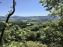
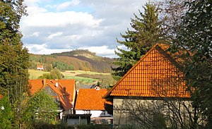
View from the Niedermeiser cemetery eastwards to the Rosenberg |
||
| height | 299.7 m above sea level NHN | |
| location | at Niedermeiser ; District of Kassel , Hessen ( Germany ) | |
| Mountains | Oberwälder Land | |
| Coordinates | 51 ° 28 '14 " N , 9 ° 19' 37" E | |
|
|
||

The Rosenberg is 299.7 m above sea level. NHN high elevation of the Oberwälder Land . It is located near Niedermeiser in the northern Hessian district of Kassel .
geography
location
The Rosenberg is, measured from the summit, 2 km northeast of Niedermeiser and 2.5 km southeast of Zwergen , two districts of Liebenauer , and 2.1 km south of the Hofgeismar district of Friedrichsdorf , 4.5 km southwest of the Hofgeismar core city and 3.2 km km west-northwest of the Hofgeismar district of Kelze . The settlement of Waldesruh is located on the southwest slope . The Apenbecke (stream from the Frenschen Warte ) flows around to the south and flows into the warm water at Niedermeiser .
Directly southwest of the summit is a former basalt quarry, which is protected as an extensive natural monument "Rosenberg" (No. 6.33.467; see list of natural monuments in Liebenau ).
Natural allocation
The Rosenberg belongs to the southern edge of the natural spatial main unit group Upper Weserbergland (No. 36) in the main unit Oberwälder Land (361) and the subunit Brakeler Kalkgebiet (361.0) to the natural area Bever-Diemel-Kalkbergland (361.02). The landscape passes in the valley of the stream from the Frenschen waiting to the main unit group West Hesse Highlands (34) to the main unit West Hesse Depression (343) and to the subunit North Habicht forests foreshore (343.5) counting natural areas West Uffelner sink (343.51) in the south and Langen- and Staufenberg plate ( 343.50) in the southwest over.
Traffic and walking
About south past the Rosenberg in the valley of the brook from the Frenschen Warte runs the state road 3212, which leads from the Hofgeismar core town in the northeast to Niedermeiser in the southwest. There it meets the L 3211, which runs along the Warme from Obermeiser through Niedermeiser to Zwergen . Starting from these roads, for example, the survey can only be reached on forest paths and paths.
Individual evidence
- ↑ a b Map services of the Federal Agency for Nature Conservation ( information )
- ↑ Martin Bürgener: Geographical Land Survey: The natural spatial units on sheet 111 Arolsen. Federal Institute for Regional Studies, Bad Godesberg 1963. → Online map (PDF; 4.1 MB)
- ^ Hans-Jürgen Klink: Geographical land survey: The natural space units on sheet 112 Kassel. Federal Institute for Regional Studies, Bad Godesberg 1969. → Online map (PDF; 6.9 MB)

