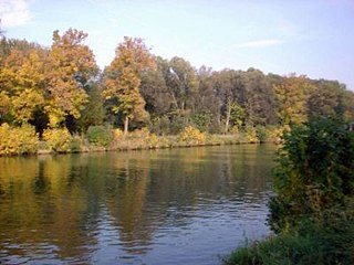
Sacrow-Paretz Canal
| Sacrow-Paretz Canal | |||||||||||||||||||||||||||||||||||||||||||||||||||||||||||||
|---|---|---|---|---|---|---|---|---|---|---|---|---|---|---|---|---|---|---|---|---|---|---|---|---|---|---|---|---|---|---|---|---|---|---|---|---|---|---|---|---|---|---|---|---|---|---|---|---|---|---|---|---|---|---|---|---|---|---|---|---|---|
|
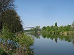
The Sacrow-Paretz Canal between Jungfernsee and Göttinsee |
|||||||||||||||||||||||||||||||||||||||||||||||||||||||||||||
| abbreviation | SPK | ||||||||||||||||||||||||||||||||||||||||||||||||||||||||||||
| length | 12.50 | ||||||||||||||||||||||||||||||||||||||||||||||||||||||||||||
| Built | 1875 | ||||||||||||||||||||||||||||||||||||||||||||||||||||||||||||
| Expanded | 1925–1930 / 2014–2017 | ||||||||||||||||||||||||||||||||||||||||||||||||||||||||||||
| class | IV and V | ||||||||||||||||||||||||||||||||||||||||||||||||||||||||||||
| Beginning | Jungfernsee | ||||||||||||||||||||||||||||||||||||||||||||||||||||||||||||
| The End | Goddess lake | ||||||||||||||||||||||||||||||||||||||||||||||||||||||||||||
| Junctions, crossings | Joke, not navigable | ||||||||||||||||||||||||||||||||||||||||||||||||||||||||||||
| Used river | Havel , Wublitz | ||||||||||||||||||||||||||||||||||||||||||||||||||||||||||||
| Kilometrage | from east to west | ||||||||||||||||||||||||||||||||||||||||||||||||||||||||||||
| Ascent | from west to east | ||||||||||||||||||||||||||||||||||||||||||||||||||||||||||||
| Competent authority | Brandenburg Waterways and Shipping Office | ||||||||||||||||||||||||||||||||||||||||||||||||||||||||||||
| The Sacrow-Paretz Canal north of Töplitz near Potsdam | |||||||||||||||||||||||||||||||||||||||||||||||||||||||||||||
|
course
|
|||||||||||||||||||||||||||||||||||||||||||||||||||||||||||||
The Sacrow-Paretzer Canal (SPK) in the state of Brandenburg is a section of the federal waterway Untere Havel-Wasserstraße (official abbreviation: UHW). The Brandenburg Waterways and Shipping Office is responsible for the administration .
location
The canal begins at km 20.11 of the UHW and connects the Havel at the city limits of Berlin - Potsdam ( Jungfernsee ) with the Havel east of Ketzin / Havel . At km 32.59 the canal ends at the Göttinsee near Paretz and there it reaches the Havel again. Shortly before that, the Havel Canal joins the Sacrow-Paretz Canal from the northeast . The Sacrow-Paretz Canal crosses the White Lake , the Fahrlander Lake on the southern edge and the Schlänitzsee ; the Schlänitzsee belongs to the river area of the Wublitz . At km 28.48 south of the village of Uetz , the federal motorway A10 - Westlicher Berliner Ring crosses the canal. A total of four bridge structures cross the Sacrow-Paretz Canal. The entire waterway is 12.5 km long, around 7.5 km of which are canals and the remaining 5.0 km of existing lakes.
Hydrology
Since the canal has no locks, at least half, but often a much larger part of the Havel water flows from Jungfernsee to Göttinsee through the canal and accordingly less through the Potsdam Havel bend with old and new voyages.
| Flows | Havel: Spandau- Jungfernsee |
difference | Canal: Jungfernsee- Schlänitzsee |
Canal: Schlänitzsee- Göttinsee |
difference | Havel: Göttinsee- Ketzin |
|
| Medium flood | 107 m³ / s | 37.1 m³ / s | 72.9 m³ / s | 74.6 m³ / s | 60.4 m³ / s | 135 m³ / s | |
| Mean water | 35.1 m³ / s | 6.5 m³ / s | 28.6 m³ / s | 32.4 m³ / s | 18.3 m³ / s | 50.7 m³ / s | |
| Medium low water | 6.33 m³ / s | 3.13 m³ / s | 3.20 m³ / s | 3.00 m³ / s | 0.47 m³ / s | 3.47 m³ / s |
Explanation for the local differences in the water flow in the canal: Part of the water here takes its way through the lower Wublitz . On the other hand, there are also lateral tributaries.
The jumps in the flow values compared to the Spandau - Jungfernsee and Götinsee - Ketzin - Brandenburg sections give an indication of the parallel flow through the Potsdam Havel. The deficit of the flows between Ketzin-, Brandenburg and Plaue compared to Spandau-Potsdam at low water is explained by the particularly large extraction of service water during drought and by the considerable evaporation of the large Havel lakes at high temperatures.
history
At the beginning of the 1870s, extensive concepts were developed to improve shipping conditions on the waterways between Berlin and the Elbe . The first implementation was the construction of the Sacrow-Paretz Canal. Work began in 1874. As early as 1876, shipping was able to operate directly between Sacrow and Paretz . As early as 1888–1890 the sole was widened to 18 m and deepened. In the 1920s it was widened. Since then it has had an average water level of 50 meters and is around 3.40 meters deep.
Main reasons for construction
The main reasons were:
- bypassing the difficult bridges in Potsdam and Werder (Havel) ;
- the shortening of the route on the waterway by 13.5 km;
- avoiding the trip over the Schwielowsee , which at that time was dangerous for shipping , especially when the wind was strong from the west.
development
The Sacrow-Paretz Canal is one of the waterways that are being expanded for larger inland waterways as part of the German Unity Transport Project No. 17 . The expansion was planned from 2008 and should take four to five years. The canal expansion originally included a widening by excavating the northern bank. At the same time, a deepening of more than four meters should be made. Except for the narrowing at the Nedlitz piercing, large ships should be able to meet along the entire length of the canal. Since the canal is partly still in an undeveloped state, a traffic regulation was introduced. This includes a stipulation of meeting and overtaking bans as well as passing points for certain traffic groups. In the region there were and are protests against the expansion, since, especially in connection with the regional effects of global climate change, far-reaching consequences for flora, fauna and water balance are to be expected. Because of unforeseeable ecological consequences, the city of Potsdam has also rejected the canal expansion in a statement (among other things because of a forecast lowering of the water level of the Jungfernsee by two to nine centimeters). Studies commissioned at the beginning of the 1990s into an increase in cargo ship traffic have not yet been confirmed. In autumn 2008, the city of Potsdam and environmental associations filed a lawsuit against the canal widening at the Federal Administrative Court in Leipzig. In this regard, a settlement was reached in January 2010 in which the canal will be deepened, the banks re-paved, the canal bottom smoothed, but not widened. After completing the environmentally relevant tests as part of the planning approval procedure, careful expansion began. Beaver castles have been implemented and protection zones for sand lizards have been established. In the area of an already relocated beaver castle, new beavers have settled.
bridges
| number | km | photography | Name of the bridge / place | Remarks | Coordinates |
|---|---|---|---|---|---|
|
|
|||||
| 1 | 20.34 |
|
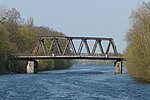
Nedlitzer Südbrücke, also called Friedensbrücke, Potsdam | Bundesstraße 2, Tschudistraße / Nedlitzer Straße | 52 ° 26 '14 " N , 13 ° 3' 3.2" E |
| 2 | 25.46 |
|
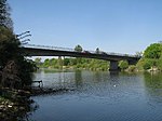
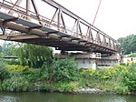
Road bridge, Marquardt Potsdam | Bundesstrasse 273, | 52 ° 27 '5.7 " N , 12 ° 58" 48.9 " E |
| 3 | 25.90 |
|
Marquardt railway bridge | 52 ° 27 '7.4 " N , 12 ° 58' 25.7" E | |
| 4th | 28.48 |
 
|
Uetz motorway bridge, BAB 10 | the federal highway 10 leads over the canal | 52 ° 27 '17.3 " N , 12 ° 56' 12" E |
annotation
With the construction of the Nedlitzer Durchstich section of the Sacrow-Paretz Canal from 1902 to 1904, the first bridge was built along the road over the new piercing between the White Lake and the Jungfernsee. The penetration was widened in 1932/33 and the bridge was also renewed in the course of the expansion. Destroyed at the end of the war in 1945, a new steel truss bridge was built in 1950 from the rubble of other bridges, which was called the Bridge of Peace . Over the years, the bridge became increasingly dilapidated, also as a result of intensive use by the heavy military vehicles of the Soviet army barracked nearby until the beginning of the 1990s. In 2010, construction work began on a new Nedlitz south bridge, which has been open to traffic since late 2011. On the post-war bridge there was a metal sign that read 1950 and Bridge of Peace . This plaque was lost for about a year and was put up again on January 23, 2013 in the presence of the Potsdam Lord Mayor on the south bank.
Traffic control
The control section 14 was defined in the section band of the Sacrow-Paretz Canal. It begins at kilometer 20 of the Lower Havel waterway (UHW) and ends at kilometer 27. In this section of the waterway, traffic is directed according to appropriate traffic groups .
Overview map
See also
literature
- Holger Lehmann: Berlin excursions - on the way to the most beautiful destinations of old Berlin . Berlin 2009, ISBN 978-3-86650-351-9
- Hans-J. Uhlemann: Berlin and the Märkische waterways . transpress Verlag Berlin, various years, ISBN 3-344-00115-9
- Writings of the Association for European Inland Shipping and Waterways e. V. various years. WESKA (Western European Shipping and Harbor Calendar), Binnenschifffahrts-Verlag, Duisburg-Ruhrort
- Folke Stender: Sports boat tickets inland 1 . Nautical Publication Verlagsgesellschaft, ISBN 3-926376-10-4 .
- W. Ciesla, H. Czesienski, W. Schlomm, K. Senzel, D. Weidner: Shipping maps of the inland waterways of the German Democratic Republic 1: 10,000, Volume 3 . GDR Waterways Inspectorate, Berlin 1988
Web links
Individual evidence
- ↑ Lengths (in km) of the main shipping routes (main routes and certain secondary routes) of the federal inland waterways. ( Memento of the original from January 21, 2016 in the Internet Archive ) Info: The archive link was inserted automatically and has not yet been checked. Please check the original and archive link according to the instructions and then remove this notice. Federal Waterways and Shipping Administration
- ↑ Directory E, serial no. 60 of the Chronicle. ( Memento of the original from July 22, 2016 in the Internet Archive ) Info: The archive link was automatically inserted and not yet checked. Please check the original and archive link according to the instructions and then remove this notice. Federal Waterways and Shipping Administration
- ↑ Q: \ GK-Daten \ Handakte \ OTHER \ Gradient-Geschw-Durchfl 2005–2014_NHN Flow rates, velocities, gradients . ( Memento of the original from March 24, 2016 in the Internet Archive ) Info: The archive link was inserted automatically and has not yet been checked. Please check the original and archive link according to the instructions and then remove this notice. (PDF) Brandenburg Waterways and Shipping Office. The Potsdam – Marquardt and Marquardt – Ketzin sections together form the Sacrow-Paretz Canal between Jungfernsee and Göttinsee.
- ↑ a b H.-J. Uhlemann: Berlin and the Märkische waterways . DSV-Verlag, Hamburg 1994
- ↑ wsv.de (PDF; 53 kB) Replacement construction of the Marquardt road bridge over the Sacrow-Paretz Canal
- ↑ The old sign is back, Nedlitzer Südbrücke is again called Bridge of Peace . In: Märkische Allgemeine / Potsdamer Tageszeitung, January 24, 2013, p. 14
Coordinates: 52 ° 27 ′ 0 ″ N , 12 ° 54 ′ 0 ″ E

