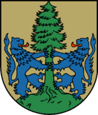
Integrated community of Dannenberg (Elbe)
| coat of arms | Germany map | |
|---|---|---|

|
Coordinates: 53 ° 6 ' N , 11 ° 6' E |
|
| Basic data (as of 2006) | ||
| Existing period: | 1972-2006 | |
| State : | Lower Saxony | |
| County : | Lüchow-Dannenberg | |
| Area : | 300.75 km 2 | |
| Residents: | 14,470 (Jun 30, 2005) | |
| Population density : | 48 inhabitants per km 2 | |
| Association structure: | 7 municipalities | |
| Mayor of the municipality : | Jürgen Meyer ( independent ) | |
The joint community of Dannenberg (Elbe) was a joint community in the Lüchow-Dannenberg district in Lower Saxony . Since July 1972, seven municipalities, which had been formed from 54 independent municipalities, were united in it to carry out their administrative business. On November 1, 2006, it merged with the Hitzacker (Elbe) community to form the new Elbtalaue community.
geography
Joint community structure
politics
Joint council
The last joint council of Dannenberg had 31 members in addition to the joint mayor.
- CDU - 15 seats
- SPD - 7 seats
- UWG - 4 seats
- GLW - 3 seats
- Green - 2 seats
- independent - 1 seat
Joint mayor of the municipality
The last mayor of the municipality was Jürgen Meyer, who was not part of the party. In the local elections on September 10, 2006, he was elected Mayor of the new Elbtalaue community with effect from November 1, 2006 .
