Schwarza (hazel)
|
Schwarza Schönau (middle course), Haselbach (upper course) |
||
|
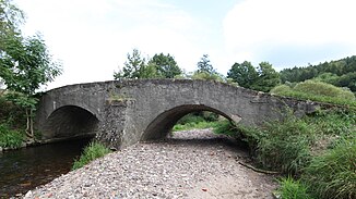
Road bridge over the Schwarza near Schwarza |
||
| Data | ||
| Water code | DE : 4128 | |
| location | Schmalkalden-Meiningen district , Thuringia | |
| River system | Weser | |
| Drain over | Hasel → Werra → Weser → North Sea | |
| source |
Haselborn u. a. on Schützenberg west-southwest of Oberhof in the Thuringian Forest 50 ° 41 ′ 59 ″ N , 10 ° 41 ′ 29 ″ E |
|
| Source height | approx. 795 m above sea level NN | |
| muzzle | at Rohr monastery in the Hasel coordinates: 50 ° 34 ′ 13 ″ N , 10 ° 30 ′ 34 ″ E 50 ° 34 ′ 13 ″ N , 10 ° 30 ′ 34 ″ E |
|
| Mouth height | approx. 322 m | |
| Height difference | approx. 473 m | |
| Bottom slope | approx. 16 ‰ | |
| length | 30 km | |
| Catchment area | 173.3 km² | |
| Discharge at the Schwarza A Eo gauge : 151 km² Location: 5 km above the mouth |
NNQ (09.01.1954) MNQ 1950/2014 MQ 1950/2014 Mq 1950/2014 MHQ 1950/2014 HHQ (01.06.2013) |
170 l / s 497 l / s 2.33 m³ / s 15.4 l / (s km²) 18.9 m³ / s 48.8 m³ / s |
| Left tributaries | Rädelsgraben (1.7 km), Dörmbach (3.8 km), Häselbach (6.4 km), Lichtenau | |
| Right tributaries | Kohlbach (2.2 km), Kienbach (3.1 km), Moosbach (3.5 km), Altersbach (3.1 km), Christeser Wasser (8.5 km), Moosbach (2.5 km) | |
| Small towns | Steinbach-Hallenberg | |
| Communities | Schwarza | |
The Schwarza , in the middle and upper reaches of Schönau and Hasel and in the Haselbach headwaters , is a 30 km long right tributary of the Hasel and at the same time its main hydrological arm in the Schmalkalden-Meiningen district in southern Thuringia . The Schwarza by name is 6.7 km long and is created by the merging of the Schönau with the Lichtenau coming from the right , which is also one of the main branches of the fan of the Hasel .
course
Spring run
The Haselbach rises at an altitude of almost 800 m , west-southwest of Oberhof in the west of the 904 m high Schützenberg in the Thuringian Forest . The source of the water in the valley axis is just over 785 m above sea level, and after 200 m the Haselborn comes at 790 meters above sea level on the left flank of the valley.
The stream then flows through the Kanzlersgrund , which separates the 900 m high main ridge of the Thuringian Forest (with the Rennsteig ) in the north from the more southerly mountain range, which is more separated into individual mountains. The stream runs at the foot of the north and north-west slopes of the Burned Stone ( 897 m ), the north slope of the Ruppberg ( 866 m ) and the north-east slope of the Großer Hermannsberg ( 867 m ).
Upper course
Once you have reached Oberschönau and Unterschönau , the name Schönau is common, but the river is still mostly referred to as Hasel on maps . The stream changes its direction from west-southwest to south and leaves the (actual) Thuringian Forest.
Middle course
In Steinbach-Hallenberg the river reaches the red sandstone foothills of the Thuringian Forest. The Herges district and finally the core municipality of Viernau are flowed through. Below flows from the left (= east) the Häselbach , 6.4 km, with its tributary Landwehr or Bermbach even 7.0 km long, with a catchment area of 13.1 km².
Lower course
In Schwarza the Schönau (so far 22.5 km long with 76.3 km² catchment area) almost doubles its water volume. First the Christeser Wasser (8.5 km, 23.8 km²) flows to the north of the town from the right , then, 800 m south of the town center, the Lichtenau (20.7 km, 49.4 km²).
The river, now called Schwarza, flows a further 6.7 km to the south and unites in monastery Rohr with the hazel coming from the east .
Individual evidence
- ↑ a b Map services of the Federal Agency for Nature Conservation ( information )
- ↑ a b c d e river lengths according to geopaths (kmz, 63 kB)
- ↑ Thuringian State Institute for the Environment (ed.): Area and water code index and map. Jena 1998; 26 pp.
- ^ Deutsches Gewässerkundliches Jahrbuch Weser-Ems 2014. Lower Saxony State Agency for Water Management, Coastal Protection and Nature Conservation, p. 113, accessed on October 4, 2017 (PDF, German, 8805 kB).
