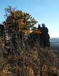
Great Hermannsberg
| Great Hermannsberg | ||
|---|---|---|
|
South side |
||
| height | 867 m | |
| location | Thuringia , Germany | |
| Mountains | Thuringian Forest | |
| Dominance | 1.9 km → Finsterbachkopf ( 898.3 m ) - east of the Haselbach or the Kanzlersgrund | |
| Notch height | 139 m ↓ In Jerusalem | |
| Coordinates | 50 ° 42 '3 " N , 10 ° 36' 52" E | |
|
|
||
The Große Hermannsberg is a 867 meter high mountain south of the Thuringian Forest main ridge ( Schmalkalden-Meiningen district , Germany ).
Location and surroundings
In the north, directly below the mountain, is the town of Oberschönau with the adjoining Kanzlersgrund . Behind it is the main ridge of the Thuringian Forest with the Rennsteig , in front of it are the mountains Hohe Möst and Hoher Stein . Bermbach is in the southwest , Zella-Mehli in the southeast and Oberhof in the east .
Routes to the summit
- From Oberschönau or from Kanzlersgrund via the Oberschönau ski and hiking hut , past the plateau of the Kleiner Hermannsberg . From the Fuhrmannswiese south of the mountain, a path now leads steeply up to the northern viewing rock with a refuge. From this hut a path runs south to the main peak and the lookout rock. As a way back you can use the path on the north side of the mountain from the Fuhrmannswiese, which comes out again at the ski and hiking hut.
- From the hiking car park at Knüllfeld, follow the path towards Ruppberg , then diagonally across the Fuhrmannswiese and continue as above.
Summit description
Coming from the northern lookout rock, the path leads below the summit, which according to an inscription should actually be 873 meters high. The path offers a wide view of the Rhön . Further towards the lookout rock, a small rock on the left offers a view to the east (see photo below). The actual viewing rock is to be climbed using steps cut into the rock and a safety rope, the top is secured by a railing. The altitude of 867 meters, which can be found on all maps, is also on this rock.
view

- north
- Oberschönau (from the northern lookout rock)
- east
- Donnershauk , Hohe Möst
- Chancellor's reason
- Kanzlersgrund ski jumping facility, Hoher Stein
- Burned stone
- Snow head
- southeast
- Ringberghaus and Adlersberg Tower near Suhl
- From south to northwest
Web links
- Labeled view from the Großer Hermannsberg to the south and west on www.panorama-photo.net
Individual evidence
- ↑ OpenTopoMap - Topographic maps from OpenStreetMap. Retrieved July 13, 2019 .


