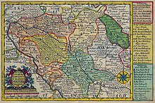
Schweinitzer Fliess
| Schweinitzer Fliess | ||
|
|
||
| Data | ||
| Water code | EN : 5388 | |
| location | Brandenburg , Saxony-Anhalt ( Germany ) | |
| River system | Elbe | |
| Drain over | Black Elster → Elbe → North Sea | |
| source | north of Hohenbucko 51 ° 46 ′ 45 ″ N , 13 ° 28 ′ 23 ″ E |
|
| Source height | 119 m above sea level NN | |
| muzzle |
Schwarze Elster near Schweinitz , ( Saxony-Anhalt ) Coordinates: 51 ° 47 '26 " N , 13 ° 0' 43" E 51 ° 47 '26 " N , 13 ° 0' 43" E |
|
| Mouth height | 71.3 m above sea level NN | |
| Height difference | 47.7 m | |
| Bottom slope | 1.9 ‰ | |
| length | over 25 km (thereof 12.8 km in the area of the state of Saxony-Anhalt) | |
| Catchment area | 576 km² | |
The Schweinitzer Fließ is a river in Brandenburg and Saxony-Anhalt , Germany . It is a right tributary of the Black Elster , into which it flows near Schweinitz , Wittenberg district . The Schweinitzer Fließ is an FFH area. It has a catchment area of 576 square kilometers .
The part of the river that is in the territory of the state of Saxony-Anhalt is 12.8 kilometers long. The river has a weir . For the last four kilometers there are dikes on both sides of the Schweinitzer Fließ .
The longer section is in Brandenburg, where the river rises north of Hohenbucko and feeds the Körba pond near Körba , a district of Lebusa . The river is navigable by boat between Schönewalde and Schweinitz, i.e. 25 kilometers in length .
In the past, the Schweinitzer Fließ was the border river between different administrative units, for example between the dioceses of Meißen and Brandenburg and between the " Jüterbog-Luckenwalder Kreis " and the " Merseburg government district ".
swell
- Hydrological manual. (PDF; 115 kB) Part 2 - Area Codes. Free State of Saxony - State Office for Environment and Geology, p. 11 , accessed on December 25, 2017 .
Web links
Individual evidence
- ↑ http://www.la-lsg.de/landschaftsplanung/lp_sap_schweinitzer-fliess.htm
- ↑ Archived copy ( memento of the original from September 24, 2015 in the Internet Archive ) Info: The archive link was inserted automatically and has not yet been checked. Please check the original and archive link according to the instructions and then remove this notice. , P. 104.
- ↑ Annex 3 to Section 69, Paragraph 1, No. 2 of the Saxony-Anhalt Water Act ( PDF )
- ↑ http://www.seismoblog.de/2010/10/06/hochwasser-fuer-den-landkreis-wittenberg-gilt-unveraendert-der-katastrophenfall/
- ↑ Appendix 5 to Section 131, Paragraph 2, Clause 1 of the Saxony-Anhalt Water Act ( PDF )
- ↑ Page no longer available , search in web archives:
- ↑ Niemeyer: Yearbook for the History of Central and Eastern Germany, Volume 19, 1971, p. 60 ( [1] )
- ^ Heinrich Karl Wilhelm Berghaus: Geographisch-Historisches-Statistisches Landbuch der Provinz, Volume 2, 1855, S. 138 ( [2] ).
