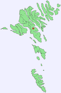
Signabøur
|
||

|
||
| position | 62 ° 6 ' N , 6 ° 56' W | |
|
Resident rank |
157 (2007) 42 |
|
| Commune | Tórshavnar kommuna | |
| Post Code | FO 416 | |
| Markatal | - | |
|
Grammar dative (in / from ...) genitive (after ...) |
í / úr Signubø til Signubøar |
|
Signabøur (Danish Signebø ) is a place in the Faroe Islands on the east coast of Streymoy .
Geography and traffic
Signabøur is located on the south bank of the Kollafjørður fjord . When driving north from Tórshavn through the Kaldbaksbotnur tunnel , Signabøur is on the right at the tunnel exit.
history
From 1903 to 1920 there was a whaling station here .
