High beech
| High beech | ||
|---|---|---|
| height | 749 m above sea level NHN | |
| location | Thuringia , Germany | |
| Mountains | Thuringian Forest | |
| Coordinates | 50 ° 34 '2 " N , 10 ° 49' 5" E | |
|
|
||
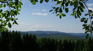
The 749 m high Hohe Buche is a mountain in the Thuringian Forest in the Hildburghausen district . In the Vessertal-Thuringian Forest biosphere reserve, it represents the highest elevation of an 8 km long and only 1.5–3 km wide mountain range that is bounded to the east by the Nahe , to the west by the Vesser and north by Schmiedefeld am Rennsteig .
The entire massif is practically uninhabited - only the village of Silbach is located in the interior of the southern tip. On the western edge, which the Vesser forms, lies the Suhl outer district of Vesser in the north and the village of Breitenbach in the south , while the village of Schleusingerneundorf lies relatively south on the eastern edge formed by the Nahe .
To the north, the Hohe Buche is a good 2 km away from the 726 m high Volkmarskopf , to the southwest the 701 m high and only 2 km away from the Audeberg . The further 2 km south-west adjoining, 627 m high Silbacher Kuppe , south of which the mountain range flattens out very quickly, is already clearly separated from the rest of the massif and can be seen as an independent summit.
Between the east behind the close located, 11 km long and up high to 784 m ridge of blacksmith meadow head and the northwest behind the Vesser subsequent until 891 m high eagle mountain massif the High Beech naturally not very spectacular action at a distance. However, the mountains are popular as hiking areas in comparatively untouched nature.

Adlersberg (849.9 m, to the left of the center, tower) with Neuhäuser Hill (891 m, to the right of the center) from the Kalten Staudenkopf (768 m). The meadow below in between is at the mare house near Vesser . On the far right the Große Eisenberg with the Salzberg (866 m, clearly to the left of it). Behind the saddle in between, the Große Beerberg (983 m, right) with its pre-summit Wildekopf (943 m, left) can be seen. To the left of the Adlersberg the Beerberg (808 m) and Großer Dröhberg (approx. 730 m) belonging to its massif .
In front of the Neuhauser hill the Hohe Buche (749 m), in front of it the Sommerberg (712 m). |

View from the Kalten Staudenkopf (768 m) to the Großer (944.1 m, half right) and the Kleine Finsterberg (875 m, right); half left the Schneekopf (978 m) with its side peaks Teufelskreise (967 m, in front of it) with Schmücke (just below, meadow) and Fichtenkopf (944 m, left of it). The meadow below is at the foot of the Great Iron Mountain (907.4 m, covered to the left); in the middle foreground the Volkmarskopf (726 m).
|

