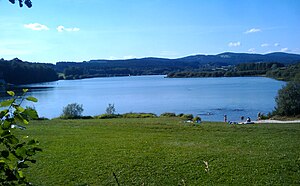
Silbersee (Treffelstein)
| Silver lake | |||||||||
|---|---|---|---|---|---|---|---|---|---|
| Silbersee, southern swimming area | |||||||||
|
|||||||||
|
|
|||||||||
| Coordinates | 49 ° 24 '43 " N , 12 ° 35' 55" E | ||||||||
| Data on the structure | |||||||||
| Construction time: | - 1968 | ||||||||
| Height above foundation level : | 14 m | ||||||||
| Height above the river bed : | 480 m | ||||||||
| Height of the structure crown: | 485 m | ||||||||
| Crown length: | 285 m | ||||||||
| Power plant output: | 96 kW | ||||||||
| Data on the reservoir | |||||||||
| Water surface | 55 ha | ||||||||
| Reservoir length | 1.5 km | ||||||||
| Reservoir width | 200 m | ||||||||
| Storage space | 5.66 million m³ | ||||||||
| Catchment area | 72.3 km² | ||||||||
The Silbersee is a reservoir created in 1968 near Treffelstein in the Cham district in Upper Palatinate .
description
The purpose of the storage facility is flood protection , energy generation as well as leisure and recreation. The reservoir is located on the Bavarian Schwarzach , which joins the Bohemian Schwarzach to Schwarzach approx. 6 km further south , a tributary of the Naab . Its water surface is about 55 hectares. It is dammed by a 285 m long earth dam. In the vicinity of the Silbersee there are two more reservoirs: the Perlsee near Waldmünchen and the Eixendorfer reservoir between Neunburg vorm Wald and Rötz .
power plant
In hydroelectric power plant of the memory by means of a Francis turbine with a power of 96 kW generates electricity. The facility, which was completely refurbished in 2012, produces around 0.27 million kWh per year. The storage facility is operated by the Regensburg Water Management Authority, and the associated Tiefenbach power station is operated by the Bavarian State Power Plants.
Freetime activities
The Silbersee is a popular destination for excursions and local recreation. There are three main bathing areas with sandy beaches on the lake - one each on the western, southern and eastern banks, where chemical toilets are set up in summer. There is also a campsite and you can fish, sail and surf. Around the lake there is an approx. 6 km long circular hiking trail with information boards about nature, landscape and history. In winter there are groomed cross-country trails.
See also
Web links
- Silbersee - Technical information from the Bavarian State Office for the Environment
- Silbersee circular hiking trail
- Tiefenbach and Silbersee - aerial photos
Individual evidence
- ↑ Bavarian State Office for the Environment, State Water Reservoir, Silbersee , accessed on June 1, 2013
- ↑ Landeskraftwerke Bayern, Silbersee , accessed on June 1, 2013
- ↑ Fritsch hiking map Schönseer Land, scale 1: 35000

