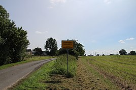
Sommersdorf (Penkun)
|
Sommersdorf
City of Penkun
Coordinates: 53 ° 17 '5 " N , 14 ° 10' 47" E
|
|
|---|---|
| Height : | 56 m above sea level NHN |
| Area : | 8.89 km² |
| Residents : | 163 (Feb 22, 2005) |
| Population density : | 18 inhabitants / km² |
| Incorporation : | January 1, 1999 |
| Postal code : | 17328 |
| Area code : | 039751 |
|
Northern entrance to the village
|
|
Sommersdorf is a district of the town of Penkun in the Vorpommern-Greifswald district in Mecklenburg-Western Pomerania .
geography
The place is four kilometers west-southwest of Penkun. In the southwest of the Sommersdorf district are the Angelsee , Moospfuhl and Igelsee . The southern edge of the district also forms the state border with neighboring Brandenburg . The northern edge of the district is formed by the federal highway 11 . The Faselberg is located at this limit . The neighboring towns are Friedefeld and Wollin in the northeast, Kirchenfeld and Neuhof in the southeast, Wartin in the southwest, Grünz in the west and Radewitz in the northwest.
history
Sommersdorf was in 1240 in connection with an exchange between Duke Barnim I of Pomerania and Bishop Conrad III. First mentioned in a document by Cammin .
On January 1, 1999, the municipality of Sommersdorf was dissolved and the place was incorporated into the city of Penkun as a district.
Culture and sights
The murder stone from 1423 stands near the churchyard wall. It is a tall, rectangular stone with a Greek cross and Gothic minuscules . Medieval atonement stone. Murder cheek made from Gotland shell limestone, the translation with the minus inscription reads: "In 1423 Hinrik von Ramin was slain by the farmers in Wartin." The legend reports that the noble Hinrik von Ramin raped a woman from Sommersdorf and then persecuted by farmers from the village has been. He tried to ask for asylum at the church, but couldn't get over the churchyard wall and was killed by the farmers.
The church, which was restored at the beginning of the 1990s, houses a small regional museum in the tower. There is also a village forge museum in the village center.
traffic
The state road 283 from Penkun to Grünz runs in an east-west direction through the town and after just five kilometers reaches the Schmölln junction of the federal motorway 11 . In the center of the village, state road 284 branches off towards the south to the nearby state border and to Wartin. In the south of the village, the district road VG 86 branches off to Neuhof.
literature
- Land book of the Duchy of Stettin, of Kamin and Western Pomerania; or the administrative district of the Königl. Government to Szczecin . Edited by Dr. Heinrich Berghaus. In: Land book of the Duchy of Pomerania and the Principality of Rügen . Part II, Volume II., Containing: the Randow circle and general information about the circles on the left bank of the Oder, 5. The Randow circle. Verlag von W. Dietze, Anklam 1865, p. 1704 f . ( Digitized version [accessed on August 3, 2017]).
- Erwin Schulz: The place name detective - medieval settlement names in the Uecker-Randow district (1121–1591) - origin, details, explanations - with an overview of place names from 1600 . Ed .: Norbert Raulin. Schibri-Verlag, Milow 2007, ISBN 978-3-937895-44-4 , pp. 54 ff .
- Georg Dehio: Mecklenburg-Western Pomerania . Edited by Hans-Christian Feldmann et al. In: Dehio Vereinigung (Hrsg.): Handbuch der deutschen Kunstdenkmäler . 2nd revised and expanded edition. Deutscher Kunstverlag, Berlin / Munich 2016, ISBN 978-3-422-03128-9 , pp. 614 .
Web links
- Sommersdorf on the website of Kultur und Heimatverein Penkun e. V.
- Sommersdorf in the genealogical directory
Individual evidence
- ^ Office Löcknitz-Penkun - SB Liegenschaften (ed.): Areas of the office area . Figures in hectares - as of June 2, 2017. Löcknitz August 2, 2017.
- ^ Sommersdorf - district of Penkun. In: penkun-info.de. Culture and local history association Penkun e. V., accessed on February 18, 2017 .
- ^ Main statute of the city of Penkun . June 18, 2019, § 9, p. 5 ( amt-loecknitz-penkun.de [PDF; 4.1 MB ; accessed on September 30, 2019]).
- ↑ a b Geodata Viewer of the Office for Geoinformation, Surveying and Cadastral Affairs Mecklenburg-Western Pomerania ( notes )
- ↑ Schulz: The place name detective. 2007, p. 59.
- ↑ Area changes from 01.01. until December 31, 1999. Federal Statistical Office (Destatis), July 1, 2007, accessed on February 18, 2017 .


