Spiegelkogel
| Rear Spiegelkogel | ||
|---|---|---|
|
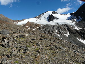
Spiegelferner with Hinterem Spiegelkogel |
||
| height | 3424 m above sea level A. | |
| location | Tyrol , Austria | |
| Mountains | Ötztal Alps | |
| Dominance | 1.1 km → Firmisanschneide | |
| Notch height | 173 m ↓ Spiegeljoch | |
| Coordinates | 46 ° 49 '48 " N , 10 ° 57' 29" E | |
|
|
||
| First ascent | 1870 by Franz Senn , Victor von Mayrl, led by Ignaz Schöpf and Josef Gstrein von Vent | |
| Normal way | from the Ramolhaus to the Spiegeljoch over the south ridge to the summit in easy climbing on the Hinteren Spiegelkogel | |
|
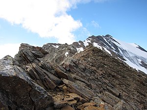
North-east ridge of the Hinteren Spiegelkogel seen from the Ramoljoch |
||
Spiegelkogel is the name of three mountain peaks in the main ridge of the Ötztal Alps , in the northern area of the Ramolkamm . A distinction is made between the rear Spiegelkogel at 3424 m above sea level. A. Höhe, the Middle ( 3311 m ) and the 3087 m high Vorderen Spiegelkogel . The peaks are in the Austrian state of Tyrol . The Hintere Spiegelkogel as the most important alpine summit was first climbed in the week from July 25th to August 2nd, 1870. The Venter pastor and co-founder of the Alpine Club Franz Senn reached the summit together with Victor von Mayrl, a merchant from Bolzano with the mountain guides Ignaz Schöpf and Josef Gstrein.
Location and surroundings
The Hintere Spiegelkogel is just 7 kilometers as the crow flies southwest of Obergurgl , a district of the municipality of Sölden in the Ötztal . On its northern flank , the Spiegelferner glacier stretches just below the summit; in the south, the Firmisanferner , which is in the process of shrinking, is still advancing to a height of a good 3200 meters. Neighboring mountains are in the course of the west ridge , separated by a notch at 3214 meters above sea level, the Mittlere Spiegelkogel and further northwest of the Vordere Spiegelkogel. In the north, separated by the Ramoljoch (3186 m), are the three Ramolkögel . To the east, the Hintere Spiegelkogel slopes down into the upper Gurgler Valley and to the south, in the direction of the actual Ötztal main ridge, is the Firmisanschneide , separated by the Spiegeljoch at 3,251 meters .
Base and routes
The route of the first to climb from Vent has not been recorded. The Ramolhaus at 3006 meters above sea level serves as the base for an inspection of the Spiegelkögel . The normal route to the summit of the Hinterer Spiegelkogel (the local mountain of the Ramolhaus) leads from the hut first west over a large field of firn up to the Spiegeljoch. From there, the path then runs over the pronounced south ridge in, according to literature, easy climbing of difficulty UIAA I in a walking time of three hours to the summit. Other routes up the mountain lead as an ice tour (only to be done with appropriate equipment and experience) through the 40 ° inclined north-west face and over the north-east ridge with difficulty UIAA II.
Literature and map
- Walter Klier : Alpine Club Guide Ötztaler Alpen , Bergverlag Rudolf Rother , Munich 2006. ISBN 3-7633-1123-8
- Richard Goedeke : 3000er in the Northern Alps , Bruckmann, Munich 2004, ISBN 3-7654-3930-4
- Alpine Club map, scale 1: 25,000, sheet 30/1, Gurgl , ISBN 3-928777-38-6
Individual evidence
- ^ Journal of the German and Austrian Alpine Association , Volume II, Munich 1871, p. 68
- ^ Walter Klier: Alpine Club Guide Ötztaler Alpen , Munich 2006, p. 379 f.


