Spurkenbach
|
Spukenbach
City of Waldbröl
Coordinates: 50 ° 50 ′ 36 " N , 7 ° 35 ′ 39" E
|
|
|---|---|
| Height : | 280 m above sea level NN |
| Residents : | 90 (December 2, 2004) |
| Postal code : | 51545 |
| Area code : | 02291 |
|
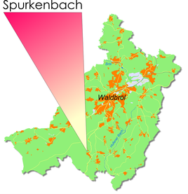
Location of Spukenbach in Waldbröl
|
|
Spurkenbach is a village in the town of Waldbröl in the Oberbergisches Kreis in southern North Rhine-Westphalia ( Germany ) within the administrative district of Cologne .
Location and description
The place is about 4.9 km south of the city center.
history
First mention
The place was mentioned for the first time in 1454, namely "One of the farms sacked in the Bergisch raids was zo der Roe"
Spelling of the first mention : Spurkinbach
leisure
Hiking and biking trails
The following hiking trails start from Spurkenbach:
| Circular / hiking trail | Waymarks | Distance | Path length |
| Circular hiking trail | A1 | Spurkenbach - Mühlenbach - west of Schönenbach - west of Seifen - Spurkenbach | 4.1 km |
| Circular hiking trail | A2 | Spurkenbach - Mühlenbach - Spurkenbach | 3.2 km |
| Circular hiking trail | A3 | Spurkenbach - Schönenbach - Wies - Krawinkel - east of Grunewald - Spurkenbach | 5 km |
| Circular hiking trail | A4 | Spurkenbach - east of Hahnenbach - west of Mühlenbach - Spurkenbach | 5.5 km |
Bus and train connections
Public bus
Stop: Spurkenbach
- 342 Waldbröl, Windeck-Schladern ( OVAG )
swell
- ^ Klaus Pampus: First documentary naming of Oberbergischer places (= contributions to Oberbergischen history. Sonderbd. 1). Oberbergische Department 1924 eV of the Bergisches Geschichtsverein, Gummersbach 1998, ISBN 3-88265-206-3 .
Web links
Commons : Spurkenbach - Collection of images, videos and audio files


