St Erth
Coordinates: 50 ° 9 ′ N , 5 ° 25 ′ W
| St Erth | |||
|---|---|---|---|
|
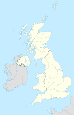
 Location in the former District of Penwith Location in the former District of Penwith
|
||
| Basic data | |||
| status | Civil Parish | ||
| region | South West England | ||
| Ceremony county | Cornwall | ||
| Trad. county | Cornwall | ||
| Administrative headquarters | St Erth | ||
| Residents | 1384 (2000) | ||
| Post Code | TR27 6xx | ||
| Telephone code | 01736 | ||
| Sub-locations | Treloweth , Chenhalls | ||
| Website | - | ||
St Erth ( Cornish : Lannudhno or Praze Pras ) is a place and a parish in the former district of Penwith in the county of Cornwall in England . The parish is bordered to the west by Ludgvan , to the north by Hayle , to the south by St Hilary and to the east by the former District Kerrier .
The name of the place comes from the Irish saint St. Erc , who evangelized the people of Cornwall during the Middle Ages.
The current church was built around 1215. Another church is said to have stood on St Erth Hill and overlooked the entire village from there. The village has a train station on the Cornish Main Line Plymouth – Penzance one kilometer from the center , the starting point of the St Ives Bay Line .
The Star Inn in the center of the village is an old inn that has existed since the 15th century and used to be a resting place for coachmen who transported the pewter from the Penwiths mines.
The geologist, politician and writer Davies Gilbert († 1839) was born in St Erth in 1767 .

