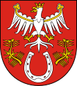
Sułkowice
| Sułkowice | ||
|---|---|---|

|
|
|
| Basic data | ||
| State : | Poland | |
| Voivodeship : | Lesser Poland | |
| Powiat : | Myślenicki | |
| Gmina : | Sułkowice | |
| Area : | 16.46 km² | |
| Geographic location : | 49 ° 51 ′ N , 19 ° 48 ′ E | |
| Residents : | 6594 (December 31, 2016) | |
| Postal code : | 32-440 | |
| Telephone code : | (+48) 12 | |
| License plate : | KMY | |
| Economy and Transport | ||
| Street : | Droga wojewódzka 956 DW956 | |
| DW955 | ||
| Next international airport : | Krakow | |

Sułkowice is a city in the Myślenicki powiat in the Lesser Poland Voivodeship in Poland . It is the seat of the town-and-country municipality of the same name with around 14,750 inhabitants.
geography
Sułkowice is located 27 km south of Kraków and has an area of 16.46 km². The Harbutówka flows through the village .
history
Until 1939
The first documented mention of Sułkowice comes from 1325, but a settlement must have existed since 1326 a parish was mentioned. A first population figure dates from 1340 and is given as 150.
1939 until today
On September 4, 1939, Sułkowice was occupied by the Wehrmacht . Right at the beginning, 22 people from Rudnik , a village in the municipality, were executed. Another 26 people were executed in a punitive action in 1941. In January 1945 the Wehrmacht was expelled from Sułkowice.
In 1969 Sułkowice received city rights. From 1975 to 1998 the city was part of the Kraków Voivodeship .
local community
The urban and rural community has an area of 60.53 km² and around 14,750 inhabitants.
Partner communities
Attractions
- Church of St Sofia from the 17th century
- Chapel of the Holy Cross from 1825
Web links
- City and municipality website (Polish)
- Church of the Sacred Heart of Jesus in Sułkowice (Polish)
- Middle school website (Polish)
- School center website (Polish)
Individual evidence
- ↑ Dz.U. 1975 no 17 poz. 92 ( Memento from April 8, 2009 on WebCite ) (Polish)

