Tinée
| Tinée | ||
|
The Tinée catchment area |
||
| Data | ||
| Water code | FR : Y62-0400 | |
| location | France , Provence-Alpes-Cote d'Azur region | |
| River system | Var | |
| Drain over | Var → Mediterranean | |
| source | in the municipality of Saint-Dalmas-le-Selvage 44 ° 19 ′ 54 ″ N , 6 ° 48 ′ 45 ″ E |
|
| Source height | approx. 2719 m | |
| muzzle | on the municipal boundary of Utelle and Tournefort in the Var Coordinates: 43 ° 54 ′ 43 ″ N , 7 ° 11 ′ 5 ″ E, 43 ° 54 ′ 43 ″ N , 7 ° 11 ′ 5 ″ E |
|
| Mouth height | approx. 179 m | |
| Height difference | approx. 2540 m | |
| Bottom slope | approx. 36 ‰ | |
| length | 70 km | |
| Discharge at the La Tour A Eo gauge : 705 km² |
MQ 1972/2009 Mq 1972/2009 |
16 m³ / s 22.7 l / (s km²) |
| Right tributaries | Vionène | |
|
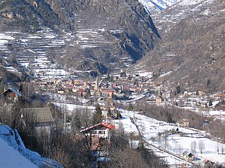
The river flows through a narrow valley near Saint-Étienne-de-Tinée |
||
The Tinée is a river in France that runs in the Alpes-Maritimes department in the Provence-Alpes-Côte d'Azur region . It rises near the Col de la Bonette , in the Mercantour National Park , in the municipality of Saint-Dalmas-le-Selvage , generally drains south-east through the Maritime Alps and flows into the Maritime Alps after 70 kilometers at the municipal boundary of Utelle and Tournefort as a left tributary Var .
Places on the river
(Order in flow direction)
- Saint-Etienne-de-Tinée
- Isola
- Saint-Sauveur-sur-Tinée
- Marie
- Clans
- Roussillion , municipality of La Tour
Energy industry
The river is dammed in several places to generate energy. The water is drained through pressure tunnels .
Attractions
The narrow gorges of the Tinée are among the most scenic in the Maritime Alps.
Picture gallery
See also
- List of French Mediterranean tributaries and their tributaries, from 36 km in length, sorted geographically
Individual evidence
- ↑ Source geoportail.gouv.fr
- ↑ estuary geoportail.gouv.fr
- ↑ a b The information on the length of the river is based on the information about the Tinée from SANDRE (French), accessed on December 10, 2013, rounded to full kilometers.
- ↑ hydro.eaufrance.fr (station: Y6234010 , option: Synthèse ) .


