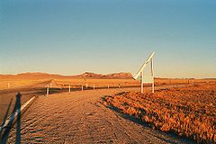
Tonopah Test Range
Coordinates: 37 ° 47 ′ 42 " N , 116 ° 46 ′ 12" W.
Tonopah Test Range , TTR for short , is a military facility about 50 km southeast of Tonopah in Nye County , Nevada ( USA ). It is located in the northern part of the Nellis Range and is not open to the public. The Tonopah Test Range has an area of approximately 1,600 km². It opened in 1957 as a testing ground for military programs for the United States Department of Energy and was administered for most of the time by Sandia National Laboratories . It is also used to launch sounding rockets , which are used to conduct free-fall experiments.
The modern air force base near the center (at 37 ° 47'N; 116 ° 46'W) is also known as the Tonopah Test Range. The base is also known for being the home base of the F-117 Nighthawk stealth aircraft between 1984 and 1992 . It has a runway that is 3.5 km long, over 50 hangars and an extensive support infrastructure.
The facility is mainly located in a valley bounded to the west by the Cactus Range. To the east is the Kawich Range with the former mine-burial town of Silverbow , one of the largest ghost towns in Nevada. Larger herds of coyotes and herds of wild horses live on the site and are closely monitored by the Bureau of Land Management .
Web links
- Tonopah in the Encyclopedia Astronautica (English)
