Torres Street
| Torres Street | ||
|---|---|---|
| Connects waters | Arafura lake | |
| with water | Coral sea | |
| Separates land mass | New Guinea | |
| of land mass | Cape York Peninsula ( Australia ) | |
| Data | ||
| Geographical location | 9 ° 53 ' S , 142 ° 35' E | |
|
|
||
| Smallest width | 185 km | |
| Coastal towns | Somerset | |
| Islands | Torres Strait Islands | |
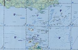
| Map of the Torres Strait with islands | ||
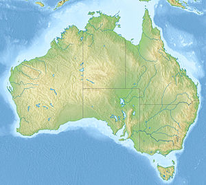
The Torres Strait (also Strait of Torres ; English Torres Strait ) is an approximately 185 km wide strait between the northeast Australian peninsula Cape York and the south coast of New Guinea , more precisely the Western Province of the state of Papua New Guinea .
geography
The Torres Street has a depth of six to nine meters over large areas. It is interspersed with coral reefs , cliffs , sandbanks and islands . The eastern and western entrances to the strait are blocked by cliffs in such a way that only narrow passages remain. Along the navigable routes, the strait reaches depths of up to 25 meters.
The Endeavor Strait carries this name since 1770; it runs south of the Torres Strait between the Prince of Wales Island and the mainland. The canal north of Prince of Wales Island, discovered by Matthew Flinders in 1803, is safer for shipping .
On the east side is the Great Barrier Reef . To the west of Torres Strait lies the Arafurasee and south of it the Gulf of Carpentaria , which itself only reaches depths of up to 53 meters.
history
In 1606 the Strait of the Sea was discovered by the Spaniard Luiz Váez de Torres . His collected reports were kept secret by the Spanish colonial rulers for a long time until they were captured by the English after the conquest of Manila in 1762. The Scottish geographer Alexander Dalrymple recognized the importance of the documents and published Torres' discovery in his work on the explorations of the South Seas.
Six months before Torres the Dutchman Willem Jansz cruised with his ship Duyfken in the waters west of the Torres Strait. But he believed that the areas in Australia where he had landed belonged to New Guinea. Jan Carstenszoon was next to explore the waters west of Torres Strait in 1623. His job was to confirm Jansz's reports. He did not manage to get through the passage. The Dutch East India Company commissioned Abel Tasman with another expedition in 1644 to clarify the question of whether New Guinea and Australia formed a contiguous land mass. Tasman, like his compatriots, did not manage to cross the strait. For over a century the question remained unanswered. It was only Dalrymple's publication that made it possible for James Cook to precisely plan the search for a passage as part of his first South Sea voyage. He passed the Torres Strait in the southern part in 1770 and named the straits Endeavor Strait after his own ship .
At the end of the 19th century, the passage on Torres Street was still considered so difficult that insurance companies excluded ships passing through from all insurance benefits. On February 28, 1890, for example, the British passenger and cargo ship RMS Quetta rammed an undisclosed underwater rock that made it sink within a few minutes. 134 of the 292 people on board died, it is still considered Queensland's worst shipwreck.
Torres Strait Islands
Most of the islands in the Torres Strait belong to the Australian state of Queensland . They extend over an area of approximately 48,000 square kilometers. Of the approximately 270 islands, only 17 are inhabited. The indigenous people , the Torres Strait Islanders , descended from the Melanesians who settled the archipelago from Papua New Guinea about 5000 years ago.
See also
Web links
Individual evidence
- ↑ CJ Lemckert, J. ornamental and J. Gustafson: Tides in Torres Strait. Journal of Coastal Research, Special Issue 56, 2009, pp . 524-528 .
- ↑ Australian Dictionary of Biography: Alexander Dalrymple .
- ↑ Gesa Gottschalk: The Enigmatic Coast , in: GEO Epoch No. 36: Australien , Gruner + Jahr, Hamburg 2009, ISBN 978-3-570-19877-3 .
- ↑ Brockhaus 14. A., Vol. 15, keyword Torresstraße.


