Trofaiach basin
| Trofaiach basin | ||
|---|---|---|
|
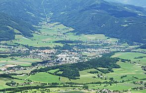
Trofaiach Basin: Eastern part, Trofaiach in the center, behind the Laintal |
||
| location | Styria | |
| Waters | Vordernbergerbach , Veitscherbach , Ploderbach | |
| Mountains | Eisenerzer Alps / Mürz Valley Alps | |
| Geographical location | 47 ° 24 '54 " N , 14 ° 59' 30" E | |
|
|
||
| Type | Inner alpine basin | |
| length | 10 km | |
| particularities | Valley watershed ; Lgld.d.Stmk. B.4 | |
The term Trofaiacher Becken is an inner-alpine basin north of the Murtal , namely a valley basin located on the southeastern edge of the Eisenerzer Alps between the Liesingtal , the Vordernbergertal and the Murtal near St. Michael in Upper Styria .
Location and landscape
The Trofaiach basin is drained through the breakthrough valleys of the Vordernberger , Ploder and Veitscherbach streams . It represents one of the larger basin landscapes in the officially used landscape structure of Styria . Around 11,000 inhabitants live in its area.
In the eastern part of the basin is the center of Trofaiach at around 650 m , from here the Vordernbergertal goes north to the Präbichl , and south-east the valley furrow from Sankt Peter-Freienstein via Donawitz to Bruck an der Mur . The valley widening to the east is called Laintal . In the western part, separated by the Kehrwald , are Edling , Gai , Töllach , Gausendorf and Schardorf , the more rural districts of Trofaiach. To the west, the basin is partially open to the Liesingtal, here the Ploderbach runs down to the Liesing near Seiz . To the south it is bounded by the Veitscherwald ( Reitererkogel 953 m above sea level ) and the Traidersberg ( 987 m above sea level ). Between these two the Veitscherbach goes to the Liesing near Traboch . The basin thus also forms a double valley watershed .
geology
Most of the basin is in the Grauwackenzone .
The connection between the individual parts of the Lower Tauern , the Eisenerzer Alps and the Hochschwab is interrupted by several basins that were filled up in the Tertiary . These form the Murparalleltal (Noric Basin), which north of the Mur and Mürz rivers form a furrow that is composed of these basins and runs parallel to them. These include the basins of Fohnsdorf , Seckau , Trofaiach and Aflenz north of the Mürz Valley Alps .
climate
In a broader sense, one can also include the Vordernbergertal with Vordernberg up to just before the Präbichl, and Sankt Peter-Freienstein up to Donawitz, as such the valley forms a climatic zone in the sense of the climatic division of Styria. The conditions in this climatic zone are very similar to those of the Mur valley between Kraubath and Bruck. As the coldest point, Töllach reaches average temperatures of −4.5 ° C in January, 7 ° C in the year and around 140 days of frost. The influence of the high fog in the Murtal is quite strong. The inversion ratios are somewhat aggravated by the pelvic position . Especially with typical inversion weather, relatively low night temperatures can occur. The most important weather characteristics are the relative lack of snow in winter (70-80d / a) and the reduced sunshine duration due to the high fog (25% in December).
Web links
- B.4 Trofaiach basin. Umwelt.steiermark.at → Landscape structure.


