
Trofaiach
|
Borough Trofaiach
|
||
|---|---|---|
| coat of arms | Austria map | |
 |
|
|
| Basic data | ||
| Country: | Austria | |
| State : | Styria | |
| Political District : | Leoben | |
| License plate : | LN | |
| Surface: | 143.25 km² | |
| Coordinates : | 47 ° 26 ' N , 15 ° 0' E | |
| Height : | 658 m above sea level A. | |
| Residents : | 11,119 (January 1, 2020) | |
| Postal code : | 8793 | |
| Area code : | 03847 | |
| Community code : | 6 11 20 | |
| NUTS region | AT223 | |
| UN / LOCODE | AT CH8 | |
| Address of the municipal administration: |
Luchinettigasse 9 8793 Trofaiach |
|
| Website: | ||
| politics | ||
| mayor | Mario Abl ( SPÖ ) | |
|
Municipal Council : ( 2020 ) (31 members) |
||
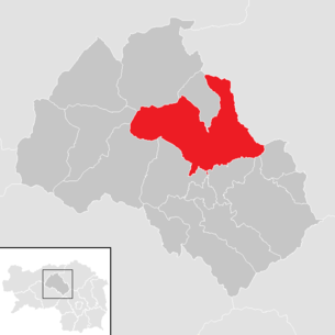
| Location of Trofaiach in the Leoben district | ||
  |
||
 View of Trofaiach from the south |
||
| Source: Municipal data from Statistics Austria | ||

Trofaiach is an Austrian city in Upper Styria in the judicial district or district of Leoben . On January 1, 2013, it was merged with the neighboring communities of Hafning bei Trofaiach and Gai . On January 1, 2020, the community had 11,119 inhabitants.
geography
Geographical location
Trofaiach is located about ten kilometers north of the district capital Leoben . It is about 13 kilometers south of the main Alpine ridge on the Austrian iron road . It is located in the Vordernbergertal , where it widens to the Trofaiach Basin , which lies on the southern edge of the Eisenerzer Alps .
A considerable area of the municipality consists of forest and mountainous land above the tree line. The municipal boundaries extend to the peaks, ridges and transitions of the surrounding mountains, such as B. Hochturm ( Trenchtling ) , ( 2081 m above sea level ), Lamingegg, Lamingsattel, Leobner Mauer , Klammkogel, Barbarakreuz, Fahnenköpfl, Grüblzinken, Rottörl, Eisenerzer Reichenstein ( 2165 m above sea level ), Reichhals, Große Scharte, Hohe Lins ( 2028 m above sea level ), Stadelstein, Wildfeld, Reiting ( Gößck 2214 m above sea level ).
The old center of Trofaiach is located on the Vordernbergerbach . Four streams flow into the Vordernbergerbach in the local area. The four side valleys Krumpen , Rötz (graben) , Trofaiacher Gößgraben and Laintal are part of the municipality.
Altitude and extent
The altitude of Trofaiach is with height class 6 (500- 600 m above sea level. A. specified), the city with 660 m above sea level. A. This corresponds to the location of the parish church. The geographically lowest point of the city is in the Gmeing pit at 645 m above sea level. A. the highest point on the Gßeck with 2214 m above sea level. A.
Trofaiach has an area of 143.25 km² and takes up a large part of the Trofaiach basin.
Community structure

The urban area is divided into ten cadastral communities (area: as of December 31, 2017):
- Gai (347.90 ha)
- Gimplach (389.91 ha)
- Gößgraben-Freienstein (4,663.23 ha)
- Hafning (804.73 ha)
- Krumpen (1,611.31 ha)
- Laintal (1,824.27 ha)
- Rötz (2,547.82 ha)
- Schardorf (824.08 ha)
- Treffning (847.80 ha)
- Trofaiach (502.33 ha)
The historical epithet "Freienstein" at Gößgraben serves to distinguish it from other cadastral communities of the same name. This addition is only used in the land register and not in common usage. It is simply called “Trofaiacher Gößgraben”.
The municipality includes the following 19 localities (residents as of January 1, 2020):
- Edling (383 Ew.)
- Gai (81 Ew.)
- Gausendorf (211 Ew.)
- Gimplach (237 Ew.)
- Gößgraben (48 Ew.) Including Löscherhube
- Hafning (505 Ew.) Including In der Loiben and Trattnig
- Krumpen (62 Ew.) Including Gladenhof
- Kurzheim (129 Ew.)
- Laintal (599 Ew.) Including Kaintal, Laintal I, Laintal II, Laintal III, Trasttal and Wolkersdorf
- Oberdorf (23 Ew.)
- Putzenberg (63 Ew.)
- Rötz (283 Ew.) Including Rötzgraben
- Schardorf (267 Ew.)
- Töllach (21 Ew.)
- Treffning (114 Ew.)
- Trofaiach (main town) (7697 Ew.)
- Untergimplach (150 Ew.)
- Unterkurzheim (64 Ew.)
- Windischbühel (182 Ew.)
Capital of the municipality
|
Trofaiach ( Stadt ) Ortschaft Katastralgemeinde Trofaiach |
|
|---|---|
| Basic data | |
| Pole. District , state | Leoben (LE), Styria |
| Judicial district | Leoben |
| Pole. local community | Trofaiach |
| Coordinates | 47 ° 25 ′ 40 ″ N , 15 ° 0 ′ 29 ″ E |
| height | 658 m above sea level A. |
| Residents of the village | 7697 (January 1, 2020) |
| Building status | 1652 (2001) |
| Area d. KG | 502.33 ha (2018) |
| Post Code | 8793 Trofaiach |
| Statistical identification | |
| Locality code | 15712 |
| Cadastral parish number | 60362 |
| Counting district / district | Trofaiach-Markt, -Nord, -Südost, -Südwest, -Kolonieg.-Kehrg., -Nordwest, -Bergmanngasse, -Tannenweg, -Montanstr.-Lagerg. (61 120 000 - 008) |
| Corresponds to the size of the municipality up to the end of 2012 Source: STAT : Ortsverzeichnis ; BEV : GEONAM ; GIS-Stmk |
|
The municipality's capital is the city of Trofaiach , which is also a locality and cadastral municipality , which corresponds to the extent before the municipal amalgamation in 2013.
The place is today in the middle of the municipality, on the Vordernbergerbach , at 660 m above sea level. A. It stretches for about 3½ kilometers along the brook, from the St. Peter-Freiensteiner municipality border in the south to the village of Hafning. Along the valley, the west-east extension is up to about three kilometers.
In total, the village has over 1,600 buildings and almost 8,500 inhabitants.
- City structure
- The old town center is still called Trofaiach-Markt (so the official counting district 000), which corresponds to the extent of Trofaiach around 1930. It is located at the confluence of the Rötzbach and the Gößbach in the Vordernbergerbach. Around 1,200 people live there in 400 buildings.
The actual urban development began in the course of the 20th century, intensively after the Second World War . Due to the young structure, the districts do not have old names:
- towards Hafning is Trofaiach-Nord . It concerns the grounds of the Glögglhof , which no longer exists in 1939, from Hafning an Trofaiach , which is the Gladensiedlung .
- to the northwest, the areas around Gößgrabenstrasse (counting district Trofaiach-Nordwest ) and the two small settlements Untergimplach and Unterkurzheim , which belonged to Gai until the end of 2012 and have largely grown together with the city center, extend.
- to the west are the areas around Koloniegasse – Kehrgasse , the industrial area around the junction of the B115 with the specialist retail center and the large settlement area called Trofaiach-West extending to Gimplach between Langefelderstrasse and the Kehrwald.
- in the southwest is the settlement area around junction B 115 – B 115a up to the Kulm (887 m), towards Edling ( Trofaiach-Süd )
- towards the south-east are the houses on the higher terrace around the Haiderhof , which already represent the transition area into the Laintal.
- towards the northeast the outer Rötz still belongs to the city (cemetery and sports field).
- Neighborhoods, cadastral communities and places
| Short home | Hafning near Trofaiach (O & KG) |
Rötz (O and KG)
|
|
Gimplach (O and KG)
Untergimplach
(both O Hafning) |
.svg)
|
Treffning (O and KG)
Laintal (O and KG) Wolkersdorf (O Laintal) |
|
Gausendorf (O)
Gai (KG)
Edling (O)
|
Hessenberg (O and KG, Gem. St. Peter-Frst. ) |
Gmeingrube (Gem. Trofaiach and St. Peter-Frst)
Sankt Peter-Freienstein (O KG, u. Gem.) |
Neighboring communities

Trofaiach borders ten other communities, eight of which belong to the political district of Leoben and two to the district of Bruck-Mürzzuschlag .
| Iron ore | Vordernberg | Tragöß-Sankt Katharein (Bez.Bruck-Mürzzuschlag) |
|
Kalwang Mautern in Styria |
|
Tragöß-Sankt Katharein (Bez.Bruck-Mürzzuschlag) |
| Chambers in the Liesingtal |
Sankt Peter-Freienstein |
Proleb |
Parish consolidation 2013
At the beginning of 2012, on the occasion of the municipal structural reform in Styria 2010-2015 , talks began between the neighboring municipalities of Gai , Hafning , Trofaiach and Vordernberg , with the aim of merging these four municipalities. A referendum was held on September 30, 2012 on the outcome of these negotiations. The residents of Vordernberg (82% of 62% of the eligible voters) voted against a community merger. In the three remaining municipalities there was a majority in favor of the merger. With 78.8% and 79.8%, respectively, the votes in Trofaiach and Gai were clear, but participation in Trofaiach was only 41% and in Gai 59%. In Hafning, the result was just under for the merger with 52.7% yes-votes and 56.9% participation. The merger talks announced in 2012 with the neighboring municipality of Sankt Peter-Freienstein did not materialize. Sankt Peter-Freienstein has remained independent.
On October 24, 2012, the Styrian state government unanimously approved the motion of the municipalities of Gai, Hafning and Trofaiach to unite these three municipalities as of January 1, 2013 under the name Trofaiach . At the same time, Trofaiach's mayor Mario Abl was appointed government commissioner and the two mayors Bernhard Zechner (Gai) and Alfred Lackner (Hafning) served on the advisory board. In retrospect, Vice Mayor Gabriele Leitenbauer (KPÖ) and Erich Temmel (ÖVP) were also appointed to advisory boards. The work of the advisory councils began after the municipal councils dissolved themselves and lasted until the new council elections, which took place on April 14, 2013. (See the next but one paragraph for election results). As a government commissioner, Abl mainly had to deal with administrative tasks. The constituent meeting of the new municipal council took place on May 7, 2013.
The area of the municipality of Trofaiach after the merger roughly coincides with the area that the parish of Trofaiach has covered for over 1000 years.
history
The friendly landscape and above all the richness of ore in the Grauwackenzone led to the relatively early settlement of the protected Trofaiach basin .
Trofaiach was a center of metal processing and raw materials trading. This testify the finds from the Middle Bronze Age , the Urnfield , the Roman period and the early Middle Ages , which found in the city and can be seen at the city museum in the castle Stibichhofen. In addition, there was the advantage, which is not insignificant for troubled times, that the area is a bit away from the major thoroughfares Murtal - Liesingtal .

Prehistoric times
In the 1st millennium BC BC - and probably earlier - it was the coveted copper that was mined and melted in the Eisenerz Alps. From around 900 to 700 BC There was a urnfield settlement on the Kulm in which an estimated 200 to 300 people lived.
In the 11th century AD, iron ore mining began on the Erzberg and in various smaller deposits, for example in the Krumpen and the Zölzboden , where traces of old iron smelting were found.
middle Ages
The sustainable settlement of the municipality began in the Middle Ages. Place and area names are reminiscent of the Slavic settlement in the early Middle Ages and the Bavarian settlement in the centuries that followed. Examples of place or area names of Slavic origin are:
- Trofaiach and Treffning von trebiti ('clearing'),
- Krumpen of kronpa (the little valley '),
- Rötz , medieval Recz von rečica ('brooklet'),
- Trattning , formerly Tradning from trata ('cattle pasture, corridor'),
- Laintal medieval Lonktal of Ionka (Meadow Aue ')
- Töllach von dolina ('valley'),
- Glabokke from glabok ('deep, deep region'),
- Gloss by klanec ('steep path').
The place name Gai, on the other hand, is derived from the Middle High German word göu , which denoted an area that was in the sphere of influence of a certain judicial authority and certain trades. In the present case, the "Gai" referred to the area of influence of the Trofaiach market and the ban miles exercised by the local craftsmen . The place name Hafning comes from the Old High German word havanari , which means potter or Hafner and indicates the activities of the original settlers. This interpretation of the place name is confirmed by the excavation of an early Hafner settlement north of the later Hafning train station. For the Trofaiach area, a mixed Bavarian-Slavic population up to the end of the 12th century can be assumed as safe due to the productive name adoption. After that, the Slavic population disappeared due to assimilation by the German-speaking majority population.
A grave field in the center of the village (today's Roseggergasse), whose finds were dated between 750 and 800, indicates a more intensive early medieval settlement. The documentary tradition begins later. Some of the found material is exhibited in the Trofaiach City Museum.
Although the settlement emerging along the Vordernbergerbach only had a north-south extension of a little more than one kilometer, it was still divided into three parts in the Middle Ages. The later core area of the market was around the parish church. To the south of it, the subjects of the Traunkirchen monastery settled around the Salvatorkapelle, which later became the Holy Trinity Church. This was followed by the Niedertrum, whose houses never belonged to the historical market, but to different manors.
In 982, Emperor Otto II confirmed various possessions to the then Archbishop of Salzburg in a document . Among them was the Liubina estate , which the Archbishopric of Salzburg had received through exchange from the high-free Reginhart and his wife Svanahild in 925. The main buildings of this property were located directly next to the Church of St. Rupert in the upper part of today's Trofaiacher Hauptstrasse. When Saint Rupert , the first bishop of Salzburg, appears as the title saint of a church, this indicates a close connection with the Salzburg archbishopric. In the first few centuries of its existence, the Trofaiach parish reached via Vordernberg , Eisenerz and Radmer to Hieflau . Trofaiach was the first parish in the vicinity of the Styrian Erzberg.
The Trofaiach Rupertikirche can be assumed to have existed as early as the 10th century. The reason for the interest of the Archdiocese of Salzburg in this property is likely to be the access to the Erzberg and thus the iron production. South of the settlement center around the Rupertikirche there was a second settlement center with the Salvatorkapelle, the later Trinity Church , as the center. The landowner here was the Upper Austrian Traunkirchen monastery.
In the 13th century, Trofaiach was the main marketplace of the Upper Styrian iron district. On January 19, 1277, King Rudolf I also mentioned the authorization to trade in Trofaiacher iron (ferrum de Treviach) when he confirmed the rights and freedoms of the citizens of the trading town of Judenburg .
Almost four decades later, in 1314, Trofaiach lost its primacy through the sovereign rule that the iron produced south of the Präbichl should only be delivered to Leoben in future. At the same time, the otherwise not very successful Duke Frederick the Fair of the Habsburg dynasty granted the princely city of Leoben sole publishing and commercial rights for iron. The associated losses caused many residents of Trofaiach to migrate to Leoben or other places. Iron production south of the Präbichl was concentrated in Vordernberg and the iron trade in Leoben.
The current town center has developed since the 11th century through the merging of the two settlement centers on the Vordernbergerbach, which was called Leuben in the Middle Ages . The place received market rights as early as 1379 . Emperor Friedrich III. confirmed in 1455 the princely market of Trofaiach, which has been in existence since 1448, the missing first certificate of market privileges. It was also Friedrich III. after a tough struggle succeeded in significantly restricting the Admont parish rights. In addition, the Traunkirchen nunnery accommodated the emperor's wishes: In Traunkirchen, the purchase contract was signed on December 21, 1448, according to which all Holden (farmers dependent on a landlord), grounds, goods and fiefs at Trofaiach, including the Salvator Chapel and all associated rights of the Benedictine monastery passed into sovereign property.
Modern times
The place changed little over the centuries. In the Trofaiach market there were mainly craftsmen, traders and innkeepers who provided the farmers living in the surrounding villages, ditches and on the forest mountains with the things they could not produce themselves. The road leading through the town was mostly heavily frequented, as the pig iron produced in Vordernberg had to be brought to Leoben by horse and cart and the goods needed in Vordernberg, especially charcoal , had to be brought to Vordernberg. For a long time Trofaiach was the ecclesiastical center for the whole area and the seat of a deanery .
The last plague occurred in Trofaiach in 1713. With about 500 inhabitants at the time, between September 24th and November 25th the high number of 70 deaths from the plague had to be lamented.
The market town was administered by the citizens from the end of the Middle Ages to the middle of the 19th century . These citizens were around 50 to 70 traders, innkeepers and merchants with house ownership in the village. Every year on St. Thomas's Day , the citizens elected the market judge and the community committee, who were responsible for the administration of the community. In 1542, King Ferdinand I ordered that the judges' elections in the Styrian towns and markets, which had previously taken place on different dates, should be postponed to the last week before Christmas.
The boundaries of the market were marked by truce crosses. These castle crosses still stand in four places in the village. Two of them date from the time of the sovereign market, the other two were made in the 19th and 20th centuries. renewed.
The area of the market town of Trofaiach was only 2.5 km² up to 1939. The other areas that today belong to Trofaiach were subject to the manorial rule until 1848 and for centuries correspond to that of an alpine rural area with rural structures and shared the checkered history of the rest of Styria . Due to the proximity to the centers of the Upper Styrian iron industry, there was mostly a good sales situation for agricultural products. On the other hand, many ironworkers and miners lived in the villages and trenches of today's Trofaiach community.
19th century
From time to time the place was affected by catastrophes and the consequences of war: floods, fires, the plague (last in 1714), migrating Turks, miners' revolts and the occupation by the Napoleonic army were the worst afflictions.
From 1805 to around 1840 there was an ore mine in the Trofaiacher Rötzgraben near the Höft Höller, where magnetic iron stone was mined, which was smelted in St. Stefan ob Leoben .
By 1840 the Trofaiach area was already commercial and industrial, for every 180 farmers and cattle breeders there were 242 traders in the Trofaiach district at that time .
As a result of the revolution of 1848 the rulership , which until then had been the dominant force in the country, was abolished and rural communities were founded. The provisional municipal law passed on March 15, 1849, as well as the Reichsgemeindegesetz passed on March 2, 1862, brought about the reorganization of the regional administrative units. Autonomous communities became the cornerstone of the newly designed state. In addition to the existing city and market communities, many rural communities emerged.
The rural community of Gai emerged from the amalgamation of the four cadastral communities Gai, Schardorf, Gimplach and Gössgraben-Freienstein , which originally belonged to the Freienstein tax district . The five cadastral communities of Hafning, Krumpen, Rötz, Treffning and Laintal , which originally belonged to the Freienstein district , were merged to form the Hafning community.
In 1873 Prince Johann Adolf II zu Schwarzenberg , who also owned a wheel factory in nearby Vordernberg , had what was then the largest blast furnace in Europe, which was commissioned in 1875, in the Niedertrum district. This blast furnace was still operated with charcoal, while the blast furnaces in Donawitz, eight kilometers away , were operated with coke. In 1897 a Siemens-Martin steelworks was put into operation. However, the company's history only lasted 37 years. After the plant was initially leased by Richard von Schoeller from Schoeller-Stahlwerke in 1899 and bought in 1905, this smelter was shut down in 1911. On December 2, 1911, the Trofaiach trade association acquired the entire factory premises including the workers' houses and sold the disused industrial plant on July 31, 1913 to Johann Gottfried Henschel from Vienna. From this a scythe factory was built, which was kept in operation by the company Weiß & Co. until the mid-1920s.
The Erzbergbahn Leoben - Vordernberg opened on May 18, 1872 . As the local press wrote at the time, Trofaiach was "connected to world traffic". On June 10, 2001, the Austrian Federal Railways stopped passenger traffic on this route.
Tourism emerged as the rural areas were more easily accessible through the expansion of the railway . An active tourist association ensured that Trofaiach was also a popular summer resort for several decades . A park was built, as well as avenues and walking paths. A tennis court, which still exists in the park today, and the swimming pool around 1895 were also built. As can be seen from the guest books, some of which are still available, the guests looking for relaxation came mainly from Vienna, Graz, western Hungary, Bohemia and Moravia.
20th and 21st centuries
During the First World War , a black powder factory was built in the west of the town on an area of around 45 hectares. For strategic reasons, a factory was built based on the model of the Imperial and Royal Powder Factory in Kamnik (Stein) near Ljubljana (Laibach, today in Slovenia), today's twin town of Trofaiach , which was far enough away from the front line. Within a few months, starting in the summer of 1915, the entire factory was built using around 5000 prisoners of war. These prisoners of war were housed in a barrack camp built in what is now the Goldbachgasse - Untergimplach settlement area. The powder colony was built for the factory workers, some of whom moved from Kamnik, and an Art Nouveau residential complex consisting of several buildings for the senior staff and officers in Gössgrabenstrasse . This residential complex was connected to the powder factory area by a path with two Art Nouveau bridges.
The establishment of the powder factory led to a decline in tourism, which had developed quite well in the previous decades. In 1926 the powder factory was closed. After the powder factory was shut down, the factory premises remained a fenced off restricted area in the possession of the state or state-affiliated companies. On April 1, 1939, the Glögglhof grounds , which belonged to the neighboring municipality of Hafning at the time, and the powder area , which had largely belonged to the then municipality of Gai, were incorporated into Trofaiach. From 1940 a camp was built on the field that remained to the community of Gai, which at times consisted of over 50 barracks and in which a maximum of 2000 people could be accommodated.
First ethnic German resettlers from Bukovina were quartered, who were forcibly resettled as a result of the German-Soviet border and friendship treaty and later resettled elsewhere. From 1941 to 1945 it was a camp for forced laborers and prisoners of war from the countries occupied by Nazi Germany who had to work in the armaments factories in the Leoben area. After the end of the war by the beginning of January 1946, the British military administration quartered up to 1,500 Jewish refugees, so-called displaced persons , the majority of whom came from Hungary and emigrated to Palestine for a few months .
From January 1946, new displaced persons - expelled ethnic Germans from Croatia, Serbia, Slovenia, Romania and the Czech Republic who had fled the persecution - were admitted to the Trofaiach DP camp. From 1948 onwards, more foreign-language refugees were quartered. From 1952 the camp could be reduced in size. After the popular uprising in 1956, refugees from Hungary were temporarily accommodated, and in 1960 the camp was demolished. In the 20 years of its existence, the Trofaiach camp served thousands of persecuted, prisoners and displaced persons as makeshift and involuntary temporary accommodation.
In the years 1939 to 1943, a large housing estate was built in the north of Trofaiach, largely on the former Glögglhof grounds, for the workers and employees of the nearby Donawitz ironworks , the originally Hermann Göring settlement and, after 1945, Gladensiedlung after the one in the west Settlement adjacent high terrace, was called.
In the area Kehrgasse - Gössbachau existed from 1940 another camp of 13 barracks, which had been set up for French prisoners of war, and therefore Franzosenlager was called. After the war, the barracks were used as substandard housing, and from 1970 they were demolished. In 2009 a specialty store center was built on this site after several supermarkets and discounters had set up shop around this area as early as 1990.
From 1960, another large housing estate was built on the site of the former powder factory in the west of Trofaiach, which was then commonly known as the powder site. In addition, new single-family houses were built in all parts of the village. As a result of this brisk construction activity, the number of inhabitants has quadrupled within 40 years (1934–1974).
1979 Trofaiach was raised to the city. On October 20, 1984, the city administration moved from the old town hall (Hauptstrasse 67), which was the seat of the local government for over 400 years, to the new official building at Luchinettigasse 9. The city administration is now located in this building and in the adjacent house no.11 , the municipal utilities, the police, the municipal council hall, the municipal library and an event hall. On December 11, 1985, the bypass road was opened, which relieved the narrow local passage through the main road, which had previously been used as an iron federal road.
Since January 16, 2015, the district heating in Trofaiach, which was previously fed with natural gas, has been operated with industrial waste heat from Voestalpine Donawitz . As a result, the CO 2 emissions in Trofaiach could be significantly reduced. This required the construction of an 8.2 km long heat pipe from Donawitz to the boiler house in Trofaiach-West. About 32 million kilowatt hours of heat are transported through these. This corresponds to the heat requirements of 6500 apartments.
The workers and employees of the nearby Voestalpine steelworks in Leoben-Donawitz dominate the population of Trofaiach . Since fewer and fewer employees are needed in the steel industry, the population of Trofaiach has been falling slowly but continuously.
Population development
In the statistical-topographical regional scheme of the Duchy of Styria from 1818 by Joseph Marx Freyherrn von Liechtenstern, the population of Trofaiach is given as 620 inhabitants on page 489, although only the old market town is meant. According to this record, a total of 1185 people lived in the villages and ditches that belong to Trofaiach today, so that there were a total of 1805 inhabitants. The mentioned country schematic was recently reissued under ISBN 978-0-266-64252-7 .

Economy and Infrastructure
traffic
The state roads B 115 and B 115a (Eisenstrasse) run through the city . From Trofaiach to the west, the federal road 115 leads to the Liesingtal in the west and to the connection to the Pyhrn motorway, seven kilometers away from the town center .
From the Edling district you can also take the Russenstraße to Sankt Peter-Freienstein and further to the district capital Leoben . The name comes from the fact that this road was built by Russian prisoners of war during the First World War in 1915. Before that there was only a simple connection. In the summer of 2017, a roundabout was built at the turn of Russenstrasse and Seizerstrasse in Edling.
The electrified Erzbergbahn Vordernberg-Markt - Leoben Hbf was discontinued in 2002. The S-Bahn Styria project had plans for an S-Bahn connection to Leoben every hour. Recently one heard from the state of Styria that instead of an S-Bahn connection, an hourly bus service would be planned.
education
- New Rosegger Middle School
- Hauptschule and Polytechnische Schule Franz Jonas , Pedagogical Panther 2005 and 2010
Culture and sights
Museums
- City Museum in Stibichhofen Castle: The museum has three main focuses: a collection of regional costumes , a pharmacy facility from 1904 and historical medical devices, preparations and documents as well as regional prehistoric finds from the period from 1500 BC. Chr. To 900 AD. Further museum exhibits are in the museum depot in the object Silvester Heider Platz 1.
The Trofaiach City Museum is part of the network of museums on the Styrian Eisenstrasse . The city museum regularly holds special exhibitions in Stibichhofen Castle - Rebenburggasse 2, for example
- 2006 Ferdinand Marian - film star with traces in Trofaiach
- 2008 The history of Trofaiach-West 1915 to 2008
- 2009 Archduke Johann and the Styrian costume
- 2011 Poison and Sugar - rarities and curiosities of ancient healing art
- 2012 Die Strasse - life and everyday stories from the Trofaiach section of the Eisenstrasse
- 2013 Breathing stone & breathing wood : Wood carving from Dongyang and stone carving from Trofaiach's Chinese sister city Qingtian
- 2014 traditional costume - tradition meets zeitgeist
- 2015 hodgepodge, curious treasures from the museum depot
- 2016 Welcome to Trofaiach - from summer visitors & tourists
- 2017 Typical, the collections in Stibichhofen and in the depot from April 20, 2017
Buildings
- Parish Church St. Rupert : First mentioned in 1195. It is believed that the church was built over 200 years earlier, as the Archdiocese of Salzburg acquired the Liubina estate in925, in the area of which the church was located. The core of the church is Romanesque; The church was incorporated into Admont Abbey until the middle of the 15th century. In 1704 the mighty tower was increased by one floor. During renovation work, frescoes from the beginning of the 15th century were uncovered.
- Filial Church of the Holy Trinity : Also occupied since 1195 (as Salvator Church ). This is originally a foundation of the Traunkirchen Benedictine monastery . The existing late Gothic building dates from the beginning of the 16th century. Since the church was no longer needed for liturgical purposes and it is no longer possible for the diocese to preserve all the buildings, it washanded overto the non-profit Austrian Baukultur-Privatstiftung , Graz,by means of a donation agreement in 2008, which has made it its task to continue modeled on the British National Trust to preserve and lookaftervaluable historical buildings.
- Mell Castle : Castle on a high terrace above the town center. Confirmation of ownership dated May 2, 1230 for the Göss Abbey . Constantly changing owners. Conversion in 1872 by the wheelworking couple Heinrich and Karoline Mitsch. Beautiful wrought iron fountain.
- Trofaiach Town Hall : With the new town hall built in the 20th century at Luchinettigasse 9, the 400 year old town hall in Hauptstrasse 67 was replaced as the administrative center.
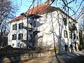
- Stibichhofen Castle : The castle stands next to the Trinity Church. Originally a late Gothic building from the 15th century, rebuilt in the 17th century. The property on which the castle is located once belonged to the Traunkirchen women's monastery. This should have operated an iron smelting furnace and a hammer mill here. From 1862 to 1953 the Rebenburg family owned Stibichhofen Castle. The Evangelical Parish AB Trofaiach has been the owner since 1953, and its castle church and youth home are housed in the castle. The exhibition rooms of the city museum are on the ground floor.
- Glögglhof : The Glögglhof , which previously belonged to Hafning, came to Trofaiach in 1939, along with the associated large areas. The originally large property was split up and sold. The Hermann-Göring-Siedlung, later called Gladensiedlung, was built on the meadows of the Glögglhof from 1939 to 1944. The main building of the Glögglhof at that time was in a very neglected condition for a long time. It was demolished in January 2012 because of dilapidation. Strangely enough, the Glögglhof was never placed under monument protection. It had an interesting history of ownership. In the 17th century, the Vordernberg family of masters, the Stampfer, was the owner. Thefarm is mentioned several times inMaria Elisabeth Stampfer's diary ( house book of the Stampferin ). On April 1, 1822 it cameinto the possession of Archduke Johann together with Vordernberger Radwerk IIand remained the property of Count Franz von Meran until 1873. In 1889, the then owner Baron Stocklasa had a villa built in the middle of the park area, which still exists. In 1919, Johann Stanitz, who had moved from Marburg (Maribor), acquired the Glögglhof.
- Stockschloss , also Oberdorf Castle: It is located in the Oberdorf district in the Trofaiacher Gössgraben. It is a three-storey double-gable building in the Renaissance style with a crooked roof and a four-storey rectangular tower. Around 1185 the castle belonged to the Admont Abbey. In the following centuries it had constantly changing owners, including the Pranckh family, the citizen of Leoben, Hans Tessalon (1629), the Klarissinnenkloster Judenburg (1679), Carl Maria Graf Breuner (1791), Hans Thunhart (1912), Franz Mayr- Melnhof (1952). After 1945 the castle served as a rest home and later a St. Martin housekeeping school was housed, which was closed in 2012.

Trofaiach main square

The old town hall of Trofaiach

Trinity Church with Reiting

Parish Church of St. Rupert, watercolor by Franz Bućar the Elder. J.

Mell Castle
Stibichhofen Castle

Oberdorf Castle. Floor lock

Franz-Jonas-Volksschule Trofaiach

Burgfriedenskreuz Friedhofgasse

Huebmannhube Schardorf farmhouse - meanwhile rebuilt

Glögglhof gable and sundial - meanwhile removed

Glögglhof painted by Matthäus Loder in 1823

Trofaiach town hall


Other sights
- Evidence of Roman settlement : On September 23, 1977, during grave work in Laintal on the property of the farmer Judmaier vulgo Ott, a marble crowning of a grave monument from Roman times was discovered. This most important Roman find so far in the Trofaiach area can be viewed in the Trofaiach City Museum.
- The nature reserve around the Eisenerzer Reichenstein with the ascent from the Hirnalm to the Krumpensee, past the Krumpenwasserfall .
- Educational forest trail: In the Prevenhueberwald of the Leobner Realgemeinschaft, an educational forest trail was established in 2009, which can be reached from the forest road that branches off behind the Schlossbauer homestead. The name Prevenhueber comes from the fact that this forest used to belong to the castle builders. The main building of the Schlossbauer used to be a castle and in the 19th century belonged to members of the Prevenhueber family from Radmer.
Sports
- Golf: On an area of around 40 hectares in the Schardorf district there is the spacious fairways operated by the Reiting-Gai Golf and Country Club with extensive greens, sand bunkers and water hazards, a golf school and a 6-hole short course for individual shot training.
- Cross-country skiing: A popular and well-maintained cross-country ski trail leads from the Hafning district into the scenic Krumpengraben.
- Cycling: The area is particularly suitable for family bike tours, but there are also challenging routes.
- Mountaineering: The nearby Eisenerzer Alps and the western foothills of the Hochschwab are an ideal area for mountaineers, mountain hikers and ski tourers. The north-south long-distance hiking trail also runs through Trofaiach .
Regular events
Folk culture Gai - a Styrian singers and musicians meeting that takes place in the middle of April in the multi-purpose hall in the Töllach district.
politics
Due to the amalgamation of Hafning and Gai with Trofaiach, local council elections took place on April 14, 2013, with the following distribution of mandates: 15 SPÖ, 7 KPÖ, 4 ÖVP, 2 citizen lists, 2 FPÖ and 1 Greens.
- With the municipal council elections in Styria in 2015 , the municipal council had the following distribution: 18 SPÖ, 5 KPÖ, 4 ÖVP, 3 FPÖ and 1 Greens.
- With the municipal council elections in Styria 2020 , the municipal council has the following distribution: 17 SPÖ, 7 KPÖ, 5 ÖVP, 1 Greens and 1 FPÖ.
mayor
- until 2009 August Wagner (SPÖ)
- since 2009 Mario Abl (SPÖ)
Community partnerships
Trofaiach has two twin cities:
coat of arms
Blazon :
- "A knight in iron armor with sword, battle ax and spear, standing on a green meadow , on a red field."
The coat of arms was in 1535 (privilege of 6 October 1535) of Archduke Ferdinand, later Emperor Ferdinand I awarded.
Personalities
sons and daughters of the town
- Hannes Arch (born September 22, 1967, † September 8, 2016 in a helicopter crash near Heiligenblut am Großglockner ), aerobatic pilot. He was the first Austrian participant in the Red Bull Air Race Series. Arch has also made a name for himself in base jumping and caused a sensation when he and Ueli Gegenschatz performed a base jump from the north face of the Eiger in 2000 and from the north face of the Matterhorn in 2003. On November 1st, 2008 he became world champion of the Red Bull Air Race World Championship 2008.
- Eduard Ehrlich (* December 12, 1821 Vidnava = Weidenau, Austrian Silesia; † August 3, 1901 in Trofaiach). He was a doctor and at times a councilor and mayor as well as a producer of a vaccine against smallpox , according to the system of Edward Jenner . The serum was sold all over Styria and this has significantly reduced this widespread serious illness. Eduard Ehrlich was the older brother of Johann Ehrlich (1831–1912) and the uncle of Adolf Lorenz .
- Josef Forster (* 1838 in Trofaiach, † 1917 in Vienna), composer. He wrote several operas that were successful at the time but now forgotten, including the "Rose of Pontevedra".
- Franz Hofer (1895–1980), regionalia collector. For decades, the merchant Franz Hofer collected agricultural, commercial and industrial equipment, household appliances, regional costumes, old documents and the like. His collection provides a comprehensive picture of all areas of life for the population of Trofaiach and the surrounding area. He was particularly interested in the local costumes and the region's iron history. Hofer donated this collection to the municipality of Trofaiach with the proviso that a museum was founded in Trofaiach, which has existed since 1976 and is housed in Stibichhofen Castle.
- Alois Karlon (born February 1, 1835 in Trofaiach; † February 9, 1902 in Graz) was a leading Catholic-Conservative politician in Styria and founder and first director of the Catholic Press Association of the Diocese of Seckau. A successor company of this organization, the Styria Media Group , still exists today and is among other things publisher of the well-known Austrian newspapers " Die Presse " and " Kleine Zeitung ". Prelate Alois Karlon and his brother Prelate Johann Karlon (* December 4, 1824 - October 14, 1891) were important helpers in the repopulation of the former Augustinian canons of Seckau by the Beuron Benedictines .
- Karl Lackner (born August 22, 1928 in Trofaiach), multiple Austrian champion in cross-country skiing, most recently in 1954
- Julius Lukas (1875–1959), politician of the Social Democratic Labor Party
- Monika Maierhofer (born January 10, 1967 in Trofaiach) is a former ski racer. From 1987 to 1995 she was one of the world's best female skiers in slalom and achieved numerous podium places and the only World Cup victory in Grindelwald in 1992.
- Hannes Missethon (born June 26, 1959 in Laintal (Trofaiach)), former General Secretary of the ÖVP
- Heinrich Mitsch (1826–1903), ironworks, owner of Mell Castle and Radwerk XI in Vordernberg
- Herbert Puchta (born August 5, 1951), internationally active language teacher trainer and author of textbooks for teaching English
- Hans von Rebenburg (1834–1917), owner of Radwerk 9 in Vordernberg and owner of Stibichhofen Castle.
- Christine Rohr (born August 2, 1969 in Trofaiach) is an Austrian milliner
- Johann Sonnleitner (* 1941 in Trofaiach), music teacher and music historian
- Hellmuth Stachel (* 1942 in Graz, grew up in Trofaiach) is an Austrian mathematician and professor of geometry at the Technical University of Vienna. Retirement: October 1, 2011
- Thomas Stipsits (born August 2, 1983 in Leoben), cabaret artist and actor, spent his childhood in Trofaiach.
- Wilfried Thoma (born March 11, 1955), farmer and forester at the Schirlhof in Kurzheim, Deputy Attorney General of the Austrian Raiffeisen Association, President of the Supervisory Board of Raiffeisen-Landesbank Steiermark , Chairman of Raiffeisenbank Leoben-Bruck eG.
- Lisa-Lena Tritscher (born March 11, 1988 in Leoben) is an Austrian actress. She grew up in Trofaiach and comes from a family that has lived in Trofaiach for several generations. Tritscher is a well-known actress
- Ludwig Tuller (1867–1942), politician of the Social Democratic Workers' Party
- Josef Zapletal (* 1839 in Trofaiach; † 1897), Catholic priest. Journalist, activity in the Catholic press association, author of numerous studies on the church history of Styria as well as (under the pseudonym Stephan Moser) of popular stories.
Personalities associated with Trofaiach
- Klara and Ludwig Krall belonged to the partisan and resistance movement in the city and during the Nazi regime passed on information from foreign news stations to the forced laborers in the town and the surrounding area. For this they were sentenced to death by the People's Court in 1943. Klara was executed on December 11, 1943, while her husband Ludwig avoided execution by suicide . On April 9, 2009, the local council decided to name a street in "Klara-u.Ludwig-Krall-Weg".
- Adam Lebaldt von Lebenwaldt (1624–1696) was a doctor (studied in Padua), medical scholar and poet. From 1674 to 1684 he lived in Trofaiach as lord of the Stibichhofen Castle. At times he worked as a regional senior physician appointed by the state parliament, although he probably had a lot to do during the plague epidemics of that time. Lebenwaldt wrote several medical writings and also some poetic works.
- Ferdinand Marian (1902–1946), actor. Born in Vienna, he often stayed in Trofaiach from 1920 to 1927, where his parents owned a house. From 1933 he worked in several popular films in Germany and became the German heartthrob of the late 1930s. His main role in “Jud Suss”, the best-known anti-Jewish inflammatory film by the National Socialists, was fateful for him. Marian died in a car accident.
- Anton Webern was probably Trofaiach's most famous summer guest. In 1927 he lived for a few weeks in the Kranewitterhube (today Krumpen 28) and composed parts of his string trio op.20 there.
literature
- Elfriede Maria Huber-Reismann, Bernhard A. Reismann: Gai. The story of a rural community . 3 volumes. Self-published by the municipality of Gai, 2005.
- Alfred Seebacher-Mesaritsch : Trofaiach, home book for the town elevation. Self-published by the municipality of Trofaiach, 1979.
- Trofaiach, the story of a Styrian parish, published by Dechant Egidius Reiter, 1963; with contributions by Herwig Ebner , Helmut Mezler-Andelberg, Georg Ocherbauer, Ulrich Kodolitsch and others.
- Conflict and Integration, the Trofaiach / Gai camps 1915–1960, published by the Institute for Structural Research and Adult Education of the Styrian Chamber of Labor, 2003, with contributions by Werner Anzenberger , Heimo Halbrainer and Gabriela Stieber. ISBN 3-9500971-4-7 .
- Gerd Stachel: The Street, Life and Everyday Stories, 2012, published by the Trofaiach City Museum - A walk through the Trofaiach main street (available in the museum depot at Trofaiach cemetery)
Web links
- 61120 - Trofaiach. Community data, Statistics Austria .
- www.trofaiach.at Website of the municipality
- Entry on Trofaiach in the Austria Forum (in the AEIOU Austria Lexicon )
Individual evidence
- ↑ Regionalinformation.zip (Excel file, 1,210 kB); accessed on January 4, 2018
- ↑ Statistics Austria: Population on January 1st, 2020 by locality (area status on January 1st, 2020) , ( CSV )
- ^ Herwig Ebner : Trofaiach - old cultural center in the Styrian ore region . Edited by dean Egydius Reiter, Trofaiach, 1963, p. 6.
- ↑ Brigitte Wieser: On the history of ownership and settlement of the Trofaiacher basin , dissertation, Karl-Franzens-Universität Graz, 1972 p. 180
- ^ Iron trade in the Middle Ages in the forum OoeGeschichte.at
- ↑ Lit. Seebacher-Mesaritsch: Heimatbuch. P. 37.
- ^ Günther Jontes : Leoben stories from history ISBN 978-3-902267-08-5
- ^ Georg Goeth : The Duchy of Styria . Geographically, statistically and topographically presented and provided with historical explanations. tape 2 . Verlag JG Heubner, Vienna 1841, 12th district Trofaiach , with tax municipality Trofaiach , p. 123 ff . ( Google eBook, full view ).
- ^ Goeth: Duchy of Styria . S. 93 and 117 .
- ↑ Lit. Seebacher-Mesaritsch: Heimatbuch , p. 114
- ↑ DP-Camp Trofaiach ( Memento of the original from November 20, 2005 in the Internet Archive ) Info: The archive link was inserted automatically and has not yet been checked. Please check the original and archive link according to the instructions and then remove this notice. , ushmm.org
- ^ Institute for structural research and adult education of the Styrian Chamber of Labor: Conflict and Integration. The Trofaiach / Gai camps 1915–1960. Clio Verlag, Graz 2003, ISBN 3-9500971-4-7 .
- ↑ kleinezeitung.at on kleinezeitung.at on January 13, 2015, accessed on August 14, 2018
- ↑ nms-trofaiach.at
- ^ The winners of the Pedagogical Panther 2005 , elternbrief.at
- ^ Pedagogical panther for quality in teaching went to Trofaiacher Schule. Kleine Zeitung , June 10, 2010, archived from the original on August 26, 2014 . .
- ^ Trofaiach City Museum. Retrieved April 27, 2013 .
- ↑ eisenstrassenmuseen.at
- ↑ Non-profit Austrian Building Culture Private Foundation - Styrian Industrial Heritage
- ↑ Entry about Stibichhofen Castle on Burgen-Austria
- ^ Election result of the 2015 municipal council elections in Trofaiach. State of Styria, March 22, 2015, accessed on July 30, 2020 .
- ↑ Results of the municipal council election 2020 in Trofaiach. State of Styria, June 28, 2020, accessed on July 30, 2020 .
- ^ Georg Goeth: The Duchy of Styria . Heubner, 1841, p. 126 ( limited preview in the Google book search - Privilegium of October 6, 1535.): "A knight in armor on a green wasen in a red field."
- ↑ a b Printing Museum: Styria ( Memento from June 18, 2012 in the Internet Archive ).
- ↑ http://www.generationendialog-steiermark.at/orte/gedenkafel-krall/ Decision on street naming

Cadastral parishes: Gai | Gimplach | Gößgraben-Freienstein | Hafning | Crumbs | Laintal | Rötz | Schardorf | Treffning | Trofaiach
Parts of the municipality (former municipalities) : Gai | Hafning near Trofaiach | Trofaiach
Locations: Edling | Gai | Gausendorf | Gimplach | Gößgraben | Hafning | Crumbs | Kurzheim | Laintal | Oberdorf | Putzenberg | Rötz | Schardorf | Töllach | Treffning | Trofaiach | Untergimplach | Short home | Windischbühel
City: Trofaiach | Villages: Edling • Gai • Gausendorf • Gimplach • Hafning • Kurzheim • Oberdorf • Schardorf • Wolkersdorf | Hamlet: Töllach | Rotten: Gladenhof • Laintal • Laintal I • Laintal II • Laintal III • Windischbühel | Settlements: Untergimplach • Unterkurzheim | Scattered houses: Gößgraben • In der Loiben • Kaintal • Krumpen • Löscherhube • Putzenberg • Rötzgraben • Trasttal • Trattning • Treffning | Other locations: Gmeingrube • Hohe Rötz • Lahnhube • Neuriedhube • Schloss Mell • Schloss Stockschloß • Schlossbauer • Sonndorf
Counting district: Trofaiach-Markt | Trofaiach-Nord | Trofaiach-Southeast | Trofaiach-Southwest | Trof.-Kolonieg.-Kehrg. | Trofaiach-Northwest | Trofaiach-Bergmanngasse | Trofaiach-Tannenweg | Trof.-Montanstr.-Lagerg. | Gai | Hafning near Trofaiach