
Tragöß-Sankt Katharein
|
Tragöß-Sankt Katharein
|
||
|---|---|---|
| coat of arms | Austria map | |
 |
|
|
| Basic data | ||
| Country: | Austria | |
| State : | Styria | |
| Political District : | Bruck-Mürzzuschlag | |
| License plate : | BM | |
| Main town : | Sankt Katharein an der Laming | |
| Surface: | 153.89 km² | |
| Coordinates : | 47 ° 28 ' N , 15 ° 9' E | |
| Height : | 651 m above sea level A. | |
| Residents : | 1,842 (January 1, 2020) | |
| Postcodes : | 8611, 8612 | |
| Primaries : | 03868, 03869 | |
| Community code : | 6 21 48 | |
| NUTS region | AT223 | |
| Address of the municipal administration: |
St. Katharein an der Laming 11 8611 St. Katharein an der Laming |
|
| Website: | ||
| politics | ||
| Mayor : | Hubert Zinner ( ÖVP ) | |
|
Municipal Council : (Election year: 2015) (15 members) |
||
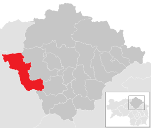
| Location of Tragöß-Sankt Katharein in the Bruck-Mürzzuschlag district | ||
 .png) |
||
| Source: Municipal data from Statistics Austria | ||

Tragöß-Sankt Katharein is a municipality in the Bruck-Mürzzuschlag district in Styria , which was newly founded on January 1, 2015 and consists of the municipalities of Tragöß and Sankt Katharein an der Laming , which were independent until December 31, 2014 . The main reason for this was the structural reform of the municipality in Styria.
The complaint brought by the municipality of Tragöß to the Constitutional Court against the merger was unsuccessful. The Constitutional Court rejected the complaint.
geography
Community structure
The municipality is divided into ten localities (population in brackets as of January 1, 2020):
- Hüttengraben (65)
- Oberdorf (212)
- Oberort (385)
- Obertal (30)
- Pichl-Grossdorf (403)
- Rastal (187)
- Sankt Katharein an der Laming (262)
- Valley (14)
- Suburb (124)
- Untertal (160)
The community consists of nine cadastral communities (area: as of December 31, 2018):
- Hüttengraben (782.55 ha)
- Oberdorf-Niederdorf (630.03 ha)
- Oberort (1,778.56 ha)
- Obertal (1,053.86 ha)
- Rastal (657.38 ha)
- Schattenberg (8,233.85 ha)
- Sonnberg (1,044.51 ha)
- St. Katharein an der Laming (131.98 ha)
- Untertal (1,131.72 ha)
Mountain area
The northern part of the municipality is dominated by the plateau of the Hochschwab group . In addition to the famous Sonnschienalm (with the refuge of the same name ), the Frauenmauerhöhle and the Sackwiesensee are located here . The following well-known peaks rise in the municipal area:
- Ebenstein ( 2123 m )
- Hochturm (Trenchtling) ( 2081 m )
- Griesmauerkogel ( 2034 m )
- TAC peak ( 2019 m )
- Brandstein ( 2003 m )
- Messnerin ( 1835 m )
- Pribitz ( 1579 m )
Population development

history
Culture and sights


St. Katharein
- The parish church of St. Catherine of Alexandria: The current parish church is a late Gothic building, which arose from the conversion of the originally Romanesque flat-roofed nave and the new construction of the choir in the second half of the 15th century.
- The church has a single nave with three bays, a retracted choir with two bays and a five-eighth end, throughout with star rib vaults. The two intersecting, free pointed ribs at the end of the choir are remarkable.
- The altars date from the 18th century, are made of wood, marbled and richly gilded. The most important, a painted winged altar (tempera on spruce wood) of Saint Martin, was created around 1430, as well as two panel paintings from around 1440 were donated to the State Museum in Graz in 1857 by the pastor Josef Schweiger.
- A Gothic tower is attached to the church. In July 1928 the church tower fell victim to a fire. In July 1931 the construction of the tower helmet began, which was completed on October 14, 1931. At the same time the church was thoroughly renovated. Since the church bells were withdrawn for war purposes in 1917, new bells had to be purchased, which were consecrated on October 25, 1931. Another interior renovation of the church took place in 1968/69, an exterior renovation in 1986/87 under pastor, Geistl. Councilor Johann Flasser.
- Filialkirche Sankt Alexius: The Filialkirche Sankt Alexius was built in the middle of the 15th century. The time of construction is based on an indulgence breve from 1444. It cannot be said whether the rare double choirs present here take account of a double foundation or whether it was the result of architectural considerations. In any case, the architect did not have to stick to older building remains. The church is characterized by its architectural style (floor and roof construction) and its frescoed ceiling.
- Forest Chapel Kircherlbrunn: On the shady slope opposite the village is the "Kircherlbrunn" chapel, which was once widely visited and to which pilgrimages were even carried out.
- Chapel of the Assumption of Mary: The chapel was originally located between the Lengger guest house and the Lammer farmhouse. In the course of renovation work and the widening of the street, it had to be removed. So it was decided to rebuild the chapel opposite the Gasthaus Lengger. The inauguration took place in 1955 by Auxiliary Bishop Dr. Leo Pietsch.
Tragedy

- Antonius Chapel in Oberort
- A late Gothic building, dated 1518 and 1524, which was built on the foundation walls of a Romanesque charnel house. At the end of the 17th century the chapel was extended by a yoke towards the churchyard wall.
- Parish church of St. Magdalena with rectory in Oberort
- A former fortified church, which is partly surrounded by walls from the late Middle Ages. The capped pointed spire roof of the three-storey late Gothic tower dates from 1923.
- Branch church in Pichl
- An early Gothic church that was expanded in the 17th century.
- Former gallows in the gallows forest between Pichl-Großdorf and Oberort-Tragöß
- Natural monuments

- Green lake in Oberort
- Marienklamm in Oberort
Economy and Infrastructure
Lamingtaler Schleppbahn
The Lamingtaler Schleppbahn was about 15 kilometers long narrow-gauge railway (track width 760 mm) led from Bruck an der Mur (freight station) to Oberdorf (magnesite works, today: STYROMAG). It was operated with steam and motor locomotives from 1920 to 1958.
education
- St. Katharein
- Parish kindergarten
- School center (secondary school and elementary school)
- Hollerbusch local library
- Tragedy
- Community kindergarten
- Elementary school
- Public library of the parish and parish
politics
After the amalgamation of the municipalities on January 1st, 2015, the mayors of Tragöß and Sankt Katharein lost their function, as did the municipal councils and councils . Until the new municipal council was sworn in, Hubert Zinner was appointed government commissioner by the Styrian state government. Eduard Lengger (Tragöß) and Werner Mikusch (Sankt Katharein) were appointed as advisors by the dissolved municipal councilors. These exercised an advisory function for the government commissioner.
The result of the municipal council election on March 23, 2015 is:
with a voter turnout of 81.58%. This results in nine mandates for the ÖVP and three each for the FPÖ and SPÖ. In the constituent meeting on April 27, 2015, Hubert Zinner (ÖVP) was elected mayor, Eduard Lengger (ÖVP) was elected vice mayor and Ronald Wenninger (FPÖ) was elected treasurer.
The municipal office is in St. Katharein, Tragöß received a citizen service point.
coat of arms
- Coats of arms of the previous municipalities

Tragedy

Sankt Katharein an der Laming


Both previous municipalities had a municipality coat of arms. Due to the amalgamation of municipalities, these lost their official validity on January 1st, 2015. At the end of 2016, the municipality adopted a municipality logo instead of a coat of arms.
Web links
- 62148 - Tragöß-Sankt Katharein. Community data, Statistics Austria .
- tragoess-st-katharein.gv.at Website of the municipality
Individual evidence
- ^ Styrian municipal structural reform
- ↑ Section 3, Paragraph 1, Item 6 of the Act of December 17, 2013 on the reorganization of the municipalities of the State of Styria ( Styrian Municipal Reform Act - StGsrG). Provincial Law Gazette for Styria of April 2, 2014, No. 31, year 2014, ZDB -ID 705127-x , p. 2.
- ^ Decision of the Constitutional Court of October 8, 2014, G 65 / 2014-9.
- ↑ Statistics Austria: Population on January 1st, 2020 by locality (area status on January 1st, 2020) , ( CSV )
- ↑ CSV file from REGIONALINFORMATION.zip (1,221 KB) ; accessed on January 12, 2019
- ↑ Horuk, official news for the community of Sankt Katharein an der Laming: Foreword by the mayor , p. 3 (PDF document, 4.13 MB; accessed on January 3, 2015)
- ↑ Elections. Retrieved April 15, 2018 .
- ↑ Tragößer Official Journal 3/15, p. 3
- ^ Parish. Retrieved April 15, 2018 (German).
- ↑ Municipality newspaper Tragöß-St. Katharein 1/2017 , website of the community, accessed on November 28, 2019
.svg)
Aflenz • Breitenau am Hochlantsch • Bruck an der Mur • Kapfenberg • Kindberg • Krieglach • Langenwang • Mariazell • Mürzzuschlag • Neuberg an der Mürz • Pernegg an der Mur • Sankt Barbara in the Mürz valley • Sankt Lorenzen in the Mürz valley • Sankt Marein in the Mürz valley • Spital am Semmering • Stanz im Mürz Valley • Thörl • Tragöß-Sankt Katharein • Turnau