
Tragedy
Tragöß ( former municipality ) |
|||
|---|---|---|---|
|
|||
| Basic data | |||
| Pole. District , state | Bruck-Mürzzuschlag (BM), Styria | ||
| Pole. local community | Tragöß-Sankt Katharein | ||
| Coordinates | 47 ° 30 ′ 0 ″ N , 15 ° 4 ′ 0 ″ E | ||
| height | 793 m above sea level A. | ||
| Residents of the stat. An H. | 933 (January 1, 2019) | ||
| surface | 110.57 km² (December 31, 2018) | ||
| Post Code | 8612 Tragöß-Sankt Katharein | ||
| prefix | + 43/3868 (Tragöß) | ||
| address | Citizen Service Point Tragöß Oberort 45 |
||
| Official website | |||
| Statistical identification | |||
| Counting district / district | Tragöß (62148 001) | ||
| Tragöß (until 2012 in the Bruck an der Mur district) | |||

|
|||
 Tragöß Oberort at the foot of the Meßnerin (below the summit, crescent-shaped, facing left, the trailing edge of the prehistoric landslide) |
|||
| Municipality until the end of 2019; KG: 60035 Oberort, 60055 Schattenberg, 60059 Sonnberg; OS: 14442 Oberort, 14443 Pichl-Großdorf, 14444 Tal, 14445 Unterort Source: STAT : Directory of places ; BEV : GEONAM ; GIS-Stmk |
|||


Tragöß is a place in the north-west of Bruck an der Mur in Styria ( judicial district Bruck an der Mur and in the political district Bruck-Mürzzuschlag ). Until December 31, 2014, Tragöß was an independent municipality with 933 inhabitants (as of January 31, 2019). As part of the municipal structural reform in Styria , it was merged with the municipality of Sankt Katharein an der Laming . The resulting new community is called Tragöß-Sankt Katharein . The basis for this was the Styrian Municipal Structural Reform Act - StGsrG.
A complaint to the Constitutional Court against the merger was unsuccessful. The Constitutional Court rejected the complaint.
geography
Tragöß lies in the Laming valley , which flows into the Mürz near Bruck an der Mur . Bruck an der Mur is 24 kilometers away by road. Tragöß-Oberort lies at the end of the valley; the surrounding mountains Trenchtling ( 2081 m above sea level ), Pribitz ( 1579 m above sea level ) and Meßnerin ( 1835 m above sea level ) belong to the Hochschwab group .
Structure of the former municipality
The former municipality consisted of three cadastral municipalities (area: as of December 31, 2018):
- Oberort (1,778.56 ha)
- Schattenberg (8,233.85 ha)
- Sonnberg (1,044.51 ha)
The former municipality was divided into four localities (population in brackets as of January 1, 2020):
- Oberort (385)
- Pichl-Grossdorf (403)
- Valley (14)
- Suburb (124)
Neighboring municipalities and places
Wildalpen , Sankt Ilgen , Etmißl , Sankt Katharein an der Laming , Trofaiach , Vordernberg and Eisenerz (clockwise).
history
It is likely that Tragoss was already inhabited by the Celts . After the Great Migration , the area was settled by Slavs in the 6th century , who did not build their houses on the valley floor, but on the slopes above. The name is also probably of Slavic origin: "tre" for three and "gozd" for forest; “Dreiwald” possibly refers to the three distinctive peaks of Trenchtling, Meßnerin and Pribitz. Until the 19th century, the area of Tragöß-Oberort was called In der Lasnitz . This name comes from the Slavic and is translated as "Waldbach", "Wiesenbach" or as a reference to water in a cleared area.
The German tribes of the Bavarians and Franks, who followed in the 9th century , mainly settled on the valley floor.
The place is mentioned for the first time in a document dated May 16, 1023, which concerns a donation from Emperor Heinrich II to the Göß convent .
In 1210 Tragöß became its own parish . It was a feudal parish belonging to the Goess monastery; the pastor was also administrator for the manor. The conflicts that often arose from this with the population culminated in 1493 with the murder of Pastor Melchior Lang. This act became the basis of the novel " Der Gottsucher " by Peter Rosegger . The priest's skull with the wound from the murder weapon could still be seen after 2000 in a glass case in the rectory. The pillars of the gallows on which the perpetrators were executed can still be seen in the gallows forest between Großdorf and Tragöß / Oberort.
In 1654, the Göß monastery also acquired the district court from the city of Bruck. In the 17th century, Tragöß was struck by the plague .
In the famine years of 1816 and 1817 there were serious crop failures. Archduke Johann also visited the Lamingtal to provide help .
religion
92.0% of the population are Roman Catholic , 3.2% Protestant , 4.2% without religious beliefs. Tragöß is the seat of a Roman Catholic parish .
Population development
After 1869 the population decreased continuously (then 1033 people) and reached its lowest level in 1910 with only 856. By the following census in 1923 there was an increase of 29.3% to 1107, to which by 1934 a further increase of 7, 0% followed 1184. The population then fluctuated between 1100 and 1180. Since the 1991 census, there has been a decline.
Culture and sights


- Antonius Chapel in Oberort
- A late Gothic building, dated 1518 and 1524, which was built on the foundation walls of a Romanesque charnel house. At the end of the 17th century the chapel was extended by a yoke towards the churchyard wall.
- Parish church of St. Magdalena and rectory in Oberort
- A former fortified church, which is partly surrounded by walls from the late Middle Ages. The capped pointed spire roof of the three-storey late Gothic tower dates from 1923.
- Branch church in Pichl
- An early Gothic church that was expanded in the 17th century.
- Former gallows in the gallows forest between Pichl-Großdorf and Oberort-Tragöß
- Local museum
- Natural monuments

education
- Community kindergarten
- Elementary school
- Public library of the parish and parish
politics
Until December 31, 2014, the mayor was Rudolf Treutler from the list “Together for Tragöß” (GfT).
The council consisted of 15 members until then and sat down since the local elections in 2010 for memberships of the following lists together:
- 7 GfT - "Together for Tragöß"
- 5 Austrian People's Party (ÖVP)
- 2 Social Democratic Party of Austria (SPÖ) and
- 1 Freedom Party of Austria (FPÖ)
coat of arms
The official description of the coat of arms ( blazon ) read:
- "In the blue shield above a green flooded shield base a three-pointed silver mountain, covered with a black kettle hook."
The foot of the shield with its green flooding (waves) denotes the Green Lake, the three-pronged rock the massif's mountain range. The kettle hook comes from the coat of arms of the cannon monastery Göß near Leoben, to which the Tragößtal belonged from the Middle Ages until the abolition of the basic subservience in 1848.
Historical maps
- Tragöß on historical maps in the 17th and 18th centuries
Oberort in the Josephinische Landesaufnahme , around 1780

In the Lasnitz, end of the 18th century (Atlas of Inner Austria )

around 1760, in the representation of the then Brucker Kreis

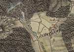
In the map by Georg Matthäus Vischer 1678


literature
Peter Rosegger : novel "Der Gottsucher". His novel “ Jacob the Last ” also describes the area.
Web links
- Tourism region Tragöß - Grüner See
- Around Tragöß (partly out of date)
- Angererhof - webcams in Tragöß
- Angererhof - weather data from Tragöß
- Rockslides in the Alps (Christof Kuhn)
Individual evidence
- ^ Styrian municipal structural reform .
- ↑ Section 3, Paragraph 1, Item 6 of the Act of December 17, 2013 on the reorganization of the municipalities of the State of Styria ( Styrian Municipal Reform Act - StGsrG). Provincial Law Gazette for Styria of April 2, 2014, No. 31, year 2014, ZDB -ID 705127-x , p. 2.
- ^ Decision of the Constitutional Court of October 8, 2014, G 65 / 2014-9.
- ↑ CSV file from REGIONALINFORMATION.zip (1,221 KB) ; accessed on January 12, 2019
- ↑ Statistics Austria: Population on January 1st, 2020 by locality (area status on January 1st, 2020) , ( CSV )
- ↑ Werner Tscherne : From Lonsperch to Deutschlandsberg. Editor and publisher: Stadtgemeinde Deutschlandsberg 1990. No ISBN. Page 40. (originally e.g. “Lieznica”, “Luosniza”).
- ↑ Using the examples (“Gereutbach”, “Rodebach” etc.): Manfred Trummer: Slavonic Steiermark = Slightly expanded version of the lecture of the same name at the symposium “To be foreign - stay together. The Slovene Ethnic Group in Austria ”as part of the“ Slovene Days ”at the Karl-Franzens University in Graz, 25. – 28. March 1996. From: Christian Stenner (ed.): Slovenian Styria. Displaced minority in Austria's southeast. Series of publications on the customer of Southeast Europe II / 23. Published by the Institute for History of the University of Graz, Department of Southeast European History, Univ.-Prof. Dr. Karl Kaser. Böhlau Verlag, Vienna-Cologne-Weimar 1997, pp. 15–34 (examples: pp. 21, 22 and 24). ISBN 3-205-98690-3 .
- ^ Eberhard Kranzmayer: Place name book of Carinthia. Part I: The settlement history of Carinthia from prehistoric times to the present in the mirror of the names. Klagenfurt 1956. Published by the History Association for Carinthia in the series Archive for patriotic history and topography , Volume 50. Derived from Old Slovene * lo (n) č (i) níca . S. 113, 158. Quoted from: Monika Voggenberger. The Slavic place names in East Tyrol. Keyword "Lasnitzen".
- ↑ Monika Voggenberger. The Slavic place names in East Tyrol. Salzburg 1983. Dissertation to obtain a doctorate at the Faculty of Humanities at the University of Salzburg. No publisher, no ISBN. Keyword "Lasnitzen".
- ^ Willi Senft: Parish murder in Tragöß . In: weekly newspaper Neues Land ("Österreichische BauernZeitung") of April 4, 2003. 63rd year No. 14, ZDB -ID 1055514-6 , p. 21.