
Via Bavarica Tyrolensis

The Via Bavarica Tyrolensis is a 225 km long hiking and cycling path that stretches from Bavaria ( Isarwanderweg ) to Tyrol (R29). Even though the paths have existed for decades, the Via Bavarica Tyrolensis was officially opened as such in 2004. The path is part of the Munich Venezia Cycle Route.
The distance
The scenic and varied route begins at the Museum Island in Munich and heads south to Pullach , where the route splits into two routes.
On the one hand, there is now the possibility of cycling (or hiking) in the direction of Straßlach , over the Pupplinger Au , past Wolfratshausen and Geretsried into the Isarwinkel . From Bad Tölz the path climbs continuously and after you have passed Lenggries and some smaller hamlets , after a steep passage you come to the fjord-like Sylvensteinsee and the village of Fall . This route merges with the alternative route along the Walchen stream .
This, which you drive from Pullach in the direction of Oberhaching , Sauerlach , over the Hofoldinger Forest and Holzkirchen , leads to the Tegernsee . The lake can be bypassed on both sides, then continues from Rottach-Egern to Kreuth and the Achenpass . A little later this route merges with the first one on the river bed of the Achen. Now the journey continues into the Achental and to Achenkirch . The last stretch along the Achensee now leads to Wiesing in the Inn Valley . Here the path joins the Inntal bike path (R1–3).

near Tölz
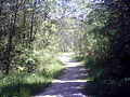
near Tölz

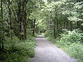
near Arzbach
near Lenggries


classification
The German Alpine Association describes the demands of this bike tour as easy to medium . Therefore, this route is suitable for experienced cyclists as well as for couples and families as a weekend excursion, whereby depending on fitness (there are steep climbs in places) and time, only individual sections can be traveled. Mountain bikes , trekking bikes or touring bikes are recommended . With a racing bike, some passages are not manageable, as especially from the second half of the route onwards, there is often no more asphalt, but rather gravel pavements and gravel roads.
Subsections
- Munich – Sauerlach (at the gates of Munich)
- Sauerlach – Holzkirchen – Gmund (Munich Alpine Foreland)
- Gmund – Kreuth (Tegernsee Valley)
- Kreuth – Achenkirch (on the Weissach to the Achensee)
- Munich – Aumühle (Mühltal)
- Aumühle – Wolfratshausen – Geretsried (Pupplinger Au)
- Bad Tölz – Lenggries – Fall (Isarwinkel, Tölzer Land)
- Fall – Achenkirch (on the Walchen to the Achensee)
- Achenkirch – Maurach (along the Achensee)
- Maurach-Wiesing (into the Inn Valley)
literature
- Via Bavarica Tyrolensis bike guide - through Upper Bavaria and Tyrol. Galli Kartographischer Verlag, ISBN 3-936-99020-4
- Via Bavarica Tyrolensis: from Munich to Jenbach. Verlag Esterbauer , Rodingersdorf 2012, ISBN 978-3-85000-342-1