Tarfaya
| Tarfaya طرفاية ⵟⴰⵔⴼⴰⵢⴰ |
||||
|---|---|---|---|---|
|
||||
| Basic data | ||||
| State : |
|
|||
| Region : | Laayoune-Sakia El Hamra | |||
| Province : | Tarfaya | |||
| Coordinates | 27 ° 56 ′ N , 12 ° 55 ′ W | |||
| Residents : | 8,027 (2014) | |||
| Height : | 10 m | |||
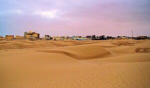
| Tarfaya - townscape and sand dunes | ||||
Tarfaya ( Arabic طرفاية, DMG Tarfaya , Central Atlas Tamazight ⵟⴰⵔⴼⴰⵢⴰ Tarfaya ) is a small town with more than 8,000 inhabitants in the region of Laayoune-Sakia El Hamra in the south of Morocco . The city is the administrative center of the province of the same name and was the southernmost and westernmost city in Morocco before the occupation of the Western Sahara regions.
Location and climate
Tarfaya is located directly on the Atlantic Ocean near Cape Juby about 545 km (driving distance) southwest of Agadir . The distance to the capital Rabat is approx. 1070 km; to Marrakech it is about 770 km. At Tarfaya there is an airport with the IATA code TFY. The climate is desert-like; Rain (approx. 40 mm / year) falls almost exclusively in the winter half-year.
Population development
| year | 1994 | 2004 | 2014 |
| Residents | 4,506 | 5,615 | 8,027 |
The inhabitants of Tarfaya are made up of settled nomads and immigrant Berbers from the areas of the Anti-Atlas . The annexation of the Western Sahara areas (1975/76) has also brought other population groups from central Morocco here.
economy
Fishing traditionally plays the most important role in the economic life of the people living here, but until the middle of the 20th century the necessary framework conditions for onward transport and marketing were lacking; other foods such as flour / bread, fruit and vegetables had to be exchanged or bought. Since the middle of the 20th century, individual tourism has experienced a steady boom. In December 2014, the nearby Tarfaya wind farm with an output of 301 megawatts went into operation.
history
During the colonial period (from 1916 to 1958 to be precise) the community belonged to the Spanish Protectorate of South Morocco under the name Villa Bens and was the administrative seat of the so-called Cape Juby Strip.
Tarfaya had supraregional importance when in November 1975 350,000 participants of the Green March lived in a tent camp near the town . The camp comprised around 22,000 tents over an area of 70 km 2 .
At the beginning of 2008 a ferry connection was started between Tarfaya and Puerto del Rosario , Fuerteventura . The car ferry Assalama the shipping company Naviera Armas wrong three times a week. It was the first ferry connection between the Canary Islands and the nearby coast of Africa. In anticipation of the car traffic between the Canary Islands and Morocco that would become possible as a result, a modest economic upswing began in Tarfaya. However, this ferry connection came to a standstill for an indefinite period of time when the Assalama leaked during an unsuccessful maneuver in the port of Tarfaya on April 30, 2008 and later stranded in the shallow water off Tarfaya, where it is still today.
Attractions
- The main attractions of Tarfaya are the sea and the almost endless sand dunes in the area.
- On the beach there is a memorial to the pilot and writer Antoine de Saint-Exupéry , who was stationed here repeatedly in the late 1920s and who received a lot of inspiration here for his later story The Little Prince .
- Approx. 1 km from the coast are the ruins of the fortress Casa Mar, built by the English in the 1880s .
- Surroundings
- A good 20 km to the east is the Khenifiss National Park, established in 2006 on the Atlantic coast (see National parks in Morocco ).
Web links
Individual evidence
- ↑ Population statistics Morocco ( Memento from March 3, 2016 in the Internet Archive )
- ↑ Tarfaya - climate tables
- ↑ Werner von Tabouillot, The Green March in the Light of Völkerrechts, Munich 1990, ISBN 3-88259-724-0
- ↑ Video with pictures of the shipwreck


