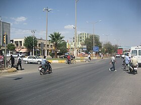
Viransehir
| Viransehir | ||||
|
||||
 Viransehir city center |
||||
| Basic data | ||||
|---|---|---|---|---|
| Province (il) : | Şanlıurfa | |||
| Coordinates : | 37 ° 14 ' N , 39 ° 46' E | |||
| Height : | 620 m | |||
| Surface: | 1,843 km² | |||
| Residents : | 189,174 (2016) | |||
| Population density : | 103 inhabitants per km² | |||
| Telephone code : | (+90) 414 | |||
| Postal code : | 63 xxx | |||
| License plate : | 63 | |||
| Structure and administration (as of 2019) | ||||
| Mayor : | Salah Ekinci ( AKP ) | |||
| Website: | ||||
Viranşehir ( Kurdish Wêranşar ; in ancient sources: Constantina / Constantia, in Assyrian sources: Tella ) is a city in southeastern Turkey and at the same time a district in the province of Şanlıurfa with around 190,000 inhabitants .
The name of the city Viranşehir is derived from wêran (destroyed) and şahr (city) and therefore literally means "destroyed city" due to its history.
population
Thanks to the income from cotton, Viranşehir is one of the fastest growing cities in Turkey. The population has more than doubled from 57,461 in 1990 to 121,382 in 2000, and in 2016 it was 189,174. Many refugees have settled in Viransehir since the civil war in Syria; In 2014 there were 11,737.
The city is predominantly inhabited by Kurds. There is also an Armenian, Yezidi and Arab community.
geography
The city, which is also the district, has an area of 1843 km² and is approximately 620 meters above sea level. Well-known mountains are the Tek Tek ( 747 m ) and the Karacadağ ( 1957 m ). A branch of the Silk Road ran through this area. The economy here is based on agriculture and animal husbandry.
Viranşehir is located in the south-eastern part of Turkey, near the border with Syria . It is approx. 50 km to the Syrian city of Raʾs al-ʿAin and approx . 180 km to Ain al-Arab . The capital of the province, Şanlıurfa , is approx. 86 km away.
sons and daughters of the town
- Deniz Kadah (* 1986), German-Turkish soccer player of Kurdish origin
- Şivan Perwer (* 1955), Kurdish singer
Web links
Individual evidence
- ↑ 2016 genel nüfus sayımı verileri. Türkiye İstatistik Kurumu, accessed June 25, 2019 (Turkish).
- ↑ Viranşehir Belediyesi. Retrieved June 25, 2019 .
- ↑ Viranşehir - All Anatolia. Retrieved June 25, 2019 .
- ↑ UNHCR: UNHCR Turkey Syrian Refugee Daily Strep. In: UNHCR - The UN Refugee Agency. August 7, 2014, accessed June 30, 2019 .


