Voigdehäger pond
| Voigdehäger pond | ||
|---|---|---|

|
||
| Voigdehäger pond (2017) | ||
| Geographical location | Western Pomerania | |
| Tributaries | Shiverbak | |
| Drain | Andershofer pond → Baltic Sea | |
| Location close to the shore | Stralsund | |
| Data | ||
| Coordinates | 54 ° 16 '37 " N , 13 ° 5' 42" E | |
|
|
||
| Altitude above sea level | 11 m above sea level NN | |
| surface | 13.59 + 8.15 + 3 ha | |
| length | 1.38 km | |
| width | 246 m | |
| Maximum depth | 6.30 m | |
|
particularities |
Reservoir |
|
The Voigdehäger pond was artificially created in the Middle Ages by damming. It is located in the south of the Hanseatic city of Stralsund in Mecklenburg-Western Pomerania .
geography
The ponds are located east of Voigdehagen , a southern district of Stralsund. The main tributary is the Zitterbäk stream , which also runs through Zitterpenningshagen and has given this place its name. The whole area is about 44 hectares . The ponds are rich in fish and some are over 6 m deep. In the south today the old Voigdehäger Straße separates the Voigdehäger pond from the Bauernteich , in the north a railway embankment from the Andershofer pond .
history
Until the High Middle Ages , the area was hardly arable as a swampy area with freely meandering waters in a post-glacial melt channel, as these became brackish in the mouth areas and, very shallow and slowly flowing, were not economically navigable.
This was only remedied by a dam created by Cistercian monks in the 1290s . The tributaries were then to a storage target of 11 m above sea level. NN dammed up and formed a coherent large body of water. This was both suitable and navigable for freshwater fish farming, and flooding from the Baltic Sea ceased to exist. End of the 13th century, the Voigdehäger pond was in its southern region by a cobblestone street divided and Bauer pond was created.
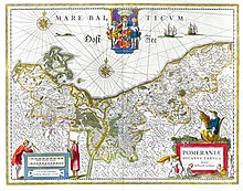
In the middle of the 17th century the lakes (not to scale) can be found on historical maps under the name Vogdenhagen Molen . (see picture on the left)
In the northern area, between 1863 and 1878, in the course of the construction of a railway embankment for the Angermünde-Stralsund railway, the Andershofer pond north was separated from the Voigdehäger pond.
For centuries fishing was carried out in the lake, and the freshwater reservoir of the ponds contributed significantly to the water supply for the Stralsund population.
Delimitations
![]() Map with all coordinates: OSM | WikiMap
Map with all coordinates: OSM | WikiMap
Andershofer pond
The Andershofer pond ⊙ has an area of about 8.15 ha and a maximum depth of about 6.30 m. The pond is the northernmost part of the three bodies of water and is navigable for the residents. There are several private investors but no public slipways .
Voigdehäger pond
The Voigdehäger pond ⊙ is the middle, 13.59 ha large damming. The water is navigable for residents with small vehicles to the Andershofer pond, but there are no public slipways.
Farmer's pond
The Bauernteich ⊙ is the southernmost of the three partial waters. It has a water surface of approx. Three hectares and is not navigable due to shallows and weeds. The pond is fished by the members of the sports fishing club Voigdehäger See Stralsund eV . It is flat, warm and densely wooded all around, which makes it suitable for nudism and swimming purposes. Just north of it is the medieval Voigdehagen church and its baroque cemetery.
Fishing
The waters are rich in fish and therefore popular with anglers. The population there includes eels , perch , lead, pike , roach , rudd , common carp and pikeperch . The farmer's pond is regularly occupied, fished and maintained by anglers.
Web links
Individual evidence
- ↑ a b c Bach Zitterbäk
- ↑ a b c History of the Voigdehäger pond
- ↑ Voigdehäger pond. Retrieved July 22, 2017 .
- ↑ stocking plantations on Voigdehäger pond
- ↑ Aerial view of the Bauernteich from the north


