Wahnebergen
|
Wahnebergen
Dörverden municipality
|
||
|---|---|---|
| Coordinates: 52 ° 53 ′ 46 ″ N , 9 ° 13 ′ 51 ″ E | ||
| Height : | 14 m above sea level NN | |
| Area : | 6.41 km² | |
| Residents : | 530 (Feb. 15, 2002) | |
| Population density : | 83 inhabitants / km² | |
| Incorporation : | July 1, 1972 | |
| Postal code : | 27313 | |
| Area code : | 04231 | |
|
Location of Wahnebergen in Lower Saxony |
||
Wahnebergen ( Low German Wambarg'n ) is a district of the municipality Dörverden in the district of Verden , Lower Saxony .
location
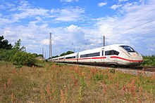
Wahnebergen is located north of Dörverden on the federal highway 215 , a few kilometers south of Verden (Aller) . Federal highway 215 passes to the west of the place. The district road 14 runs through the village. The Wunstorf – Bremen railway line runs past the eastern edge of the village.
history
The place was first mentioned in 1230 as Wanebergen . The knight family of those at Wahnebergen was also mentioned for the first time. A school was mentioned as early as 1742. After the school closed , a kindergarten was established there.

The railway line (Hanover–) Wunstorf – Bremen was opened in 1847 and Wahnebergen received its own train station . From 1905 the Verden- Schwarmstedt railway line (a section of the Allertal Railway) branched off there and existed until the 1990s. Today there is still a transfer point at the former train station .
On February 1, 1971, the communities of Ahnebergen and Stedebergen were added. On July 1, 1972 Wahnebergen was incorporated into the municipality of Dörverden.
Web links
Individual evidence
- ^ Federal Statistical Office (ed.): Historical municipality directory for the Federal Republic of Germany. Name, border and key number changes in municipalities, counties and administrative districts from May 27, 1970 to December 31, 1982 . W. Kohlhammer GmbH, Stuttgart / Mainz 1983, ISBN 3-17-003263-1 , p. 247 .

