Walpole, Massachusetts
| Walpole | ||
|---|---|---|
 |
||
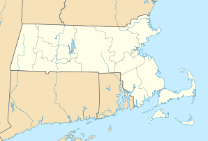
| Location in Massachusetts | ||
|
|
||
| Basic data | ||
| Foundation : | 1724 | |
| State : | United States | |
| State : | Massachusetts | |
| County : | Norfolk County | |
| Coordinates : | 42 ° 9 ′ N , 71 ° 15 ′ W | |
| Time zone : | Eastern ( UTC − 5 / −4 ) | |
| Residents : | 24,070 (as of 2010) | |
| Population density : | 452.4 inhabitants per km 2 | |
| Area : | 54.4 km 2 (approx. 21 mi 2 ) of which 53.2 km 2 (approx. 21 mi 2 ) is land |
|
| Height : | 46 m | |
| Postcodes : | 02032, 02071, 02081 | |
| Area code : | +1 339, 781 | |
| FIPS : | 25-72495 | |
| GNIS ID : | 0618331 | |
| Website : | www.walpole-ma.gov | |
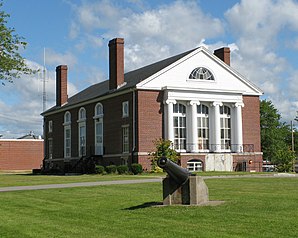
 Blackburn Hall |
||
Walpole is a town ( Town ) in Norfolk County in the US state of Massachusetts with well 24,000 inhabitants on the Neponset River .
The place is a good 20 kilometers southwest of Boston on the historic postal route from New York City . In terms of traffic, it is well integrated due to its location between Massachusetts Route 1A in the north and US Highway 1 , which touches Interstate 95 in the south , at the intersection of Walpole Union Station of the Dedham – Willimantic and Back Bay – Harrisville railway lines .
The local baseball team made it to the finals of the 2007 World Cup for children between the ages of 11 and 12.
The Francis William Bird Park on the Bay Circuit Trail has recreational value in the city .
Personalities
- Tim Clifford (born 1986), basketball player
- Albert Henry DeSalvo (1931–1973), serial killer
- Caleb Ellis (1767-1816), politician
- Clifford Harrison (1927–1988), ice hockey player
- Roger Turner (1901-1993), figure skater
- Chris Wagner (* 1991), ice hockey player
Web links
Commons : Walpole, Massachusetts - Collection of pictures, videos, and audio files
