West Hartford
| West Hartford | ||
|---|---|---|
|
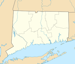
Location in Connecticut
|
||
| Basic data | ||
| Foundation : | 1854 | |
| State : | United States | |
| State : | Connecticut | |
| County : | Hartford County | |
| Coordinates : | 41 ° 46 ′ N , 72 ° 45 ′ W | |
| Time zone : | Eastern ( UTC − 5 / −4 ) | |
| Residents : | 62,903 (as of 2016) | |
| Population density : | 1,105.5 inhabitants per km 2 | |
| Area : | 58.0 km 2 (approx. 22 mi 2 ) of which 56.9 km 2 (approx. 22 mi 2 ) is land |
|
| Height : | 50 m | |
| Postcodes : | 06107, 06110-06119 | |
| Area code : | +1 860 | |
| FIPS : | 09-82590 | |
| GNIS ID : | 0213529 | |
| Website : | www.west-hartford.com | |
| Mayor : | Scott Slifka | |
West Hartford is a town in Hartford County in the US -amerikanischen State Connecticut with about 62,000 inhabitants (estimate 2016 US Census Bureau ). The geographical coordinates are: 41.77 ° North, 72.75 ° West. The urban area has a size of 57.9 km².
history
In the years 1672–1677 the parish of the "West Division" of the parish Hartford with Quaker Lane, Mountain Road and the parishes of Bloomfield and Newington was staked. Parts of Hartford and Farmington were added later. The first settler, Stephen Hosmer, settled in 1679 in what is now West Hartford, where he built a mill on Trout Brook.
Hartford's West Division became a parish in 1711 (West Division Parish or West Society). In 1806, the district was renamed "West Hartford" by the Connecticut State Parliament. In 1854 West Hartford was finally split off from Hartford and entered as a separate parish in the parish register. In 2004 the community celebrated its 150th anniversary with a festival month.
Like many places in this region, the community lived mainly from agriculture for many years. Over time, the community developed into a wealthy suburb of Hartford.
schools
- Aiken Elementary School
- Braeburn Elementary School
- Bugbee Elementary School
- Charter Oak Elementary School
- Louise Duffy Elementary School
- Morley Elementary School
- Norfeldt Elementary School
- Smith Elementary School
- Webster Hill Elementary School
- Whiting Lane Elementary School
- Wolcott Elementary School
- King Philip Middle School
- Sedgwick Middle School
- Bristow Middle School
- Conard High School
- Hall high school
- American School for the Deaf
Further educational institutions
- University of Hartford
- St. Joseph College
- University of Connecticut
Population development
|
|
|
Personalities
sons and daughters of the town
- Titus Hosmer (1736–1780), lawyer, judge and politician
- Theodore Sedgwick (1746-1813), politician
- Noah Webster (1758–1843), lexicographer, spelling reformer, publicist, translator and writer
- Richard H. Whiting (1826–1888), politician
- John Woodruff (1826–1868), politician
- William Thompson Sedgwick (1855-1921), Professor of Public Health
- John Franklin Enders (1897–1985), bacteriologist and winner of the 1954 Nobel Prize for Medicine
- Edward N. Lorenz (1917–2008), mathematician and professor of meteorology (butterfly effect)
- Eric Osterling (1926–2005), composer and arranger
- Teresa Stich-Randall (1927-2007), opera singer (soprano)
- Joseph Mascolo (1929–2016), actor and soap actor
- John Gregory Dunne (1932–2003), writer, journalist and screenwriter
- Kevin Sullivan (born 1949), politician
- Frank Luntz (* 1962), pollster and political advisor
- Peter Paige (born 1969), actor
- Michael Schur (* 1975), screenwriter, television producer, director and actor
Other personalities associated with the city
- Edward W. Morley (1838-1923), chemist
- Thomas Norval Hepburn (1879–1962), physician; Father of actress Katharine Hepburn
- Robert A. Hurley (1895–1968), politician and Governor of Connecticut
- William A. Purtell (1897–1978), politician
- John A. Danaher (1899–1990), politician
- Roger Sperry (1913–1994), neuroscientist and winner of the 1981 Nobel Prize for Medicine
- Joseph F. Ryter (1914–1978), politician
- Charles Kaman (1919–2011), engineer and businessman
- Steve Little (* 1935), jazz and studio musician
- Carla Shatz (* 1947), neuroscientist at Stanford University
- David Alan Basche (* 1968), film and stage actor
- Brett H. McGurk (* 1973), lawyer and diplomat
Web links
- Official website of the City of West Hartford ( English )
