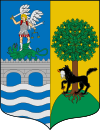
Zalla
| Zalla municipality | ||
|---|---|---|
 View of Zalla from Ibarra
|
||
| coat of arms | Map of Spain | |

|
|
|
| Basic data | ||
| Autonomous Community : | Basque Country | |
| Province : | Bizkaia | |
| Comarca : | Las Encartaciones | |
| Coordinates | 43 ° 14 ′ N , 3 ° 8 ′ W | |
| Area : | 30.83 km² | |
| Residents : | 8,447 (Jan 1, 2019) | |
| Population density : | 273.99 inhabitants / km² | |
| Postal code : | 48860 | |
| Municipality number ( INE ): | 48096 | |
| administration | ||
| Mayor : | Juanra Urkijo Etxeguren (2019) | |
| Website : | www.zalla.org | |
Zalla is a city and municipality in northern Spain. It belongs to the province of Bizkaia in the Basque Country . The municipality is traversed by the Rio Cadagua ; it is about 20 kilometers (as the crow flies) west of Bilbao.
There are rail connections on the regional line R 4 León - Bilbao of the railway company FEVE . The local transport connection on the section to Valmaseda is operated every half hour during the day. There are also several Bizkaibus bus routes via Zalle.
| Population development of Zalla between 1877 and 2007 | ||||||||||||||||||||
| 1877 | 1900 | 1910 | 1920 | 1930 | 1940 | 1950 | 1960 | 1970 | 1981 | 1991 | 1996 | 2000 | 2002 | 2005 | 2007 | 2011 | ||||
| 1,382 | 2,194 | 2,842 | 3,453 | 3,733 | 3,698 | 4.131 | 5,004 | 5,615 | 7,027 | 7,307 | 7,503 | 7,804 | 7,872 | 8,712 | 9,693 | 10,414 | ||||
Web links
Commons : Zalla - collection of images, videos and audio files
Individual evidence
- ↑ Cifras oficiales de población resultantes de la revisión del Padrón municipal a 1 de enero . Population statistics from the Instituto Nacional de Estadística (population update).
