Kamanová: Difference between revisions
Content deleted Content added
m →Genealogical resources: Remove blank line(s) between list items per WP:LISTGAP to fix an accessibility issue for users of screen readers. Do WP:GENFIXES and cleanup if needed. Discuss this at [[Wikipedia talk:WikiProject Accessibility#L... |
m →External links: add category using AWB |
||
| Line 27: | Line 27: | ||
{{DEFAULTSORT:Kamanova}} |
{{DEFAULTSORT:Kamanova}} |
||
[[Category:Villages and municipalities in Topoľčany District]] |
[[Category:Villages and municipalities in Topoľčany District]] |
||
[[Category:Topoľčany District]] |
|||
Revision as of 16:56, 19 April 2017

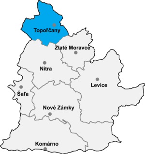
Kamanová is a municipality in the Topoľčany District of the Nitra Region, Slovakia.[1] In 2011 it had 601 inhabitants.[2]
See also
References
Genealogical resources
The records for genealogical research are available at the state archive "Statny Archiv in Nitra, Slovakia"
- Roman Catholic church records (births/marriages/deaths): 1758-1895 (parish B)
- Lutheran church records (births/marriages/deaths): 1708-1895 (parish B)
External links
- http://en.e-obce.sk/obec/kamanova/kamanova.html
- Official homepage
- Surnames of living people in Kamanova
48°28′N 18°06′E / 48.467°N 18.100°E
